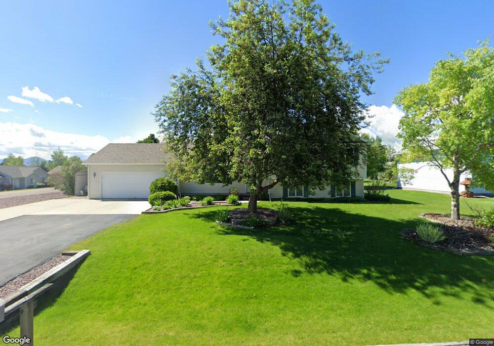
10 Bronco Dr Bozeman, MT 59718
Estimated Value: $586,144 - $682,000
3
Beds
2
Baths
1,178
Sq Ft
$534/Sq Ft
Est. Value
About This Home
This home is located at 10 Bronco Dr, Bozeman, MT 59718 and is currently estimated at $629,536, approximately $534 per square foot. 10 Bronco Dr is a home located in Gallatin County with nearby schools including Saddle Peak Elementary School, Belgrade High School, and Great Beginnings Montessori School.
Ownership History
Date
Name
Owned For
Owner Type
Purchase Details
Closed on
Jun 26, 2020
Sold by
Kirchner Richard E
Bought by
Kirchner Richard E and Blakeslee Marylou J
Current Estimated Value
Home Financials for this Owner
Home Financials are based on the most recent Mortgage that was taken out on this home.
Original Mortgage
$173,000
Interest Rate
2.8%
Mortgage Type
New Conventional
Create a Home Valuation Report for This Property
The Home Valuation Report is an in-depth analysis detailing your home's value as well as a comparison with similar homes in the area
Purchase History
| Date | Buyer | Sale Price | Title Company |
|---|---|---|---|
| Kirchner Richard E | -- | Solidifi |
Source: Public Records
Mortgage History
| Date | Status | Borrower | Loan Amount |
|---|---|---|---|
| Closed | Kirchner Richard E | $173,000 |
Source: Public Records
Tax History Compared to Growth
Tax History
| Year | Tax Paid | Tax Assessment Tax Assessment Total Assessment is a certain percentage of the fair market value that is determined by local assessors to be the total taxable value of land and additions on the property. | Land | Improvement |
|---|---|---|---|---|
| 2025 | $2,551 | $652,200 | $0 | $0 |
| 2024 | $3,550 | $586,700 | $0 | $0 |
| 2023 | $3,540 | $586,700 | $0 | $0 |
| 2022 | $2,581 | $344,400 | $0 | $0 |
| 2021 | $2,733 | $344,400 | $0 | $0 |
| 2020 | $2,470 | $307,800 | $0 | $0 |
| 2019 | $2,515 | $307,800 | $0 | $0 |
| 2018 | $2,400 | $276,900 | $0 | $0 |
| 2017 | $2,337 | $276,900 | $0 | $0 |
| 2016 | $2,047 | $226,200 | $0 | $0 |
| 2015 | $1,908 | $226,200 | $0 | $0 |
| 2014 | $1,961 | $141,722 | $0 | $0 |
Source: Public Records
Map
Nearby Homes
- 174 Valley Grove Dr
- 61 Buckhorn Trail
- 339 Mountain Lion Trail
- Lot 2A Bison Trail
- 604 Morrison Ave Unit B
- 47 Poplar Dr
- 56 Poplar Dr
- TBD E Cameron Bridge Rd
- 2030 and 2032 Love Ln
- Lot 10 Riparian Way
- Lot 3 Riparian Way
- 29 Border Ln Unit 3
- TBD Riparian Way
- TBD Harper Puckett
- 79 Dry Fly Ln
- 2426 Harper Puckett Rd
- 890 Hidden Valley Rd Unit 52
- 827 Accolade Loop
- 829 Accolade Loop
- 703 Ketchikan Dr
- 30 Bronco Dr
- 50 Vigilante Trail
- 261 Valley Grove Dr
- 15 Bronco Dr
- 72 Vigilante Trail
- 50 Bronco Dr
- 30 Vigilante Trail
- 37 Bronco Dr
- 94 Vigilante Trail
- 70 Bronco Dr
- 301 Valley Grove Dr
- 221 Valley Grove Dr
- 112 Vigilante Trail
- 63 Bronco Dr
- 321 Valley Grove Dr
- 121 Mountain Lion Trail
- 278 Valley Grove Dr
- 256 Valley Grove Dr
- 195 Valley Grove Dr
- 16 Wrangler Dr