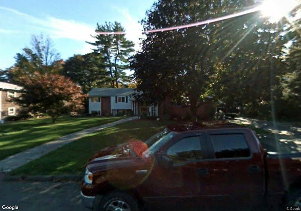
10 Carol Ln Holyoke, MA 01040
Estimated Value: $500,837 - $533,000
3
Beds
3
Baths
2,820
Sq Ft
$183/Sq Ft
Est. Value
About This Home
This home is located at 10 Carol Ln, Holyoke, MA 01040 and is currently estimated at $515,959, approximately $182 per square foot. 10 Carol Ln is a home located in Hampden County with nearby schools including Lt. Clayre Sullivan Elementary School, Holyoke High School, and First Lutheran Christian School.
Ownership History
Date
Name
Owned For
Owner Type
Purchase Details
Closed on
Nov 30, 2016
Sold by
Wielgosz David
Bought by
Wielgosz David and Oleary-Wielgosz Rita
Current Estimated Value
Purchase Details
Closed on
Oct 18, 1994
Sold by
Messier Dorothy A and Messier Bernard L
Bought by
Wielgosz David and Wielgosz Rita Oleary
Create a Home Valuation Report for This Property
The Home Valuation Report is an in-depth analysis detailing your home's value as well as a comparison with similar homes in the area
Home Values in the Area
Average Home Value in this Area
Purchase History
| Date | Buyer | Sale Price | Title Company |
|---|---|---|---|
| Wielgosz David | -- | -- | |
| Wielgosz David | $159,000 | -- |
Source: Public Records
Mortgage History
| Date | Status | Borrower | Loan Amount |
|---|---|---|---|
| Previous Owner | Wielgosz David | $225,000 | |
| Previous Owner | Wielgosz David | $27,000 | |
| Previous Owner | Wielgosz David | $154,430 |
Source: Public Records
Tax History Compared to Growth
Tax History
| Year | Tax Paid | Tax Assessment Tax Assessment Total Assessment is a certain percentage of the fair market value that is determined by local assessors to be the total taxable value of land and additions on the property. | Land | Improvement |
|---|---|---|---|---|
| 2025 | $7,719 | $442,100 | $79,700 | $362,400 |
| 2024 | $7,229 | $381,500 | $75,900 | $305,600 |
| 2023 | $6,746 | $359,600 | $75,900 | $283,700 |
| 2022 | $6,466 | $335,700 | $75,900 | $259,800 |
| 2021 | $6,263 | $321,700 | $75,900 | $245,800 |
| 2020 | $5,873 | $307,800 | $75,900 | $231,900 |
| 2019 | $5,667 | $293,800 | $75,900 | $217,900 |
| 2018 | $3,850 | $282,500 | $75,900 | $206,600 |
| 2017 | $5,416 | $282,500 | $75,900 | $206,600 |
| 2016 | $5,294 | $276,900 | $78,200 | $198,700 |
| 2015 | $5,272 | $276,900 | $78,200 | $198,700 |
Source: Public Records
Map
Nearby Homes
- 165 Lincoln St
- 68 Fairfield Ave
- 1225 Hampden St
- 129 Morgan St
- 1114 Hampden St
- 1421 Dwight St
- 68 Shawmut Ave
- 50 Nonotuck St
- 55 Longfellow Rd
- 391 Pleasant St
- 22 Liberty St
- 429 Pleasant St
- 104 Saint James Ave
- 12 Saint James Ave
- 43 Woods Ave
- 1212 Northampton St
- 11 Longfellow Rd
- 211 Pleasant St
- 102 W Meadowview Rd
- 66 Taylor St
- 16 Carol Ln
- 4 Carol Ln
- 1421 Northampton St Unit 1423
- 15 Carol Ln
- 22 Carol Ln
- 1383 Northampton St
- 1425 Northampton St
- 21 Carol Ln
- 73 Fairfield Ave
- 28 Carol Ln
- 1439 Northampton St
- 74 Fairfield Ave
- 34 Carol Ln
- 33 Carol Ln
- 71 Fairfield Ave
- 171 Lincoln St
- 176 Lincoln St
- 1374 Northampton St
- 72 Fairfield Ave
- 1447 Northampton St Unit 1449