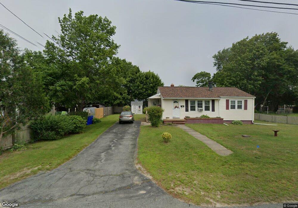
10 Carver St Bourne, MA 02532
Buzzards Bay NeighborhoodEstimated Value: $603,000 - $807,000
3
Beds
3
Baths
1,512
Sq Ft
$471/Sq Ft
Est. Value
About This Home
This home is located at 10 Carver St, Bourne, MA 02532 and is currently estimated at $712,185, approximately $471 per square foot. 10 Carver St is a home located in Barnstable County with nearby schools including Bourne High School and St Margaret Regional School.
Create a Home Valuation Report for This Property
The Home Valuation Report is an in-depth analysis detailing your home's value as well as a comparison with similar homes in the area
Home Values in the Area
Average Home Value in this Area
Tax History Compared to Growth
Tax History
| Year | Tax Paid | Tax Assessment Tax Assessment Total Assessment is a certain percentage of the fair market value that is determined by local assessors to be the total taxable value of land and additions on the property. | Land | Improvement |
|---|---|---|---|---|
| 2025 | $5,212 | $667,300 | $284,800 | $382,500 |
| 2024 | $5,096 | $635,400 | $271,200 | $364,200 |
| 2023 | $4,953 | $562,200 | $240,000 | $322,200 |
| 2022 | $4,754 | $471,200 | $212,400 | $258,800 |
| 2021 | $4,618 | $428,800 | $193,300 | $235,500 |
| 2020 | $4,366 | $406,500 | $191,500 | $215,000 |
| 2019 | $4,145 | $394,400 | $191,500 | $202,900 |
| 2018 | $3,868 | $367,000 | $182,400 | $184,600 |
| 2017 | $3,580 | $347,600 | $180,600 | $167,000 |
| 2016 | $3,451 | $339,700 | $180,600 | $159,100 |
| 2015 | $2,870 | $285,000 | $125,900 | $159,100 |
Source: Public Records
Map
Nearby Homes
- 34 Washington Ave
- 151 - 153 Main St
- 17 Maple St
- 46 Holt Rd
- 46 Holt Rd Unit A
- 3 Wolf Rd
- 41 Lewis Point Rd
- 0 Lewis Point Rd
- 162 Puritan Rd
- 56 Rip Van Winkle Way
- 65 Lewis Point Rd
- 171 Puritan Rd
- 73 Lewis Point Rd
- 304 Main St
- 38 Old Bridge Rd
- 4 Knob Ln
- 9 Hideaway Rd Unit F
- 27 Baker Ln Unit 27H
- 13 Hideaway Village Unit G
- 810 Head of The Bay Rd