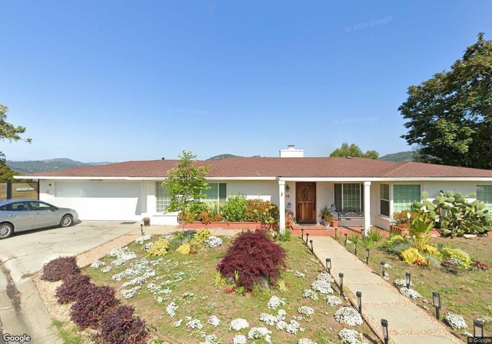
10 Crown Point San Rafael, CA 94901
Country Club NeighborhoodEstimated Value: $1,263,000 - $1,641,000
2
Beds
2
Baths
1,511
Sq Ft
$927/Sq Ft
Est. Value
About This Home
This home is located at 10 Crown Point, San Rafael, CA 94901 and is currently estimated at $1,399,946, approximately $926 per square foot. 10 Crown Point is a home located in Marin County with nearby schools including Coleman Elementary School, James B. Davidson Middle School, and San Rafael High School.
Ownership History
Date
Name
Owned For
Owner Type
Purchase Details
Closed on
Mar 5, 2007
Sold by
Mcculloch Brigitte and Mcculloch Bill
Bought by
Arauzhaase Bryan and Arauzhaase Lillian
Current Estimated Value
Home Financials for this Owner
Home Financials are based on the most recent Mortgage that was taken out on this home.
Original Mortgage
$686,000
Outstanding Balance
$407,895
Interest Rate
6.12%
Mortgage Type
Purchase Money Mortgage
Estimated Equity
$992,051
Purchase Details
Closed on
Dec 19, 2003
Sold by
Mcculloch William P and Mcculloch Brigitte
Bought by
Mcculloch William P and Mcculloch Brigitte
Purchase Details
Closed on
May 13, 1997
Sold by
Taylor Laurie L
Bought by
Mcculloch William P and Mcculloch Brigitte
Home Financials for this Owner
Home Financials are based on the most recent Mortgage that was taken out on this home.
Original Mortgage
$241,000
Interest Rate
7.5%
Create a Home Valuation Report for This Property
The Home Valuation Report is an in-depth analysis detailing your home's value as well as a comparison with similar homes in the area
Home Values in the Area
Average Home Value in this Area
Purchase History
| Date | Buyer | Sale Price | Title Company |
|---|---|---|---|
| Arauzhaase Bryan | $857,500 | Commonwealth Land Title Co | |
| Mcculloch William P | -- | -- | |
| Mcculloch William P | $449,000 | Pacific Coast Title Company | |
| Taylor Laurie L | -- | Pacific Coast Title Company |
Source: Public Records
Mortgage History
| Date | Status | Borrower | Loan Amount |
|---|---|---|---|
| Open | Arauzhaase Bryan | $686,000 | |
| Previous Owner | Mcculloch William P | $241,000 |
Source: Public Records
Tax History
| Year | Tax Paid | Tax Assessment Tax Assessment Total Assessment is a certain percentage of the fair market value that is determined by local assessors to be the total taxable value of land and additions on the property. | Land | Improvement |
|---|---|---|---|---|
| 2025 | $16,243 | $1,148,775 | $803,808 | $344,967 |
| 2024 | $15,670 | $1,126,257 | $788,052 | $338,205 |
| 2023 | $15,413 | $1,104,177 | $772,602 | $331,575 |
| 2022 | $14,557 | $1,082,533 | $757,458 | $325,075 |
| 2021 | $14,321 | $1,061,310 | $742,608 | $318,702 |
| 2020 | $14,184 | $1,050,428 | $734,994 | $315,434 |
| 2019 | $13,748 | $1,029,840 | $720,588 | $309,252 |
| 2018 | $13,600 | $1,009,654 | $706,464 | $303,190 |
| 2017 | $13,075 | $989,863 | $692,616 | $297,247 |
| 2016 | $12,296 | $939,961 | $657,701 | $282,260 |
| 2015 | $11,135 | $870,335 | $608,983 | $261,352 |
| 2014 | $10,247 | $813,398 | $569,143 | $244,255 |
Source: Public Records
Map
Nearby Homes
- 60 Marina Court Dr
- 4 Point San Pedro Rd Unit 4
- 28 Marina Court Dr
- 22 Mooring Rd
- 24 Mooring Rd
- 26 Mooring Rd Unit 1
- 307 Summit Ave
- 20 Porto Bello Dr
- 24 Porto Bello Dr
- 313 Summit Ave
- 50 Porto Bello Dr
- 99 Deer Park Ave
- 177 Canal St Unit 10
- 120 Fairway Dr
- 120 Canal St
- 155 Canal St Unit 7
- 176 Highland Ave
- 1 Highland Ave
- 35 Fairfax St Unit 8
- 3720 Kerner Blvd
- 2 Crown Point
- 11 Crown Point
- 20 Crown Point
- 17 Crown Point
- 3 Crown Point Rd
- 3 Crown Point
- 40 Mission Ave
- 44 Mission Ave
- 50 Mission Ave
- 3 W Seaview Ave
- 36 Mission Ave
- 30 Mission Ave
- 26 Mission Ave
- 7 Sea View Dr
- 22 Mission Ave
- 20 Mission Ave
- 16 Mission Ave
- 12 Mission Ave
- 54 Mission Ave
- 35 E Mission Ave
Your Personal Tour Guide
Ask me questions while you tour the home.