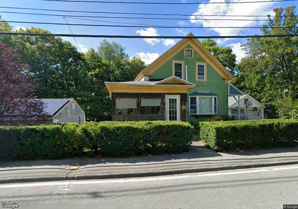
10 Davis St Shirley, MA 01464
Estimated Value: $420,102 - $443,000
3
Beds
1
Bath
1,578
Sq Ft
$277/Sq Ft
Est. Value
About This Home
This home is located at 10 Davis St, Shirley, MA 01464 and is currently estimated at $436,776, approximately $276 per square foot. 10 Davis St is a home located in Middlesex County with nearby schools including Page Hilltop School, Lura A. White Elementary School, and Ayer Shirley Regional Middle School.
Ownership History
Date
Name
Owned For
Owner Type
Purchase Details
Closed on
Nov 24, 1999
Sold by
Sheldon Ralph M and Sheldon Chizuko
Bought by
Sheldon Charles M and Sheldon Elizabeth
Current Estimated Value
Home Financials for this Owner
Home Financials are based on the most recent Mortgage that was taken out on this home.
Original Mortgage
$72,200
Outstanding Balance
$22,076
Interest Rate
7.77%
Mortgage Type
Purchase Money Mortgage
Estimated Equity
$414,700
Create a Home Valuation Report for This Property
The Home Valuation Report is an in-depth analysis detailing your home's value as well as a comparison with similar homes in the area
Home Values in the Area
Average Home Value in this Area
Purchase History
| Date | Buyer | Sale Price | Title Company |
|---|---|---|---|
| Sheldon Charles M | $76,000 | -- |
Source: Public Records
Mortgage History
| Date | Status | Borrower | Loan Amount |
|---|---|---|---|
| Open | Sheldon Charles M | $35,000 | |
| Open | Sheldon Charles M | $72,200 | |
| Previous Owner | Sheldon Charles M | $246,000 | |
| Previous Owner | Sheldon Charles M | $88,200 |
Source: Public Records
Tax History
| Year | Tax Paid | Tax Assessment Tax Assessment Total Assessment is a certain percentage of the fair market value that is determined by local assessors to be the total taxable value of land and additions on the property. | Land | Improvement |
|---|---|---|---|---|
| 2025 | $48 | $368,900 | $130,900 | $238,000 |
| 2024 | $4,572 | $336,900 | $111,700 | $225,200 |
| 2023 | $4,450 | $313,800 | $111,700 | $202,100 |
| 2022 | $4,317 | $278,900 | $107,800 | $171,100 |
| 2021 | $4,189 | $253,400 | $96,300 | $157,100 |
| 2020 | $4,065 | $252,300 | $96,300 | $156,000 |
| 2019 | $3,882 | $241,400 | $96,300 | $145,100 |
| 2018 | $3,678 | $224,000 | $92,400 | $131,600 |
| 2017 | $3,395 | $205,500 | $84,700 | $120,800 |
| 2016 | $3,352 | $203,000 | $86,200 | $116,800 |
| 2015 | $3,258 | $188,200 | $80,900 | $107,300 |
Source: Public Records
Map
Nearby Homes
- 4 Davis St
- 25 Front St
- 11 Ambrose Way Unit 9
- 43 Ambrose Way Unit 43
- 10 Ambrose Way Unit 10
- 31 Ambrose Way Unit 31
- 34 Ambrose Way Unit 34
- 12 Ambrose Way Unit 12
- 6 Ambrose Way Unit 3
- 2 Ambrose Way Unit 2
- 9 Ambrose Way Unit 9
- 41 Ambrose Way Unit 41
- 1 Ambrose Way Unit 1
- 30 Ambrose Way Unit 30
- 29 Ambrose Way Unit 29
- 15 Ambrose Way Unit 15
- 8 Ambrose Way Unit 8
- 36 Ambrose Way Unit 36
- 10 Nashua St
- 0 Windsor Rd
- 11 Center Rd
- 9 Davis St
- 9B Center Rd
- 9 Center Rd
- 11 Davis St
- 6 Davis St
- 7 Center Rd
- 12 Center Rd
- 4 Davis St Unit 1
- 4 Davis St Unit 3
- 4 Davis St Unit 5
- 4 Davis St Unit 10
- 9A Center Rd
- 20 Center Rd
- 0 Call First Unit 72203342
- 0 Forrest Hill Ln Unit 71480337
- 0 Call First
- Lot 30 Gideon Ln
- Lot 27 Gideon Ln
- Lot 25a Gideon Ln
Your Personal Tour Guide
Ask me questions while you tour the home.