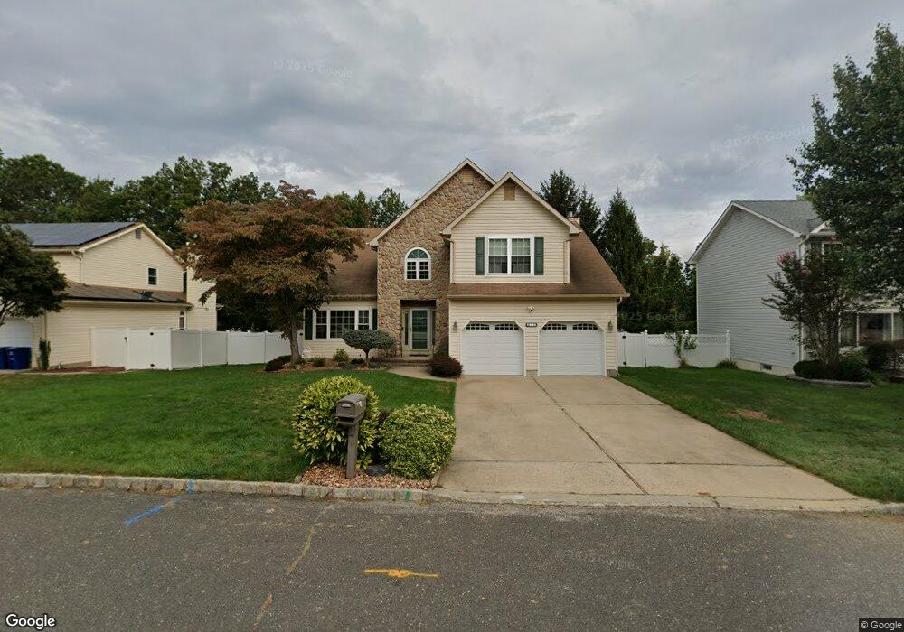
10 Derringer Dr Howell, NJ 07731
Southard NeighborhoodEstimated Value: $769,108 - $862,000
4
Beds
2
Baths
2,421
Sq Ft
$336/Sq Ft
Est. Value
About This Home
This home is located at 10 Derringer Dr, Howell, NJ 07731 and is currently estimated at $813,527, approximately $336 per square foot. 10 Derringer Dr is a home located in Monmouth County with nearby schools including Taunton School, Aldrich School, and Howell Township Middle School South.
Ownership History
Date
Name
Owned For
Owner Type
Purchase Details
Closed on
Aug 12, 2002
Sold by
Vecchione Andrew
Bought by
Symczak Stephen and Symczak Lisa
Current Estimated Value
Home Financials for this Owner
Home Financials are based on the most recent Mortgage that was taken out on this home.
Original Mortgage
$200,000
Outstanding Balance
$83,479
Interest Rate
6.36%
Estimated Equity
$730,048
Create a Home Valuation Report for This Property
The Home Valuation Report is an in-depth analysis detailing your home's value as well as a comparison with similar homes in the area
Home Values in the Area
Average Home Value in this Area
Purchase History
| Date | Buyer | Sale Price | Title Company |
|---|---|---|---|
| Symczak Stephen | $355,000 | -- |
Source: Public Records
Mortgage History
| Date | Status | Borrower | Loan Amount |
|---|---|---|---|
| Open | Symczak Stephen | $200,000 |
Source: Public Records
Tax History Compared to Growth
Tax History
| Year | Tax Paid | Tax Assessment Tax Assessment Total Assessment is a certain percentage of the fair market value that is determined by local assessors to be the total taxable value of land and additions on the property. | Land | Improvement |
|---|---|---|---|---|
| 2025 | $11,356 | $714,200 | $309,200 | $405,000 |
| 2024 | $10,254 | $638,700 | $309,200 | $329,500 |
| 2023 | $10,254 | $551,000 | $229,200 | $321,800 |
| 2022 | $8,993 | $450,600 | $144,200 | $306,400 |
| 2021 | $8,993 | $391,700 | $119,200 | $272,500 |
| 2020 | $9,023 | $388,600 | $119,200 | $269,400 |
| 2019 | $9,490 | $401,100 | $136,300 | $264,800 |
| 2018 | $9,257 | $388,800 | $136,300 | $252,500 |
| 2017 | $9,661 | $401,200 | $136,300 | $264,900 |
| 2016 | $9,217 | $379,000 | $120,700 | $258,300 |
| 2015 | $8,975 | $365,300 | $113,700 | $251,600 |
| 2014 | $8,294 | $313,200 | $113,300 | $199,900 |
Source: Public Records
Map
Nearby Homes
- 53 Hilltop Rd
- 24 Friendship Rd
- 3 Timberline Dr
- 12 Glen Arden Dr
- 20 N Longview Rd
- 17 N Longview Rd
- 15 N Longview Rd
- 47 Glen Rd
- 409 Middle Ln
- 459 Shady Ln
- 215 Sunset Ln
- 5 Weasel Creek Ct
- 9 Bell Ct
- 224 Sunset Ln
- RT 9 Rustic Dr
- 14 Cobblestone Ct
- 12 Colonial Ct
- 409 Aldrich Rd
- 10 Colonial Ct
- 15 Windsor Rd
- 8 Derringer Dr
- 12 Derringer Dr
- 11 Derringer Dr
- 9 Derringer Dr
- 6 Derringer Dr
- 14 Derringer Dr
- 7 Derringer Dr
- 15 Derringer Dr
- 5 Derringer Dr
- 16 Derringer Dr
- 17 Derringer Dr
- 3 Derringer Dr
- 18 Derringer Dr
- 25 Cambridge Dr
- 27 Cambridge Dr
- 23 Cambridge Dr
- 39 Winchester Dr
- 2 Derringer Dr
- 29 Cambridge Dr
- 37 Winchester Dr