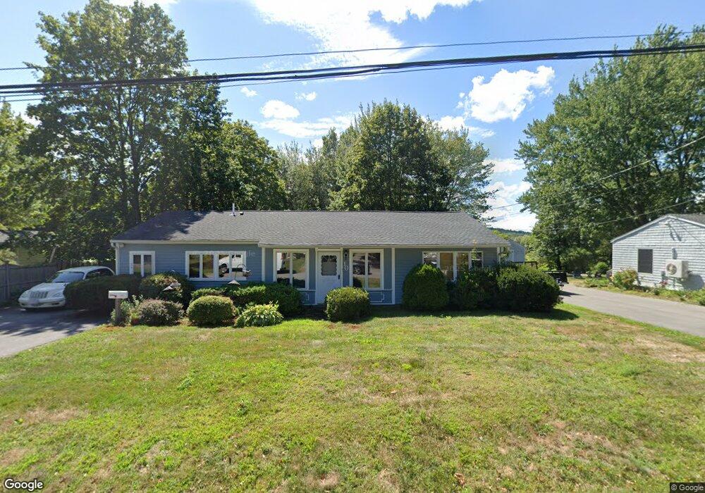
10 Dornell Rd Ipswich, MA 01938
Estimated Value: $620,255 - $683,000
3
Beds
1
Bath
1,577
Sq Ft
$414/Sq Ft
Est. Value
About This Home
This home is located at 10 Dornell Rd, Ipswich, MA 01938 and is currently estimated at $653,064, approximately $414 per square foot. 10 Dornell Rd is a home located in Essex County with nearby schools including Ipswich High School and Clark School.
Ownership History
Date
Name
Owned For
Owner Type
Purchase Details
Closed on
Aug 16, 2006
Sold by
Vinci Christopher J and Vinci Maria L
Bought by
Armstrong James C and Armstrong Therese A
Current Estimated Value
Home Financials for this Owner
Home Financials are based on the most recent Mortgage that was taken out on this home.
Original Mortgage
$287,920
Outstanding Balance
$173,987
Interest Rate
6.88%
Mortgage Type
Purchase Money Mortgage
Estimated Equity
$479,077
Purchase Details
Closed on
Sep 30, 2002
Sold by
Irvine Mary Ann and Irvine Robert L
Bought by
Vinci Christopher J and Vinci Maria L
Home Financials for this Owner
Home Financials are based on the most recent Mortgage that was taken out on this home.
Original Mortgage
$201,000
Interest Rate
6.25%
Mortgage Type
Purchase Money Mortgage
Create a Home Valuation Report for This Property
The Home Valuation Report is an in-depth analysis detailing your home's value as well as a comparison with similar homes in the area
Home Values in the Area
Average Home Value in this Area
Purchase History
| Date | Buyer | Sale Price | Title Company |
|---|---|---|---|
| Armstrong James C | $359,900 | -- | |
| Armstrong James C | $359,900 | -- | |
| Vinci Christopher J | $310,000 | -- | |
| Vinci Christopher J | $310,000 | -- |
Source: Public Records
Mortgage History
| Date | Status | Borrower | Loan Amount |
|---|---|---|---|
| Open | Armstrong James C | $287,920 | |
| Closed | Vinci Christopher J | $287,920 | |
| Previous Owner | Vinci Christopher J | $201,000 | |
| Previous Owner | Vinci Christopher J | $47,000 |
Source: Public Records
Tax History Compared to Growth
Tax History
| Year | Tax Paid | Tax Assessment Tax Assessment Total Assessment is a certain percentage of the fair market value that is determined by local assessors to be the total taxable value of land and additions on the property. | Land | Improvement |
|---|---|---|---|---|
| 2025 | $5,480 | $491,500 | $276,000 | $215,500 |
| 2024 | $5,314 | $467,000 | $275,600 | $191,400 |
| 2023 | $4,860 | $397,400 | $211,900 | $185,500 |
| 2022 | $4,850 | $377,100 | $211,900 | $165,200 |
| 2021 | $4,646 | $351,400 | $198,100 | $153,300 |
| 2020 | $4,472 | $319,000 | $184,300 | $134,700 |
| 2019 | $4,440 | $315,100 | $179,200 | $135,900 |
| 2018 | $4,174 | $293,100 | $165,400 | $127,700 |
| 2017 | $4,019 | $283,200 | $160,200 | $123,000 |
| 2016 | $3,947 | $265,800 | $160,200 | $105,600 |
| 2015 | $3,442 | $254,800 | $155,000 | $99,800 |
Source: Public Records
Map
Nearby Homes
- 4 Dornell Rd
- 128 High St Unit 4
- 10 Olde Ipswich Way Unit E
- 64 Linebrook Rd
- 59 Washington St
- 3 Cottage St
- 11 Washington St Unit 5
- 11 Washington St Unit Nine
- 11 Washington St
- 11 Washington St Unit 12
- 11 Washington St Unit 10
- 3 Soffron Ln Unit 2
- 41 Brownville Ave
- 54 N Main St
- 0 Lanes End
- 23 Heard Dr
- 52 Pineswamp Rd
- 18 Lafayette Rd
- 22 Brownville Ave
- 7 Highland Ave Unit 9