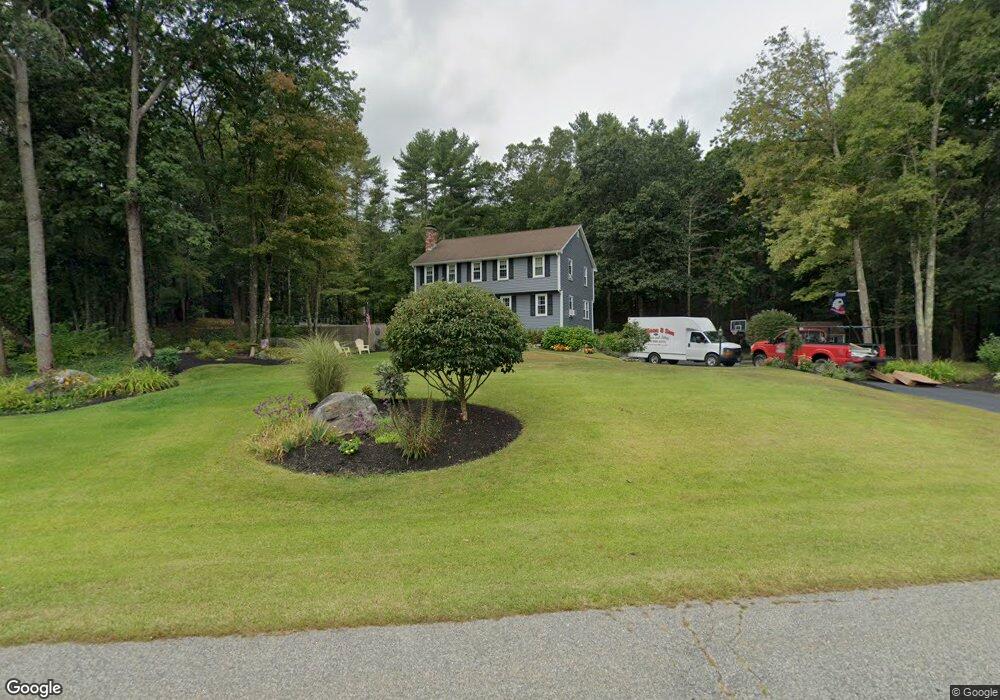
10 Duncan Dr North Andover, MA 01845
Estimated Value: $869,279 - $974,000
4
Beds
3
Baths
2,197
Sq Ft
$423/Sq Ft
Est. Value
About This Home
This home is located at 10 Duncan Dr, North Andover, MA 01845 and is currently estimated at $930,070, approximately $423 per square foot. 10 Duncan Dr is a home located in Essex County with nearby schools including Annie L Sargent Elementary School, North Andover Middle School, and North Andover High School.
Ownership History
Date
Name
Owned For
Owner Type
Purchase Details
Closed on
Dec 2, 2016
Sold by
Rodden Brett and Blaney Michaela
Bought by
Wilson Mark M and Wilson Susan M
Current Estimated Value
Home Financials for this Owner
Home Financials are based on the most recent Mortgage that was taken out on this home.
Original Mortgage
$345,000
Outstanding Balance
$281,759
Interest Rate
3.52%
Mortgage Type
New Conventional
Estimated Equity
$648,311
Purchase Details
Closed on
Jun 11, 2010
Sold by
Call Barbara
Bought by
Rodden Brett and Blaney Michaela
Home Financials for this Owner
Home Financials are based on the most recent Mortgage that was taken out on this home.
Original Mortgage
$350,000
Interest Rate
5.11%
Mortgage Type
Purchase Money Mortgage
Purchase Details
Closed on
Jun 19, 2009
Sold by
Bourassa Mark E
Bought by
Call Barbara
Home Financials for this Owner
Home Financials are based on the most recent Mortgage that was taken out on this home.
Original Mortgage
$3,820,000
Interest Rate
4.91%
Mortgage Type
Purchase Money Mortgage
Purchase Details
Closed on
Jul 15, 2004
Sold by
Mcallister Arthur and Mcallister Susan G
Bought by
Bourassa Barbara C and Bourassa Mark E
Home Financials for this Owner
Home Financials are based on the most recent Mortgage that was taken out on this home.
Original Mortgage
$333,000
Interest Rate
6.25%
Mortgage Type
Purchase Money Mortgage
Purchase Details
Closed on
May 28, 1991
Sold by
Amann David J
Bought by
Mcallister Arthur
Home Financials for this Owner
Home Financials are based on the most recent Mortgage that was taken out on this home.
Original Mortgage
$173,000
Interest Rate
9.36%
Mortgage Type
Purchase Money Mortgage
Create a Home Valuation Report for This Property
The Home Valuation Report is an in-depth analysis detailing your home's value as well as a comparison with similar homes in the area
Home Values in the Area
Average Home Value in this Area
Purchase History
| Date | Buyer | Sale Price | Title Company |
|---|---|---|---|
| Wilson Mark M | $510,000 | -- | |
| Rodden Brett | $420,000 | -- | |
| Call Barbara | -- | -- | |
| Bourassa Barbara C | $510,000 | -- | |
| Mcallister Arthur | $243,000 | -- |
Source: Public Records
Mortgage History
| Date | Status | Borrower | Loan Amount |
|---|---|---|---|
| Open | Wilson Mark M | $345,000 | |
| Previous Owner | Mcallister Arthur | $343,000 | |
| Previous Owner | Mcallister Arthur | $352,000 | |
| Previous Owner | Rodden Brett | $350,000 | |
| Previous Owner | Call Barbara | $3,820,000 | |
| Previous Owner | Bourassa Barbara C | $333,000 | |
| Previous Owner | Mcallister Arthur | $173,000 |
Source: Public Records
Tax History Compared to Growth
Tax History
| Year | Tax Paid | Tax Assessment Tax Assessment Total Assessment is a certain percentage of the fair market value that is determined by local assessors to be the total taxable value of land and additions on the property. | Land | Improvement |
|---|---|---|---|---|
| 2025 | $8,794 | $781,000 | $413,900 | $367,100 |
| 2024 | $8,462 | $763,000 | $392,200 | $370,800 |
| 2023 | $8,061 | $658,600 | $331,200 | $327,400 |
| 2022 | $7,846 | $579,900 | $300,700 | $279,200 |
| 2021 | $7,533 | $531,600 | $272,300 | $259,300 |
| 2020 | $7,198 | $523,900 | $272,300 | $251,600 |
| 2019 | $6,776 | $505,300 | $272,300 | $233,000 |
| 2018 | $7,342 | $505,300 | $272,300 | $233,000 |
| 2017 | $6,633 | $464,500 | $213,500 | $251,000 |
| 2016 | $6,309 | $442,100 | $212,200 | $229,900 |
| 2015 | $5,957 | $414,000 | $208,700 | $205,300 |
Source: Public Records
Map
Nearby Homes
- Lot 10 Stonecleave Rd
- 114 Stonecleave Rd
- 590 Foster St
- 53 Lawrence Rd
- Lot 2 (31) Lawrence Rd
- 50 Stonecleave Rd
- 121 Cortland Dr
- 55 Sheffield Rd
- 851 Forest St
- 10 Woodchuck Ln
- 141 Cortland Dr Unit 141
- 141 Cortland Dr
- 2 Lawrence Rd
- 39 Sheffield Rd
- 660 Sharpners Pond Rd
- 45 Thistle Rd
- 480 Sharpners Pond Rd
- 75 Thistle Rd
- 10 High Ridge Rd
- 12 Farnum St
- 448 Boxford St
- 7 Duncan Dr
- 28 Duncan Dr
- 465 Boxford St
- 434 Boxford St
- 439 Boxford St
- 480 Boxford St
- 11 Stonecleave Rd
- 50 Duncan Dr
- 425 Boxford St
- 31 Stonecleave Rd
- 37 Stonecleave Rd
- 43 Stonecleave Rd
- 1 Boxford St
- 501 Boxford St
- 500 Boxford St
- 500 Boxford St
- 55 Stonecleave Rd
- 0 Stonecleave Rd
- 525 Boxford St