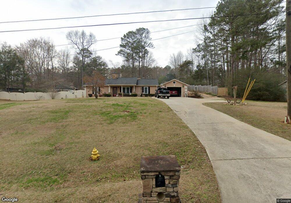
10 Dunsindane Ln Griffin, GA 30223
Spalding County NeighborhoodEstimated Value: $163,934 - $231,000
--
Bed
2
Baths
1,209
Sq Ft
$162/Sq Ft
Est. Value
About This Home
This home is located at 10 Dunsindane Ln, Griffin, GA 30223 and is currently estimated at $195,734, approximately $161 per square foot. 10 Dunsindane Ln is a home located in Spalding County with nearby schools including Jackson Road Elementary School, Kennedy Road Middle School, and Spalding High School.
Ownership History
Date
Name
Owned For
Owner Type
Purchase Details
Closed on
Aug 10, 1988
Sold by
Johnson Ronnie
Bought by
Tiller Ronnie
Current Estimated Value
Purchase Details
Closed on
Jun 29, 1988
Sold by
Emory Egleston Childrens Research
Bought by
Johnson Russell
Purchase Details
Closed on
Dec 31, 1986
Sold by
Joiner Thomas E
Bought by
Emory-Egleston Childrens Research
Purchase Details
Closed on
Jan 6, 1982
Sold by
Properties Unlimited Inc
Bought by
Joiner Thomas E
Create a Home Valuation Report for This Property
The Home Valuation Report is an in-depth analysis detailing your home's value as well as a comparison with similar homes in the area
Home Values in the Area
Average Home Value in this Area
Purchase History
| Date | Buyer | Sale Price | Title Company |
|---|---|---|---|
| Tiller Ronnie | -- | -- | |
| Johnson Russell | $16,000 | -- | |
| Emory-Egleston Childrens Research | $31,000 | -- | |
| Joiner Thomas E | $6,800 | -- |
Source: Public Records
Tax History Compared to Growth
Tax History
| Year | Tax Paid | Tax Assessment Tax Assessment Total Assessment is a certain percentage of the fair market value that is determined by local assessors to be the total taxable value of land and additions on the property. | Land | Improvement |
|---|---|---|---|---|
| 2024 | $810 | $56,127 | $5,720 | $50,407 |
| 2023 | $815 | $56,127 | $5,720 | $50,407 |
| 2022 | $959 | $54,219 | $4,840 | $49,379 |
| 2021 | $1,525 | $43,742 | $4,840 | $38,902 |
| 2020 | $1,530 | $43,742 | $4,840 | $38,902 |
| 2019 | $1,561 | $43,742 | $4,840 | $38,902 |
Source: Public Records
Map
Nearby Homes
- 501 Musgrove Rd
- 230 Sapelo Rd
- 0 N Mcdonough Rd Unit 10599249
- 273 Dutchman Rd
- 140 Morris Mill Rd
- 2014 High Falls Rd
- 2650 Jackson Rd
- 119 Banks Rd
- 2775 Jackson Rd
- 121 Orchard Dr
- 1248 Newton Rd
- 1015 N Walkers Mill Rd
- 265 Hamil Rd Unit 31.89 AC
- 265 Hamil Rd Unit LOT 9
- 243 Hamil Rd Unit 13.18 AC
- 221 Hamil Rd Unit 12.5 AC
- 243 Hamil Rd
- 0 Hamil Rd Unit 6.21 AC 10578337
- 1015 Dutchman Rd
- 0 Chehaw Rd Unit 10594275
- 14 Dunsindane Ln
- 4 Dunsindane Ln
- 566 Musgrove Rd
- 576 Musgrove Rd
- 586 Musgrove Rd
- 7 Dunsindane Ln
- 22 Dunsindane Ln
- 3 Dunsindane Ln
- 11 Dunsindane Ln Unit 16/2
- 11 Dunsindane Ln
- 15 Dunsindane Ln
- 26 Dunsindane Ln
- 13 Birnam Woods Dr
- 600 Musgrove Rd
- 33 Dunsindane Ln
- 0 Birnam Woods Rd Unit 20170098
- 0 Birnam Woods Rd Unit 20170086
- 000 Birnam Woods Rd
- 11 Birnam Woods Dr
- 3 Lochwood Cir