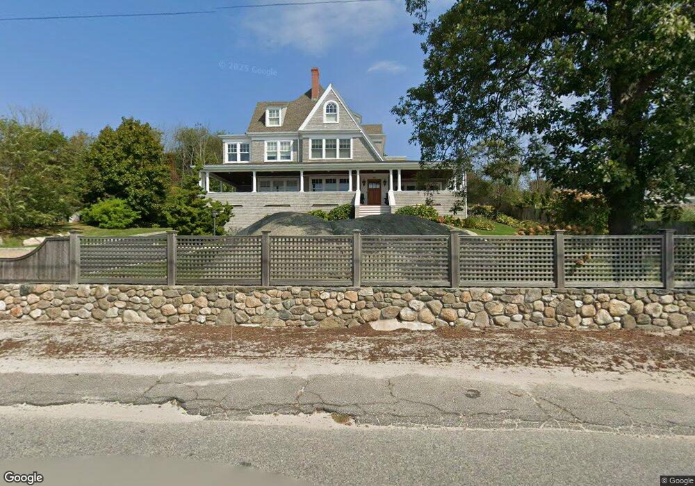
10 Eastern Point Blvd Gloucester, MA 01930
East Gloucester NeighborhoodEstimated Value: $2,741,000 - $3,372,662
6
Beds
3
Baths
3,104
Sq Ft
$992/Sq Ft
Est. Value
About This Home
This home is located at 10 Eastern Point Blvd, Gloucester, MA 01930 and is currently estimated at $3,080,221, approximately $992 per square foot. 10 Eastern Point Blvd is a home located in Essex County with nearby schools including East Gloucester Elementary School, Ralph B O'maley Middle School, and Gloucester High School.
Ownership History
Date
Name
Owned For
Owner Type
Purchase Details
Closed on
Sep 30, 2005
Sold by
Farber Daniel L
Bought by
Olmsted Craig D and Olmsted Lillian M
Current Estimated Value
Home Financials for this Owner
Home Financials are based on the most recent Mortgage that was taken out on this home.
Original Mortgage
$600,000
Interest Rate
5.84%
Mortgage Type
Purchase Money Mortgage
Create a Home Valuation Report for This Property
The Home Valuation Report is an in-depth analysis detailing your home's value as well as a comparison with similar homes in the area
Home Values in the Area
Average Home Value in this Area
Purchase History
| Date | Buyer | Sale Price | Title Company |
|---|---|---|---|
| Olmsted Craig D | $960,000 | -- |
Source: Public Records
Mortgage History
| Date | Status | Borrower | Loan Amount |
|---|---|---|---|
| Open | Olmsted Craig D | $200,000 | |
| Open | Olmsted Craig D | $412,000 | |
| Closed | Olmsted Craig D | $417,000 | |
| Closed | Olmsted Craig D | $600,000 |
Source: Public Records
Tax History
| Year | Tax Paid | Tax Assessment Tax Assessment Total Assessment is a certain percentage of the fair market value that is determined by local assessors to be the total taxable value of land and additions on the property. | Land | Improvement |
|---|---|---|---|---|
| 2025 | $25,388 | $2,611,900 | $1,021,000 | $1,590,900 |
| 2024 | $25,282 | $2,598,400 | $972,500 | $1,625,900 |
| 2023 | $23,832 | $2,250,400 | $829,400 | $1,421,000 |
| 2022 | $23,068 | $1,966,600 | $721,300 | $1,245,300 |
| 2021 | $22,260 | $1,789,400 | $655,400 | $1,134,000 |
| 2020 | $22,524 | $1,826,800 | $655,400 | $1,171,400 |
| 2019 | $21,721 | $1,711,700 | $624,900 | $1,086,800 |
| 2018 | $21,205 | $1,640,000 | $609,600 | $1,030,400 |
| 2017 | $20,696 | $1,569,100 | $581,400 | $987,700 |
| 2016 | $20,126 | $1,478,800 | $555,700 | $923,100 |
| 2015 | $19,757 | $1,447,400 | $543,100 | $904,300 |
Source: Public Records
Map
Nearby Homes
- 15 Raven Ln Unit 15
- 11 Ocean View Dr
- 1 Wonson St
- 10 Seaview Rd
- 73 Rocky Neck Ave Unit 2
- 60 Rocky Neck Ave Unit 202
- 197 E Main St Unit 1
- 100 Eastern Point Blvd
- 191 Main St Unit 3
- 191 Main St Unit 2A
- 33 Middle St
- 35 Middle St Unit 4
- 139A Prospect St
- 87 Atlantic Rd Unit 2
- 3 Mondello Square
- 15 Mount Vernon St
- 20 Beacon St
- 20 Beacon St Unit 2
- 20 Beacon St Unit 1
- 113 Pleasant St
- 10 Eastern Point Blvd Unit 1
- 4 Stewart Ave
- 8 Eastern Point Blvd
- 6 Stewart Ave
- 10 Farrington Ave
- 2 Daventry Ln Unit A
- 4 & 6 Eastern Point Blvd
- 10 Stewart Ave
- 3 Daventry Ln Unit B
- 11 Stewart Ave Unit 1
- 11 Stewart Ave
- 7 Stewart Ave
- 12 Stewart Ave
- 2 Eastern Point Blvd
- 66 Eastern Point Rd
- 62 Eastern Point Rd Unit 2
- 62 Eastern Point Rd
- 62 Eastern Point Rd
- 62 Eastern Point Rd Unit WINTER
- 62 Eastern Point Rd Unit 1
Your Personal Tour Guide
Ask me questions while you tour the home.