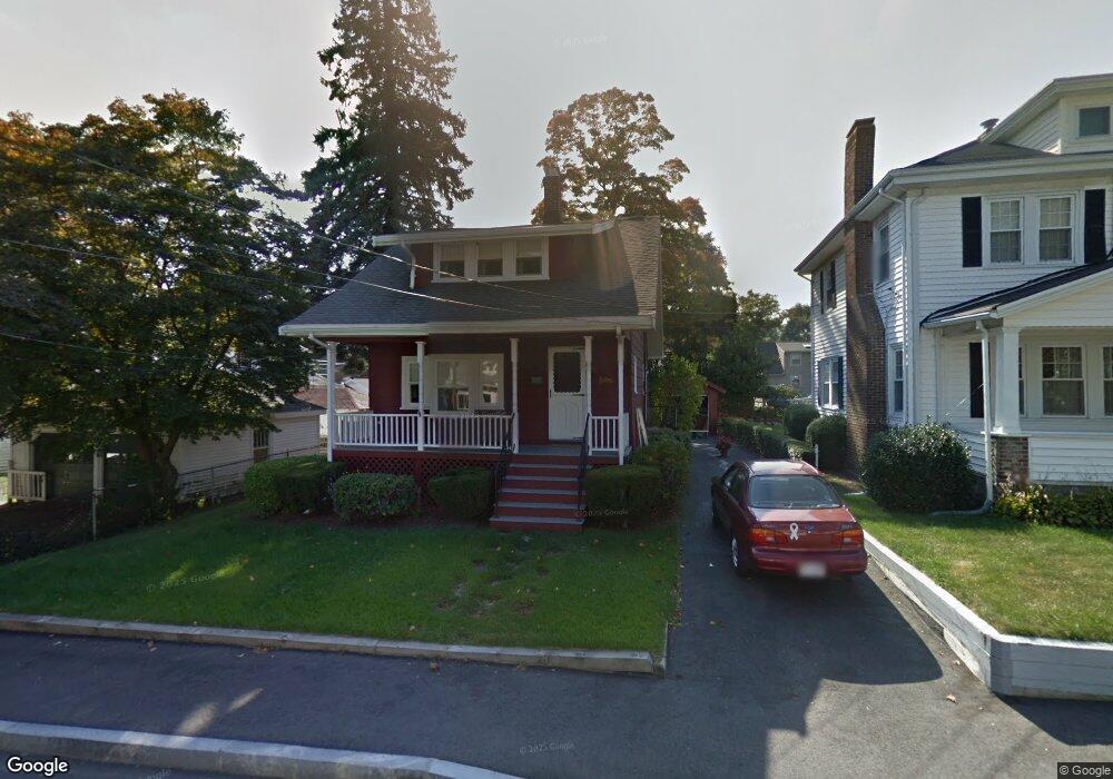
10 Elmlawn Rd Braintree, MA 02184
East Braintree NeighborhoodEstimated Value: $631,994 - $680,000
3
Beds
2
Baths
1,254
Sq Ft
$519/Sq Ft
Est. Value
About This Home
This home is located at 10 Elmlawn Rd, Braintree, MA 02184 and is currently estimated at $650,499, approximately $518 per square foot. 10 Elmlawn Rd is a home located in Norfolk County with nearby schools including Braintree High School, Step Ahead Kindergarten, and Meeting House Montessori School.
Ownership History
Date
Name
Owned For
Owner Type
Purchase Details
Closed on
Dec 18, 2007
Sold by
Mcgrath Annemarie and Mahoney Francis C
Bought by
Mahoney Ft and Mahoney Francis C
Current Estimated Value
Create a Home Valuation Report for This Property
The Home Valuation Report is an in-depth analysis detailing your home's value as well as a comparison with similar homes in the area
Home Values in the Area
Average Home Value in this Area
Purchase History
| Date | Buyer | Sale Price | Title Company |
|---|---|---|---|
| Mahoney Ft | -- | -- |
Source: Public Records
Tax History
| Year | Tax Paid | Tax Assessment Tax Assessment Total Assessment is a certain percentage of the fair market value that is determined by local assessors to be the total taxable value of land and additions on the property. | Land | Improvement |
|---|---|---|---|---|
| 2025 | $5,643 | $565,400 | $314,500 | $250,900 |
| 2024 | $5,127 | $540,800 | $293,300 | $247,500 |
| 2023 | $4,859 | $497,800 | $263,500 | $234,300 |
| 2022 | $4,699 | $472,300 | $238,000 | $234,300 |
| 2021 | $4,340 | $436,200 | $215,100 | $221,100 |
| 2020 | $4,016 | $407,300 | $195,500 | $211,800 |
| 2019 | $3,874 | $383,900 | $187,000 | $196,900 |
| 2018 | $3,783 | $358,900 | $170,000 | $188,900 |
| 2017 | $3,651 | $339,900 | $161,500 | $178,400 |
| 2016 | $3,372 | $307,100 | $136,000 | $171,100 |
| 2015 | $3,315 | $299,500 | $134,300 | $165,200 |
| 2014 | $3,148 | $275,700 | $122,400 | $153,300 |
Source: Public Records
Map
Nearby Homes
- 17 White Rd
- 255 River St
- 30 Church St Unit 4
- 26 Tingley Rd
- 9 Independence Ave Unit 307
- 10 Skyline Dr Unit 5
- 30 Skyline Dr Unit 6
- 192 Federal Ave Unit B
- 50 Cleveland Ave
- 312 Shaw St
- 583 Union St
- 25 W Howard St Unit C3
- 155 Kendrick Ave Unit 502
- 36 Chestnut Ave
- 177 Franklin St
- 166 Phipps St
- 36 Independence Ave Unit 1
- 200 Falls Blvd Unit B305
- 491 Washington St Unit 1
- 29 Joseph Rd
Your Personal Tour Guide
Ask me questions while you tour the home.