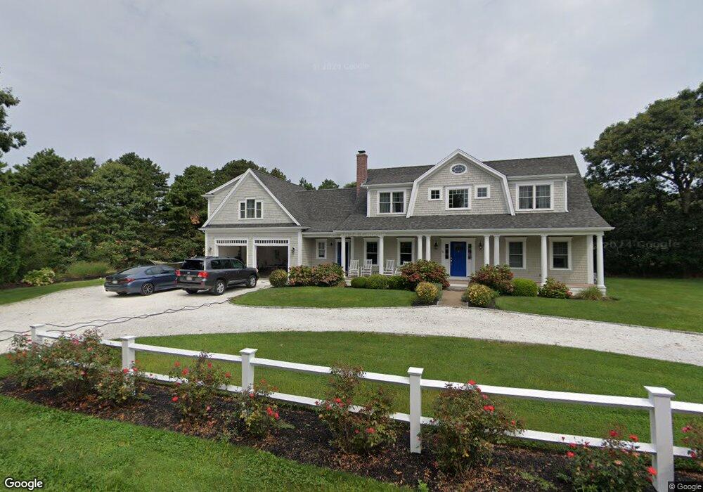
10 Fife Ct Eastham, MA 2642
Estimated Value: $1,155,000 - $1,641,000
About This Home
This home is located at 10 Fife Ct, Eastham, MA 2642 and is currently estimated at $1,389,966, approximately $553 per square foot. 10 Fife Ct is a home located in Barnstable County with nearby schools including Eastham Elementary School, Nauset Regional Middle School, and Nauset Regional High School.
Ownership History
We collect this data history from publicly available records. To have your information removed, we recommend requesting removal directly through your county’s website.
Purchase Details
Purchase Details
Home Values in the Area
Average Home Value in this Area
Purchase History
We collect this data history from publicly available records. To have your information removed, we recommend requesting removal directly through your county’s website.
| Date | Buyer | Sale Price | Title Company |
|---|---|---|---|
| $220,000 | -- | ||
| $220,000 | -- |
Tax History
We collect this data history from publicly available records. To have your information removed, we recommend requesting removal directly through your county’s website.
| Year | Tax Paid | Tax Assessment Tax Assessment Total Assessment is a certain percentage of the fair market value that is determined by local assessors to be the total taxable value of land and additions on the property. | Land | Improvement |
|---|---|---|---|---|
| 2025 | $9,314 | $1,208,100 | $292,700 | $915,400 |
| 2024 | $8,287 | $1,182,100 | $284,100 | $898,000 |
| 2023 | $7,628 | $1,053,600 | $263,100 | $790,500 |
| 2022 | $6,933 | $808,100 | $234,900 | $573,200 |
| 2021 | $6,792 | $739,900 | $213,500 | $526,400 |
| 2020 | $6,336 | $726,600 | $239,700 | $486,900 |
| 2019 | $5,952 | $721,400 | $243,300 | $478,100 |
| 2018 | $5,892 | $705,600 | $236,300 | $469,300 |
| 2017 | $5,502 | $696,500 | $231,600 | $464,900 |
| 2016 | $4,932 | $662,900 | $201,400 | $461,500 |
| 2015 | $4,616 | $650,200 | $197,400 | $452,800 |
Map
- 655 Herring Brook Rd
- 20 Priscilla Cir
- 10 Cartway N
- 20 Stone Ct
- 163 Samoset Rd
- 1690 Herring Brook Rd
- 600 Kingsbury Beach Rd
- 1975 State Hwy Unit 1
- 1975 State Hwy Unit 9
- 1145 Kingsbury Beach Rd
- 10 Polly Seabury Way
- 21 Locust Rd
- 3098 State Hwy
- 5 Weir Rd
- 65 Whitney Rd
- 12 Settlers Trace
- 40 Bayview Rd
- 1061 State Hwy Unit 4
- 1061 State Hwy Unit 1061
- 90 Whitney Rd
- 40 Heritage Hill Cir
- 45 Heritage Hill Cir
- 25 Heritage Hill Cir
- 30 Heritage Hill Cir
- 20 Fife Ct
- 105 Lawton Rd
- 30 Fife Ct
- 600 Herring Brook Rd
- 20 Heritage Hill Cir
- 40 Fife Ct
- 75 Lawton Rd
- 620 Herring Brook Rd
- 145 Lawton Rd
- 630 Herring Brook Rd
- 45 Lawton Rd
- 60 Sands Rd
- 10 Heritage Hill Cir
- 50 Sands Rd
- 680 Herring Brook Rd
- 100 Lawton Rd
Ask me questions while you tour the home.