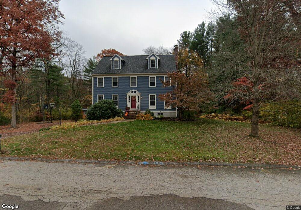
10 Forest Rd Medway, MA 02053
Estimated Value: $793,000 - $942,000
4
Beds
3
Baths
2,312
Sq Ft
$374/Sq Ft
Est. Value
About This Home
This home is located at 10 Forest Rd, Medway, MA 02053 and is currently estimated at $864,073, approximately $373 per square foot. 10 Forest Rd is a home located in Norfolk County with nearby schools including John D. McGovern Elementary School, Burke-Memorial Elementary, and Medway Middle School.
Ownership History
Date
Name
Owned For
Owner Type
Purchase Details
Closed on
Jun 29, 2000
Sold by
Trainer Philip D and Trainer Nelda
Bought by
Faichney Robert J and Faichney Deborah J
Current Estimated Value
Home Financials for this Owner
Home Financials are based on the most recent Mortgage that was taken out on this home.
Original Mortgage
$280,000
Interest Rate
8.59%
Mortgage Type
Purchase Money Mortgage
Purchase Details
Closed on
Dec 2, 1992
Sold by
Centola Tr Joseph P
Bought by
Trainer Philip D and Trainer Nelda
Home Financials for this Owner
Home Financials are based on the most recent Mortgage that was taken out on this home.
Original Mortgage
$185,600
Interest Rate
8.22%
Mortgage Type
Purchase Money Mortgage
Create a Home Valuation Report for This Property
The Home Valuation Report is an in-depth analysis detailing your home's value as well as a comparison with similar homes in the area
Home Values in the Area
Average Home Value in this Area
Purchase History
| Date | Buyer | Sale Price | Title Company |
|---|---|---|---|
| Faichney Robert J | $359,900 | -- | |
| Trainer Philip D | $232,000 | -- |
Source: Public Records
Mortgage History
| Date | Status | Borrower | Loan Amount |
|---|---|---|---|
| Open | Trainer Philip D | $275,000 | |
| Closed | Trainer Philip D | $280,000 | |
| Previous Owner | Trainer Philip D | $184,000 | |
| Previous Owner | Trainer Philip D | $185,600 |
Source: Public Records
Tax History Compared to Growth
Tax History
| Year | Tax Paid | Tax Assessment Tax Assessment Total Assessment is a certain percentage of the fair market value that is determined by local assessors to be the total taxable value of land and additions on the property. | Land | Improvement |
|---|---|---|---|---|
| 2025 | $10,535 | $739,300 | $326,600 | $412,700 |
| 2024 | $10,646 | $739,300 | $326,600 | $412,700 |
| 2023 | $10,530 | $660,600 | $297,300 | $363,300 |
| 2022 | $9,469 | $559,300 | $219,800 | $339,500 |
| 2021 | $9,381 | $537,300 | $205,200 | $332,100 |
| 2020 | $9,349 | $534,200 | $205,200 | $329,000 |
| 2019 | $8,717 | $513,700 | $196,800 | $316,900 |
| 2018 | $8,788 | $497,600 | $188,400 | $309,200 |
| 2017 | $8,698 | $485,400 | $184,200 | $301,200 |
| 2016 | $8,336 | $460,300 | $169,600 | $290,700 |
| 2015 | $8,265 | $453,100 | $167,500 | $285,600 |
| 2014 | $7,990 | $424,100 | $167,500 | $256,600 |
Source: Public Records
Map
Nearby Homes
- 280 Village St Unit D2
- 5 Richardson St
- 4 Shaw St
- 10 Prospect St
- 176 Main St Unit 3
- 21 Riverside Rd
- 14 Heritage Dr
- 14 Sanford St Unit 15
- 20 Broad St Unit 6
- 20 Broad St Unit A
- 20 Broad St Unit 4
- 0 Elm St
- 3 Meryl St
- 220 Main St Unit 220
- 5 Fales St
- 9 Sanford St
- 12 Lovering St
- 7 Gloucester Dr
- 36 Lovering St
- 50 Main St