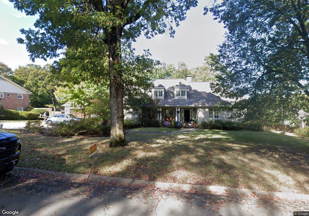
10 Glenridge Rd Little Rock, AR 72227
Foxcroft NeighborhoodEstimated Value: $803,000 - $1,068,000
5
Beds
6
Baths
5,250
Sq Ft
$179/Sq Ft
Est. Value
About This Home
This home is located at 10 Glenridge Rd, Little Rock, AR 72227 and is currently estimated at $940,003, approximately $179 per square foot. 10 Glenridge Rd is a home located in Pulaski County with nearby schools including Jefferson Elementary School, Pulaski Heights Middle School, and Central High School.
Ownership History
Date
Name
Owned For
Owner Type
Purchase Details
Closed on
Jul 3, 2008
Sold by
Anthonisen Margot L Hilger and Margot L Cranford Trust
Bought by
England Lane and England Tracy
Current Estimated Value
Home Financials for this Owner
Home Financials are based on the most recent Mortgage that was taken out on this home.
Original Mortgage
$630,000
Outstanding Balance
$403,027
Interest Rate
5.99%
Mortgage Type
Construction
Estimated Equity
$536,976
Purchase Details
Closed on
Aug 18, 2005
Sold by
Joyner J C and Joyner Ellen
Bought by
Hilger Margot L and Margot L Cranford Trust
Create a Home Valuation Report for This Property
The Home Valuation Report is an in-depth analysis detailing your home's value as well as a comparison with similar homes in the area
Home Values in the Area
Average Home Value in this Area
Purchase History
| Date | Buyer | Sale Price | Title Company |
|---|---|---|---|
| England Lane | $391,000 | Pulaski County Title | |
| Hilger Margot L | $350,000 | Lenders Title Co |
Source: Public Records
Mortgage History
| Date | Status | Borrower | Loan Amount |
|---|---|---|---|
| Open | England Lane | $630,000 |
Source: Public Records
Tax History Compared to Growth
Tax History
| Year | Tax Paid | Tax Assessment Tax Assessment Total Assessment is a certain percentage of the fair market value that is determined by local assessors to be the total taxable value of land and additions on the property. | Land | Improvement |
|---|---|---|---|---|
| 2025 | $11,700 | $172,767 | $17,600 | $155,167 |
| 2024 | $10,725 | $172,767 | $17,600 | $155,167 |
| 2023 | $10,725 | $172,767 | $17,600 | $155,167 |
| 2022 | $10,238 | $172,767 | $17,600 | $155,167 |
| 2021 | $9,821 | $152,730 | $17,600 | $135,130 |
| 2020 | $8,986 | $152,730 | $17,600 | $135,130 |
| 2019 | $8,596 | $152,730 | $17,600 | $135,130 |
| 2018 | $8,231 | $152,730 | $17,600 | $135,130 |
| 2017 | $7,841 | $152,730 | $17,600 | $135,130 |
| 2016 | $7,452 | $137,910 | $18,000 | $119,910 |
| 2015 | $6,875 | $106,990 | $18,000 | $88,990 |
| 2014 | $6,875 | $98,070 | $18,000 | $80,070 |
Source: Public Records
Map
Nearby Homes
- 72 Robinwood Dr
- 4 Hillandale Dr
- 5 Berwyn Dr
- 4 Robinwood Dr
- 27 River Ridge Ct
- 28 River Ridge Cir
- 13 Misty Ct
- 107 Claremore Ct
- 9 Misty Ct
- 9 River View Point
- 11 Vantage Point
- 1 Rivers Edge Dr
- 9925 Echo Valley Ct
- Lot 17 River Ridge Pointe
- 23 Woodglen Rd
- 40 Woodglen Rd
- 801 Pleasant Valley Dr
- 21 Woodglen Rd
- 2908 Breckenridge Dr
- 26 Foxcroft Village Dr
- 8 Glenridge Rd
- 60 Robinwood Dr
- 64 Robinwood Dr
- 68 Robinwood Dr
- 11 Glenridge Rd
- 9 Glenridge Rd
- 6 Glenridge Rd
- 58 Robinwood Dr
- 7 Glenridge Rd
- 63 Robinwood Dr
- 61 Robinwood Dr
- 65 Robinwood Dr
- 67 Robinwood Dr
- 0 Robinwood Dr
- 4 Glenridge Rd
- 54 Robinwood Dr
- 5 Glenridge Rd
- 69 Robinwood Dr
- 46 Robinwood Dr
- 48 Robinwood Dr