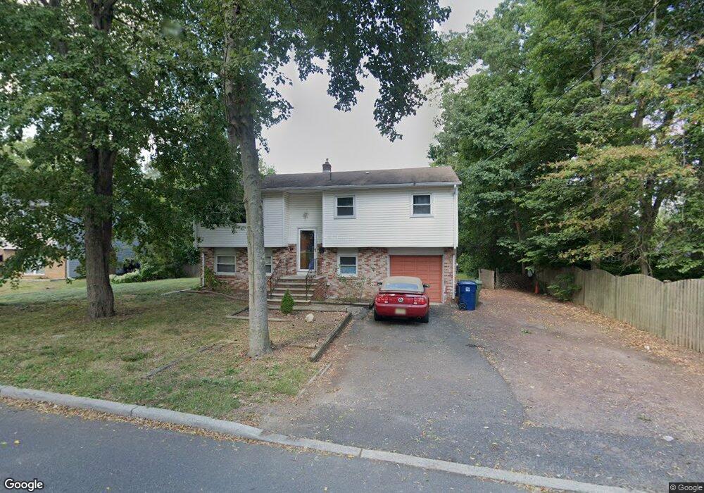
10 Grape Run Rd Hightstown, NJ 08520
Estimated Value: $439,000 - $542,000
4
Beds
2
Baths
1,890
Sq Ft
$269/Sq Ft
Est. Value
About This Home
This home is located at 10 Grape Run Rd, Hightstown, NJ 08520 and is currently estimated at $508,287, approximately $268 per square foot. 10 Grape Run Rd is a home located in Mercer County with nearby schools including Melvin H. Kreps Middle School, Hightstown High School, and SciCore Academy.
Ownership History
Date
Name
Owned For
Owner Type
Purchase Details
Closed on
Mar 26, 2016
Sold by
Yi Jau and Chuang Sharle
Bought by
Chuang Jau Yi and Chuang Sharley
Current Estimated Value
Purchase Details
Closed on
Jun 5, 2003
Sold by
Cendant Mtg
Bought by
Chuang Jau Yi Chuang and Chuang Sharley
Purchase Details
Closed on
Feb 9, 1989
Sold by
Quayle Robert M and Quayle Debbora B
Bought by
Lewis Reinaldo A and Lewis Althea C
Create a Home Valuation Report for This Property
The Home Valuation Report is an in-depth analysis detailing your home's value as well as a comparison with similar homes in the area
Home Values in the Area
Average Home Value in this Area
Purchase History
| Date | Buyer | Sale Price | Title Company |
|---|---|---|---|
| Chuang Jau Yi | -- | First American Title Insco | |
| Chuang Jau Yi Chuang | $145,655 | -- | |
| -- | $145,600 | -- | |
| Lewis Reinaldo A | $152,400 | -- |
Source: Public Records
Tax History Compared to Growth
Tax History
| Year | Tax Paid | Tax Assessment Tax Assessment Total Assessment is a certain percentage of the fair market value that is determined by local assessors to be the total taxable value of land and additions on the property. | Land | Improvement |
|---|---|---|---|---|
| 2025 | $9,620 | $196,200 | $81,400 | $114,800 |
| 2024 | $9,522 | $196,200 | $81,400 | $114,800 |
| 2023 | $9,522 | $196,200 | $81,400 | $114,800 |
| 2022 | $9,192 | $196,200 | $81,400 | $114,800 |
| 2021 | $8,860 | $196,200 | $81,400 | $114,800 |
| 2020 | $8,658 | $196,200 | $81,400 | $114,800 |
| 2019 | $8,417 | $196,200 | $81,400 | $114,800 |
| 2018 | $8,172 | $196,200 | $81,400 | $114,800 |
| 2017 | $8,087 | $196,200 | $81,400 | $114,800 |
| 2016 | $8,017 | $196,200 | $81,400 | $114,800 |
| 2015 | $7,966 | $196,200 | $81,400 | $114,800 |
| 2014 | $8,017 | $196,200 | $81,400 | $114,800 |
Source: Public Records
Map
Nearby Homes
- 12 Grape Run Rd
- 14 Pershing Ave
- 3 Brook Dr
- 1 Brook Dr
- 5 Grape Run Rd
- 6 Pershing Ave
- 14 Grape Run Rd
- 10 Westerlea Ave Unit B-144
- 2 Pershing Ave
- 9 Pershing Ave
- 16 Grape Run Rd
- 11 Pershing Ave
- 5 Pershing Ave
- 18 Grape Run Rd
- 3 Grape Run Rd
- 3 Pershing Ave
- 163 South St
- 1 Pershing Ave
- 171 South St
- 175 South St