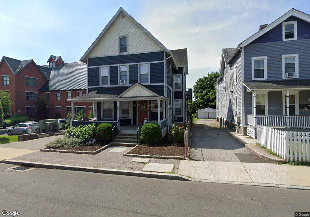
10 Hanford Place Unit 2 Norwalk, CT 06854
South Norwalk NeighborhoodEstimated Value: $778,026 - $886,000
3
Beds
1
Bath
900
Sq Ft
$915/Sq Ft
Est. Value
About This Home
This home is located at 10 Hanford Place Unit 2, Norwalk, CT 06854 and is currently estimated at $823,757, approximately $915 per square foot. 10 Hanford Place Unit 2 is a home located in Fairfield County with nearby schools including Silvermine Elementary School, West Rocks Middle School, and Norwalk High School.
Ownership History
Date
Name
Owned For
Owner Type
Purchase Details
Closed on
May 10, 2007
Sold by
Potter Rose Marie
Bought by
Hanford Group Llc
Current Estimated Value
Home Financials for this Owner
Home Financials are based on the most recent Mortgage that was taken out on this home.
Original Mortgage
$484,650
Outstanding Balance
$223,012
Interest Rate
7.5%
Estimated Equity
$580,067
Create a Home Valuation Report for This Property
The Home Valuation Report is an in-depth analysis detailing your home's value as well as a comparison with similar homes in the area
Home Values in the Area
Average Home Value in this Area
Purchase History
| Date | Buyer | Sale Price | Title Company |
|---|---|---|---|
| Hanford Group Llc | $538,500 | -- | |
| Hanford Group Llc | $538,500 | -- |
Source: Public Records
Mortgage History
| Date | Status | Borrower | Loan Amount |
|---|---|---|---|
| Open | Hanford Group Llc | $484,650 | |
| Closed | Hanford Group Llc | $484,650 |
Source: Public Records
Tax History Compared to Growth
Tax History
| Year | Tax Paid | Tax Assessment Tax Assessment Total Assessment is a certain percentage of the fair market value that is determined by local assessors to be the total taxable value of land and additions on the property. | Land | Improvement |
|---|---|---|---|---|
| 2025 | $9,616 | $402,330 | $107,160 | $295,170 |
| 2024 | $9,473 | $402,330 | $107,160 | $295,170 |
| 2023 | $6,559 | $261,460 | $92,090 | $169,370 |
| 2022 | $6,418 | $261,460 | $92,090 | $169,370 |
| 2021 | $6,267 | $261,460 | $92,090 | $169,370 |
| 2020 | $6,264 | $261,460 | $92,090 | $169,370 |
| 2019 | $6,096 | $261,460 | $92,090 | $169,370 |
| 2018 | $4,601 | $172,950 | $82,810 | $90,140 |
| 2017 | $4,442 | $172,950 | $82,810 | $90,140 |
| 2016 | $4,400 | $172,950 | $82,810 | $90,140 |
| 2015 | $4,388 | $172,950 | $82,810 | $90,140 |
| 2014 | $4,331 | $172,950 | $82,810 | $90,140 |
Source: Public Records
Map
Nearby Homes
- 28 Chestnut St
- 42 S Main St Unit 202
- 25 Chestnut St Unit 1-I
- 94 Washington St Unit 20
- 134 Washington St Unit 206
- 15 Madison St Unit F9
- 15 Madison St Unit G11
- 131 Washington St Unit 204
- 7 Hamilton Ave Unit 32
- 10 Ann St Unit 206
- 187 Flax Hill Rd Unit D5
- 33 N Water St Unit 607
- 33 N Water St Unit 505
- 33 N Water St Unit 804
- 52 Lexington Ave
- 32 Pine St Unit 27
- 32 Pine St Unit 26
- 58 Shorefront Park
- 9 Lawrence St
- 4 van Zant St Unit A2
- 10 Hanford Place
- 8 Hanford Place
- 11 Day St
- 4 Hanford Place
- 11 Hanford Place
- 11 Hanford Place Unit 1st F
- 11 Hanford Place Unit 2nd f
- 11 Hanford Place Unit 3
- 11 Hanford Place Unit 2
- 11 Hanford Place Unit 1
- 9 Hanford Place
- 2 Hanford Place
- 7 Hanford Place
- 5 Hanford Place
- 5 Hanford Place Unit 1
- 3 Hanford Place
- 19 Day St Unit 204
- 19 Day St Unit 412
- 19 Day St Unit 509
- 19 Day St Unit 409