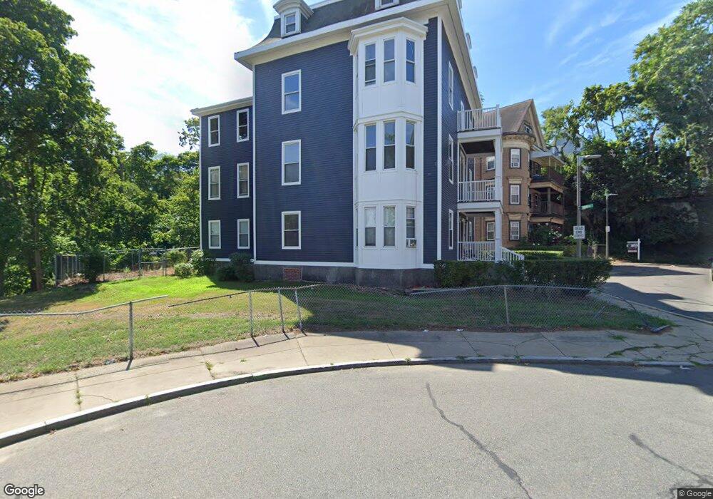
10 Harold Park Roxbury, MA 02119
Washington Park NeighborhoodEstimated Value: $1,392,000 - $1,578,000
9
Beds
3
Baths
5,379
Sq Ft
$269/Sq Ft
Est. Value
About This Home
This home is located at 10 Harold Park, Roxbury, MA 02119 and is currently estimated at $1,446,121, approximately $268 per square foot. 10 Harold Park is a home located in Suffolk County with nearby schools including Bridge Boston Charter School and City on a Hill Charter Public School.
Ownership History
Date
Name
Owned For
Owner Type
Purchase Details
Closed on
Apr 1, 2016
Sold by
Shepard Dennis L
Bought by
Park View Associates M
Current Estimated Value
Purchase Details
Closed on
Feb 12, 2010
Sold by
Shepard Dennis C
Bought by
Shepard Dennis L
Create a Home Valuation Report for This Property
The Home Valuation Report is an in-depth analysis detailing your home's value as well as a comparison with similar homes in the area
Home Values in the Area
Average Home Value in this Area
Purchase History
| Date | Buyer | Sale Price | Title Company |
|---|---|---|---|
| Park View Associates M | -- | -- | |
| Park View Associates M | -- | -- | |
| Shepard Dennis L | -- | -- | |
| Shepard Dennis L | -- | -- |
Source: Public Records
Mortgage History
| Date | Status | Borrower | Loan Amount |
|---|---|---|---|
| Previous Owner | Shepard Dennis L | $65,000 | |
| Previous Owner | Shepard Dennis L | $39,000 |
Source: Public Records
Tax History Compared to Growth
Tax History
| Year | Tax Paid | Tax Assessment Tax Assessment Total Assessment is a certain percentage of the fair market value that is determined by local assessors to be the total taxable value of land and additions on the property. | Land | Improvement |
|---|---|---|---|---|
| 2025 | $12,799 | $1,105,300 | $417,200 | $688,100 |
| 2024 | $11,544 | $1,059,100 | $310,500 | $748,600 |
| 2023 | $10,446 | $972,600 | $277,100 | $695,500 |
| 2022 | $9,889 | $908,900 | $259,000 | $649,900 |
| 2021 | $9,325 | $873,900 | $249,000 | $624,900 |
| 2020 | $6,248 | $591,700 | $246,200 | $345,500 |
| 2019 | $5,608 | $532,100 | $194,600 | $337,500 |
| 2018 | $5,309 | $506,600 | $194,600 | $312,000 |
| 2017 | $5,365 | $506,600 | $194,600 | $312,000 |
| 2016 | $4,846 | $440,500 | $194,600 | $245,900 |
| 2015 | $4,591 | $379,100 | $147,300 | $231,800 |
| 2014 | $5,380 | $427,700 | $147,300 | $280,400 |
Source: Public Records
Map
Nearby Homes
- 90 Munroe St
- 151 Townsend St
- 99 Harrishof St
- 16 Mayfair St
- 94 Walnut Ave
- 8 Brinton St Unit 2
- 10 Rockland St Unit 4
- 2856 Washington St
- 28 Wabon St
- 4 Wyoming St Unit 2
- 495 Warren St
- 476 Warren St
- 5 Glenburne St
- 12 Weldon St
- 8 Weldon St
- 9 W Cedar St Unit 1
- 9-45 Vale St
- 30 Copeland St Unit 1
- 7 Waumbeck St Unit 3
- 9 Abbotsford St Unit 1
- 18 Harold Park Unit 3
- 18 Harold Park Unit 1
- 18 Harold Park
- 18 Harold Park Unit 1
- 18 Harold Park Unit 3
- 18 Harold Park Unit 2
- 19 Harold Park
- 15 Harold Park Unit 1
- 15 Harold Park
- 15 Harold Park Unit 2
- 77 Munroe St
- 79 Munroe St Unit 81
- 75 Munroe St
- 75 Munroe St
- 75 Munroe St Unit 1
- 75 Munroe St Unit 2
- 71 Munroe St Unit 73
- 11 Harold Park
- 85 Munroe St Unit 4
- 85 Munroe St Unit 3