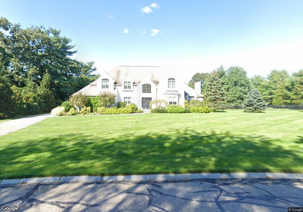
10 Haven Rd Medfield, MA 02052
Estimated Value: $1,359,000 - $1,578,000
4
Beds
4
Baths
3,266
Sq Ft
$447/Sq Ft
Est. Value
About This Home
This home is located at 10 Haven Rd, Medfield, MA 02052 and is currently estimated at $1,460,768, approximately $447 per square foot. 10 Haven Rd is a home located in Norfolk County with nearby schools including Ralph Wheelock School, Memorial School, and Dale Street School.
Ownership History
Date
Name
Owned For
Owner Type
Purchase Details
Closed on
Mar 4, 2025
Sold by
Yerardi Debora L and Yerardi Ronald W
Bought by
Deboral Yerardi Ret and Yerardi
Current Estimated Value
Purchase Details
Closed on
Dec 31, 2009
Sold by
Yerardi Ronald W and Yerardi Debora L
Bought by
Yerardi Debora L
Purchase Details
Closed on
Jun 30, 2005
Sold by
Eiland Robert A and Eiland Sharlotte A
Bought by
Yerardi Debora L and Yerardi Ronald W
Purchase Details
Closed on
Feb 4, 2000
Sold by
Dwivedi Chandra M and Dwivedi Poornima
Bought by
Eiland Robert A and Eiland Sharlotte A
Purchase Details
Closed on
Sep 2, 1994
Sold by
Sunpath Designs Inc
Bought by
Dwivedi Chandra M and Dwivedi Poornima
Create a Home Valuation Report for This Property
The Home Valuation Report is an in-depth analysis detailing your home's value as well as a comparison with similar homes in the area
Home Values in the Area
Average Home Value in this Area
Purchase History
| Date | Buyer | Sale Price | Title Company |
|---|---|---|---|
| Deboral Yerardi Ret | -- | None Available | |
| Deboral Yerardi Ret | -- | None Available | |
| Yerardi Debora L | -- | -- | |
| Yerardi Debora L | -- | -- | |
| Yerardi Debora L | $890,000 | -- | |
| Yerardi Debora L | $890,000 | -- | |
| Eiland Robert A | $615,000 | -- | |
| Dwivedi Chandra M | $420,000 | -- | |
| Dwivedi Chandra M | $420,000 | -- |
Source: Public Records
Mortgage History
| Date | Status | Borrower | Loan Amount |
|---|---|---|---|
| Previous Owner | Dwivedi Chandra M | $400,000 | |
| Previous Owner | Dwivedi Chandra M | $150,000 |
Source: Public Records
Tax History
| Year | Tax Paid | Tax Assessment Tax Assessment Total Assessment is a certain percentage of the fair market value that is determined by local assessors to be the total taxable value of land and additions on the property. | Land | Improvement |
|---|---|---|---|---|
| 2025 | $18,172 | $1,316,800 | $475,400 | $841,400 |
| 2024 | $17,846 | $1,219,000 | $435,400 | $783,600 |
| 2023 | $17,552 | $1,137,500 | $415,400 | $722,100 |
| 2022 | $17,035 | $977,900 | $395,400 | $582,500 |
| 2021 | $16,835 | $947,900 | $393,400 | $554,500 |
| 2020 | $16,582 | $930,000 | $391,400 | $538,600 |
| 2019 | $16,251 | $909,400 | $375,400 | $534,000 |
| 2018 | $14,888 | $874,200 | $350,600 | $523,600 |
| 2017 | $14,480 | $857,300 | $339,400 | $517,900 |
| 2016 | $14,293 | $853,300 | $335,400 | $517,900 |
| 2015 | $13,069 | $814,800 | $327,400 | $487,400 |
| 2014 | $12,838 | $796,400 | $309,000 | $487,400 |
Source: Public Records
Map
Nearby Homes
- 15 Homestead Dr
- 38 Philip St
- 71 Philip St
- 26 Maple Ln Unit 26
- 42 Maple Ln
- 89 Pleasant St Unit D1
- 82 Pleasant St
- 91 Pleasant St Unit A6
- 80 Pleasant St
- 16 Laurel Dr
- 16 Rocky Ln
- 17 Rolling Ln
- 40 Hearthstone Dr
- 26 Dover Dr
- 160 Granite St
- 30 Snyder Rd
- 2 Stagecoach Rd
- 5 Castle Ave
- 104 Wood End Ln
- 2 Lincoln Ct
Your Personal Tour Guide
Ask me questions while you tour the home.