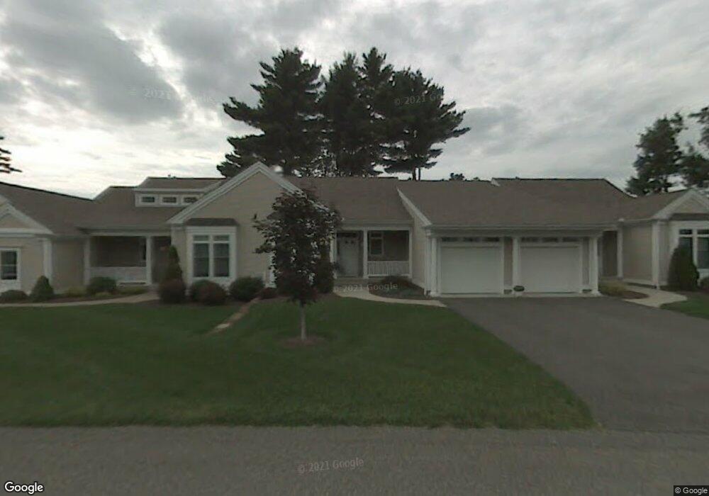
10 High Pine Cir Wilbraham, MA 01095
Estimated Value: $616,000 - $657,000
3
Beds
4
Baths
2,417
Sq Ft
$263/Sq Ft
Est. Value
About This Home
This home is located at 10 High Pine Cir, Wilbraham, MA 01095 and is currently estimated at $636,587, approximately $263 per square foot. 10 High Pine Cir is a home located in Hampden County with nearby schools including Minnechaug Regional High School and Wilbraham & Monson Academy.
Ownership History
Date
Name
Owned For
Owner Type
Purchase Details
Closed on
Dec 12, 2024
Sold by
Robert L Lounsbury Lt and Lounsbury
Bought by
Eaton Stuart C and Eaton Sandra C
Current Estimated Value
Purchase Details
Closed on
Jul 16, 2019
Sold by
Conway Kevin J and Lagodich-Conway Theresa A
Bought by
Robert L Lounsbury Lt and Lounsbury
Purchase Details
Closed on
May 31, 2017
Sold by
Levanos Peter A and Levanos Beatrice R
Bought by
Conway Kevin J and Lagodich-Conway Theresa A
Home Financials for this Owner
Home Financials are based on the most recent Mortgage that was taken out on this home.
Original Mortgage
$256,000
Interest Rate
3.97%
Mortgage Type
New Conventional
Purchase Details
Closed on
Dec 29, 2004
Sold by
Levanos Constantinos and Thompson Maria V
Bought by
Levanos Beatrice R and Levanos Peter A
Home Financials for this Owner
Home Financials are based on the most recent Mortgage that was taken out on this home.
Original Mortgage
$376,200
Interest Rate
5.73%
Mortgage Type
Purchase Money Mortgage
Purchase Details
Closed on
Sep 29, 2000
Sold by
Woods At Wilbraham Llc and Landry Laurence D
Bought by
Levanos Constantinos and Thompson Maria
Create a Home Valuation Report for This Property
The Home Valuation Report is an in-depth analysis detailing your home's value as well as a comparison with similar homes in the area
Home Values in the Area
Average Home Value in this Area
Purchase History
| Date | Buyer | Sale Price | Title Company |
|---|---|---|---|
| Eaton Stuart C | $610,000 | None Available | |
| Eaton Stuart C | $610,000 | None Available | |
| Robert L Lounsbury Lt | $395,000 | -- | |
| Robert L Lounsbury Lt | $395,000 | -- | |
| Conway Kevin J | $320,000 | -- | |
| Conway Kevin J | $320,000 | -- | |
| Levanos Beatrice R | $418,000 | -- | |
| Levanos Beatrice R | $418,000 | -- | |
| Levanos Constantinos | $264,900 | -- | |
| Levanos Constantinos | $264,900 | -- |
Source: Public Records
Mortgage History
| Date | Status | Borrower | Loan Amount |
|---|---|---|---|
| Previous Owner | Conway Kevin J | $256,000 | |
| Previous Owner | Levanos Beatrice R | $376,200 |
Source: Public Records
Tax History Compared to Growth
Tax History
| Year | Tax Paid | Tax Assessment Tax Assessment Total Assessment is a certain percentage of the fair market value that is determined by local assessors to be the total taxable value of land and additions on the property. | Land | Improvement |
|---|---|---|---|---|
| 2025 | $9,616 | $537,800 | $0 | $537,800 |
| 2024 | $7,853 | $424,500 | $0 | $424,500 |
| 2023 | $82 | $413,000 | $0 | $413,000 |
| 2022 | $8,151 | $397,800 | $0 | $397,800 |
| 2021 | $8,160 | $355,400 | $0 | $355,400 |
| 2020 | $7,110 | $317,700 | $0 | $317,700 |
| 2019 | $6,926 | $317,700 | $0 | $317,700 |
| 2018 | $7,639 | $337,400 | $0 | $337,400 |
| 2017 | $7,423 | $337,400 | $0 | $337,400 |
| 2016 | $7,191 | $332,900 | $0 | $332,900 |
| 2015 | $6,951 | $332,900 | $0 | $332,900 |
Source: Public Records
Map
Nearby Homes
- 79 High Pine Cir
- 69 High Pine Cir
- 54 High Pine Cir
- 35 Lake Dr
- 2 Vista Rd
- 4 Hillcrest Dr
- 28 Decorie Dr
- 46 Washington Rd
- 20 Old Orchard Rd
- 2 Bayberry Dr Unit 51
- 8 Patriot Ridge Ln
- 474-480 Mountain Rd
- 474 Mountain Rd
- 182 Mountain Rd
- 6 Teak Terrace Unit 24
- 19 Linwood Dr
- 99 Sandalwood Dr Unit site 00
- 103 Sandalwood Dr Unit site 00
- 57 Sandalwood Dr Unit site 61
- 111 Sandalwood Dr Unit site 00
- 14 High Pine Cir
- 12 High Pine Cir
- 20 High Pine Cir
- 18 High Pine Cir
- 16 High Pine Cir
- 16 High Pine Cir Unit 7
- 5 Peach St
- 5 Peach St Unit 5
- 3 Peach St
- 1 Peach St
- 9 High Pine Cir
- 15 High Pine Cir
- 11 High Pine Cir
- 11 High Pine Cir Unit 11 2
- 9 Spruce Dr
- 17 Spruce Dr
- 15 Spruce Dr
- 11 Spruce Dr
- 11 Spruce Dr
- 11 Spruce Dr Unit 11