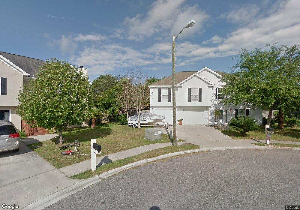
10 Hightide Ln Savannah, GA 31410
Estimated Value: $417,000 - $424,000
3
Beds
2
Baths
1,276
Sq Ft
$329/Sq Ft
Est. Value
About This Home
This home is located at 10 Hightide Ln, Savannah, GA 31410 and is currently estimated at $419,563, approximately $328 per square foot. 10 Hightide Ln is a home located in Chatham County with nearby schools including Marshpoint Elementary School, Coastal Middle School, and Islands High School.
Ownership History
Date
Name
Owned For
Owner Type
Purchase Details
Closed on
Oct 24, 2008
Sold by
Not Provided
Bought by
Martin John and Martin Lisa
Current Estimated Value
Home Financials for this Owner
Home Financials are based on the most recent Mortgage that was taken out on this home.
Original Mortgage
$192,880
Outstanding Balance
$126,274
Interest Rate
6.11%
Mortgage Type
FHA
Estimated Equity
$293,289
Create a Home Valuation Report for This Property
The Home Valuation Report is an in-depth analysis detailing your home's value as well as a comparison with similar homes in the area
Home Values in the Area
Average Home Value in this Area
Purchase History
| Date | Buyer | Sale Price | Title Company |
|---|---|---|---|
| Martin John | $208,000 | -- |
Source: Public Records
Mortgage History
| Date | Status | Borrower | Loan Amount |
|---|---|---|---|
| Open | Martin John | $192,880 |
Source: Public Records
Tax History Compared to Growth
Tax History
| Year | Tax Paid | Tax Assessment Tax Assessment Total Assessment is a certain percentage of the fair market value that is determined by local assessors to be the total taxable value of land and additions on the property. | Land | Improvement |
|---|---|---|---|---|
| 2025 | $3,776 | $151,600 | $30,000 | $121,600 |
| 2024 | $3,776 | $138,680 | $26,000 | $112,680 |
| 2023 | $2,684 | $114,520 | $26,000 | $88,520 |
| 2022 | $2,575 | $94,080 | $14,000 | $80,080 |
| 2021 | $2,692 | $79,200 | $14,000 | $65,200 |
| 2020 | $2,593 | $77,280 | $14,000 | $63,280 |
| 2019 | $2,703 | $77,880 | $14,000 | $63,880 |
| 2018 | $2,655 | $76,400 | $14,000 | $62,400 |
| 2017 | $2,593 | $76,880 | $14,000 | $62,880 |
| 2016 | $2,305 | $74,160 | $14,000 | $60,160 |
| 2015 | $2,334 | $74,920 | $14,000 | $60,920 |
| 2014 | $3,441 | $76,000 | $0 | $0 |
Source: Public Records
Map
Nearby Homes
- 109 Runner Rd
- 12 Castaway Place
- 141 Runner Rd
- 212 Fish Hawk Ln
- 4 Highwater Ct
- 98 Picket Row
- 106 Natalie Ct
- 46 River Oaks Rd
- 103 Shoals Dr Unit K12
- 115 River Pointe Dr
- 419 Walthour Rd
- 142 Bull River Bluff Dr
- 106 Bull River Bluff Dr
- 226 Bull River Bluff Dr
- 7311 Tropical Way
- 7201 Tropical Way
- 7313 Tropical Way
- 302 Sugar Tree Ct
- 11 Morningside Dr
- 509 Pointe North Dr
- 11 Hightide Ln
- 8 Hightide Ln
- 9 Hightide Ln
- 6 Hightide Ln
- 7 Hightide Ln
- 119 Teakwood Dr
- 5 Hightide Ln
- 113 Teakwood Dr
- 115 Teakwood Dr
- 111 Teakwood Dr
- 121 Teakwood Dr
- 4 Hightide Ln
- 109 Teakwood Dr
- 117 Teakwood Dr
- 123 Teakwood Dr
- 107 Teakwood Dr
- 112 Runner Rd
- 110 Runner Rd
- 125 Teakwood Dr
- 114 Runner Rd