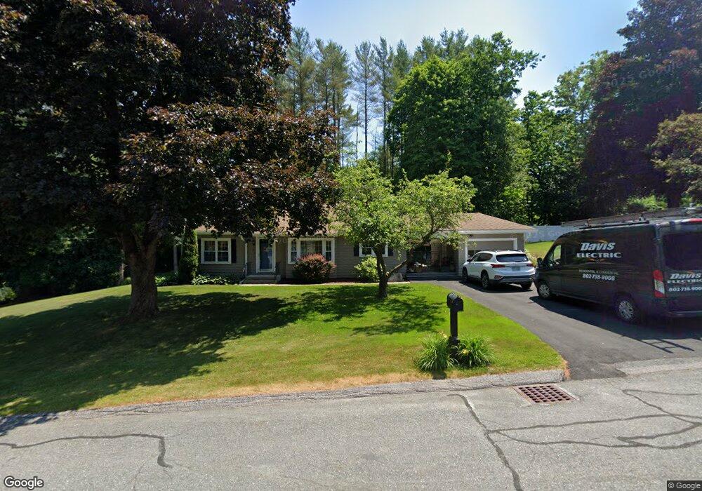
10 Hillstead Rd Claremont, NH 03743
South End NeighborhoodEstimated Value: $291,839 - $327,000
2
Beds
1
Bath
1,253
Sq Ft
$251/Sq Ft
Est. Value
About This Home
This home is located at 10 Hillstead Rd, Claremont, NH 03743 and is currently estimated at $314,960, approximately $251 per square foot. 10 Hillstead Rd is a home located in Sullivan County with nearby schools including Maple Avenue School, Claremont Middle School, and Stevens High School.
Ownership History
Date
Name
Owned For
Owner Type
Purchase Details
Closed on
Jan 10, 2005
Sold by
Mayo Raymond L and Mayo Laurette C
Bought by
Barton David and Barton Debra
Current Estimated Value
Purchase Details
Closed on
Dec 17, 1997
Sold by
Eyth Mary Ellen
Bought by
Mayo Raymond L and Mayo Laurette C
Home Financials for this Owner
Home Financials are based on the most recent Mortgage that was taken out on this home.
Original Mortgage
$72,900
Interest Rate
7.14%
Create a Home Valuation Report for This Property
The Home Valuation Report is an in-depth analysis detailing your home's value as well as a comparison with similar homes in the area
Home Values in the Area
Average Home Value in this Area
Purchase History
| Date | Buyer | Sale Price | Title Company |
|---|---|---|---|
| Barton David | $135,000 | -- | |
| Mayo Raymond L | $81,000 | -- |
Source: Public Records
Mortgage History
| Date | Status | Borrower | Loan Amount |
|---|---|---|---|
| Open | Mayo Raymond L | $163,518 | |
| Previous Owner | Mayo Raymond L | $72,900 |
Source: Public Records
Tax History Compared to Growth
Tax History
| Year | Tax Paid | Tax Assessment Tax Assessment Total Assessment is a certain percentage of the fair market value that is determined by local assessors to be the total taxable value of land and additions on the property. | Land | Improvement |
|---|---|---|---|---|
| 2024 | $6,829 | $233,400 | $38,400 | $195,000 |
| 2023 | $6,489 | $233,400 | $38,400 | $195,000 |
| 2022 | $5,377 | $129,000 | $17,500 | $111,500 |
| 2021 | $5,286 | $129,000 | $17,500 | $111,500 |
| 2020 | $5,253 | $129,000 | $17,500 | $111,500 |
| 2019 | $5,194 | $129,000 | $17,500 | $111,500 |
| 2018 | $5,146 | $122,300 | $17,500 | $104,800 |
| 2017 | $5,217 | $122,300 | $17,500 | $104,800 |
| 2016 | $5,212 | $122,300 | $17,500 | $104,800 |
| 2015 | $5,072 | $122,300 | $17,500 | $104,800 |
| 2014 | $5,055 | $122,300 | $17,500 | $104,800 |
| 2013 | $5,322 | $146,800 | $20,200 | $126,600 |
Source: Public Records
Map
Nearby Homes
- 22 Bible Hill Rd
- 37 Maple Ave
- 278 Pleasant St
- 46 Ridge Ave
- 62 Ridge Ave
- 2 Birchwood Rd
- 20 Highland Ave
- 16 Cherry Hill Rd
- 5 Nel Mar Heights
- 38 Goyette Ave
- 46 Park Ave
- 13 Green St
- 10 Acer Heights Rd
- 3 Treeline Dr
- 7 Memorial Dr
- 26 Myrtle St Unit 6
- 35 Woodland St
- 85 Myrtle St
- 93 Myrtle St
- 22 Chestnut St
- 12 Hillstead Rd
- 11 Hillstead Rd
- 25 Bible Hill Rd
- 7 Hillstead Rd
- 6 Hillstead Rd
- 25 Hillstead Rd
- 31 Bible Hill Rd
- 2 Charlestown Rd
- 39 Bible Hill Rd
- 43 Bible Hill Rd
- 4 Hillstead Rd
- 45 Bible Hill Rd
- 11 Durham Ave
- 13 Durham Ave
- 18 Maple Ave
- 32 Bible Hill Rd
- 10 Maple Ave
- 15 Durham Ave
- 34 Bible Hill Rd
- 28 Bible Hill Rd