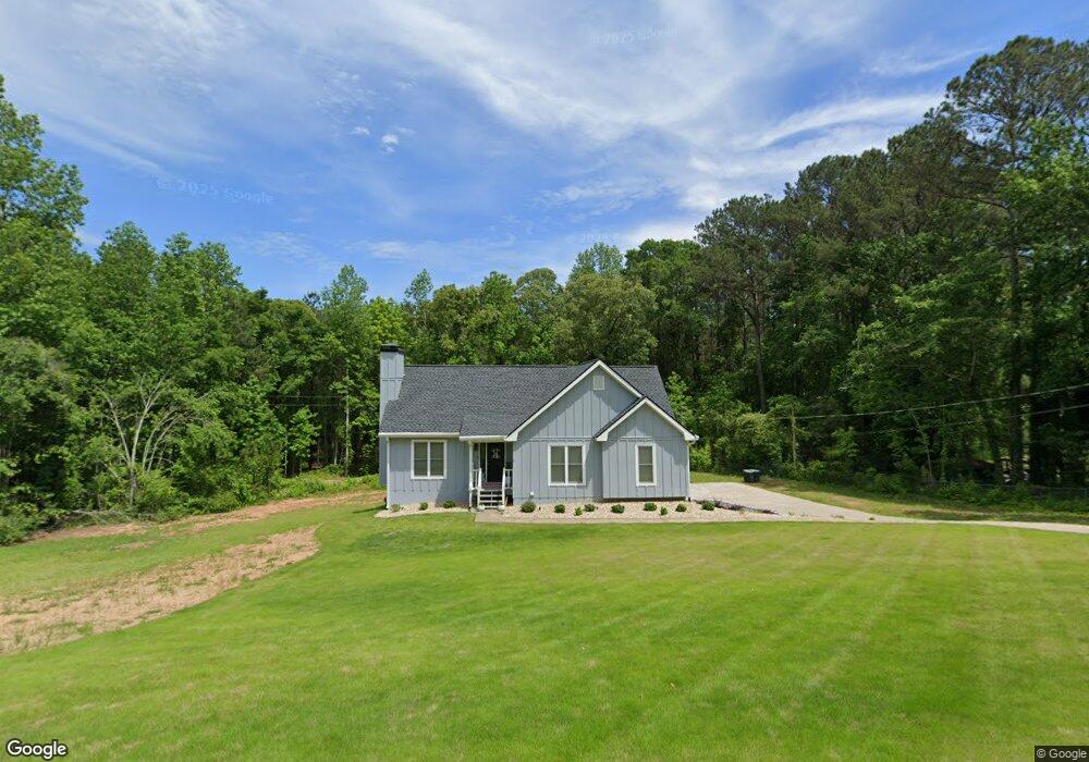
10 Hubbard Dr Newnan, GA 30263
Estimated Value: $270,000 - $328,000
3
Beds
2
Baths
1,390
Sq Ft
$214/Sq Ft
Est. Value
About This Home
This home is located at 10 Hubbard Dr, Newnan, GA 30263 and is currently estimated at $298,107, approximately $214 per square foot. 10 Hubbard Dr is a home located in Coweta County with nearby schools including Ruth Hill Elementary School, Evans Middle School, and Newnan High School.
Ownership History
Date
Name
Owned For
Owner Type
Purchase Details
Closed on
Jun 12, 2000
Sold by
Boylan Stephen P
Bought by
Garner Thomas F and Garner Vickie P
Current Estimated Value
Home Financials for this Owner
Home Financials are based on the most recent Mortgage that was taken out on this home.
Original Mortgage
$105,828
Outstanding Balance
$37,441
Interest Rate
8.27%
Mortgage Type
FHA
Estimated Equity
$260,666
Purchase Details
Closed on
Jan 11, 1994
Sold by
Driver And Assoc
Bought by
Boylan Stephen P
Home Financials for this Owner
Home Financials are based on the most recent Mortgage that was taken out on this home.
Original Mortgage
$86,550
Interest Rate
7.19%
Mortgage Type
Purchase Money Mortgage
Purchase Details
Closed on
Jan 31, 1986
Bought by
Driver & Associates
Create a Home Valuation Report for This Property
The Home Valuation Report is an in-depth analysis detailing your home's value as well as a comparison with similar homes in the area
Home Values in the Area
Average Home Value in this Area
Purchase History
| Date | Buyer | Sale Price | Title Company |
|---|---|---|---|
| Garner Thomas F | $115,000 | -- | |
| Boylan Stephen P | $91,200 | -- | |
| Driver & Associates | -- | -- |
Source: Public Records
Mortgage History
| Date | Status | Borrower | Loan Amount |
|---|---|---|---|
| Open | Garner Thomas F | $105,828 | |
| Previous Owner | Boylan Stephen P | $86,550 |
Source: Public Records
Tax History Compared to Growth
Tax History
| Year | Tax Paid | Tax Assessment Tax Assessment Total Assessment is a certain percentage of the fair market value that is determined by local assessors to be the total taxable value of land and additions on the property. | Land | Improvement |
|---|---|---|---|---|
| 2024 | $2,233 | $100,797 | $16,000 | $84,797 |
| 2023 | $2,233 | $80,934 | $16,000 | $64,934 |
| 2022 | $1,536 | $67,051 | $16,000 | $51,051 |
| 2021 | $1,383 | $57,194 | $12,000 | $45,194 |
| 2020 | $1,391 | $57,194 | $12,000 | $45,194 |
| 2019 | $1,063 | $41,129 | $8,000 | $33,129 |
| 2018 | $1,066 | $41,129 | $8,000 | $33,129 |
| 2017 | $984 | $38,339 | $8,000 | $30,339 |
| 2016 | $974 | $38,339 | $8,000 | $30,339 |
| 2015 | $804 | $32,852 | $6,000 | $26,852 |
| 2014 | $800 | $32,852 | $6,000 | $26,852 |
Source: Public Records
Map
Nearby Homes
- 20 Beaver Ct
- 175 Thigpen Rd
- 0 Ga Hwy 34 W Unit 21 10564723
- 0 Walt Sanders Rd Unit 10607560
- 0 Highway 34 W Unit 5.03+/- ACRES
- 195 Frances Shirey Way
- 147 Sheppard Dr
- 20 Sunflower Dr
- 199 Sagebrook Ln
- Zoey II Plan at Chapel Hill
- Middleton Plan at Chapel Hill
- Radcliffe Plan at Chapel Hill
- Horizon Plan at Chapel Hill
- Alexis Plan at Chapel Hill
- Reagan Plan at Chapel Hill
- Millhaven Plan at Chapel Hill
- Drayton Plan at Chapel Hill
- Everest III Plan at Chapel Hill
- Jordan Plan at Chapel Hill
- 15 Dixon Rd
- 20 Hubbard Dr
- 5 Hubbard Dr
- 5 Hubbard Ct
- 30 Hubbard Dr
- 10 Hubbard Ct
- 944 Highway 34 W
- 40 Hubbard Dr
- 15 Hubbard Ct
- 15 Hubbard Ct Unit LOT 36
- 1061 Highway 34 W
- 35 Hubbard Dr
- 25 Hubbard Ct
- 40 Hubbard Ct
- 45 Hubbard Dr
- 0 Hubbard Dr Unit 7386059
- 0 Hubbard Dr Unit 3217620
- 0 Hubbard Dr Unit 3131751
- 0 Hubbard Dr Unit 8832771
- 0 Hubbard Dr Unit 8809863
- 0 Hubbard Dr Unit 8547354