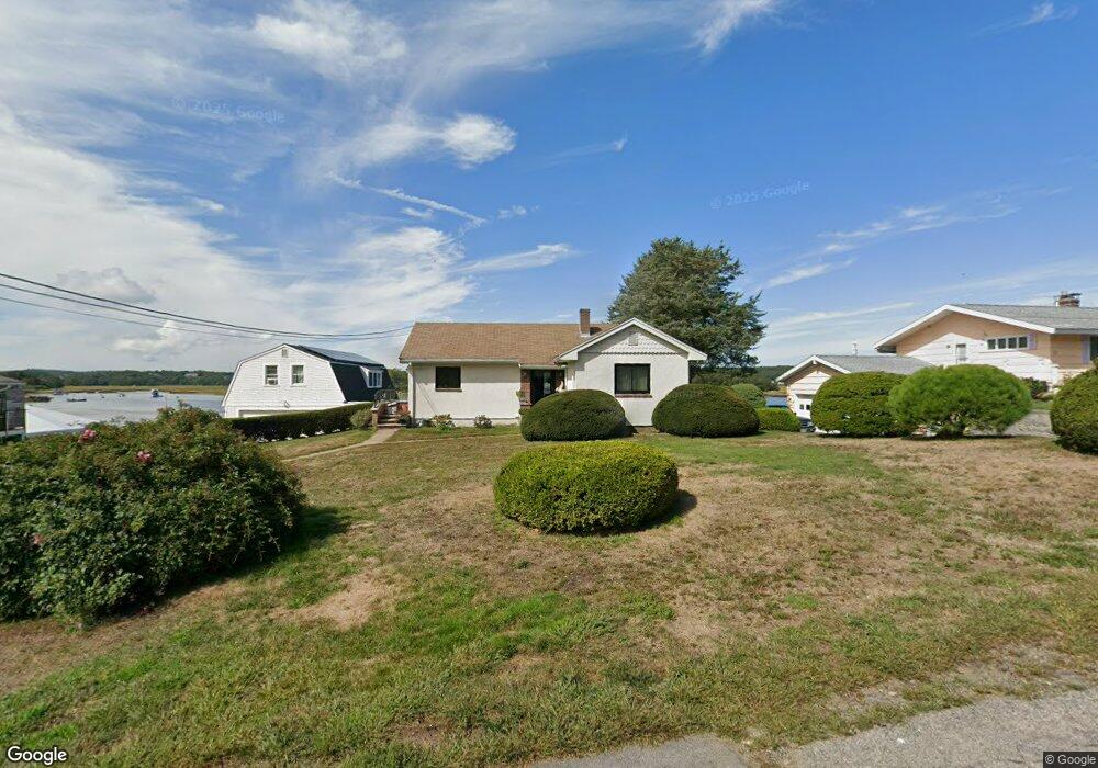
10 Juniper Rd Gloucester, MA 01930
Riverview NeighborhoodEstimated Value: $1,366,000 - $1,625,015
7
Beds
3
Baths
3,472
Sq Ft
$435/Sq Ft
Est. Value
About This Home
This home is located at 10 Juniper Rd, Gloucester, MA 01930 and is currently estimated at $1,509,254, approximately $434 per square foot. 10 Juniper Rd is a home located in Essex County with nearby schools including Beeman Memorial, Ralph B O'maley Middle School, and Gloucester High School.
Ownership History
Date
Name
Owned For
Owner Type
Purchase Details
Closed on
Nov 9, 2016
Sold by
Crocker Donna I and Seeley Gretel C
Bought by
Seeley Gretel
Current Estimated Value
Home Financials for this Owner
Home Financials are based on the most recent Mortgage that was taken out on this home.
Original Mortgage
$550,000
Outstanding Balance
$443,918
Interest Rate
3.42%
Mortgage Type
Stand Alone Refi Refinance Of Original Loan
Estimated Equity
$1,065,336
Purchase Details
Closed on
Nov 10, 2008
Sold by
Juniper Road Nt
Bought by
Crocker Donna I
Home Financials for this Owner
Home Financials are based on the most recent Mortgage that was taken out on this home.
Original Mortgage
$668,000
Interest Rate
6.08%
Mortgage Type
Purchase Money Mortgage
Create a Home Valuation Report for This Property
The Home Valuation Report is an in-depth analysis detailing your home's value as well as a comparison with similar homes in the area
Home Values in the Area
Average Home Value in this Area
Purchase History
| Date | Buyer | Sale Price | Title Company |
|---|---|---|---|
| Seeley Gretel | -- | -- | |
| Crocker Donna I | $835,000 | -- |
Source: Public Records
Mortgage History
| Date | Status | Borrower | Loan Amount |
|---|---|---|---|
| Open | Seeley Gretel | $550,000 | |
| Previous Owner | Juniper Road Nt | $628,000 | |
| Previous Owner | Juniper Road Nt | $641,000 | |
| Previous Owner | Juniper Road Nt | $668,000 | |
| Previous Owner | Juniper Road Nt | $600,000 |
Source: Public Records
Tax History
| Year | Tax Paid | Tax Assessment Tax Assessment Total Assessment is a certain percentage of the fair market value that is determined by local assessors to be the total taxable value of land and additions on the property. | Land | Improvement |
|---|---|---|---|---|
| 2025 | $14,124 | $1,453,100 | $882,800 | $570,300 |
| 2024 | $13,730 | $1,411,100 | $840,800 | $570,300 |
| 2023 | $13,720 | $1,295,600 | $717,400 | $578,200 |
| 2022 | $12,776 | $1,089,200 | $624,300 | $464,900 |
| 2021 | $12,350 | $992,800 | $567,400 | $425,400 |
| 2020 | $12,066 | $978,600 | $567,400 | $411,200 |
| 2019 | $11,432 | $900,900 | $541,000 | $359,900 |
| 2018 | $10,954 | $847,200 | $527,800 | $319,400 |
| 2017 | $10,536 | $798,800 | $502,600 | $296,200 |
| 2016 | $11,268 | $827,900 | $562,300 | $265,600 |
| 2015 | $11,018 | $807,200 | $549,500 | $257,700 |
Source: Public Records
Map
Nearby Homes
- 13 Honeysuckle Rd
- 31 Echo Ave
- 2 Breezy Point Rd
- 2 Finch Ln
- 167 Atlantic St
- 6 Monroe Ct
- 13 Mystic Ave
- 8 Mystic Ave
- 98 Maplewood Ave
- 672 Washington St
- 5 Samoset Rd Unit B
- 145 Essex Ave Unit 402
- 226 Atlantic St
- 5 Lepage Ln
- 15 Harvard St
- 40 Sargent St
- 33 Maplewood Ave Unit 310
- 33 Maplewood Ave Unit 16
- 20 Beacon St
- 20 Beacon St Unit 2
- 8 Juniper Rd
- 12 Juniper Rd
- 9 Juniper Rd
- 7 Juniper Rd
- 6 Juniper Rd
- 11 Juniper Rd
- 14 Juniper Rd
- 14 Juniper Rd Unit 2
- 14 Juniper Rd Unit WINTER
- 14 Juniper Rd Unit 1
- 5 Juniper Rd
- 6 Blueberry Ln
- 4 Blueberry Ln
- 8 Blueberry Ln
- 13 Juniper Rd
- 2 Blueberry Ln
- 4 Juniper Rd
- 10 Blueberry Ln
- 16 Juniper Rd
- 3 Juniper Rd
Your Personal Tour Guide
Ask me questions while you tour the home.