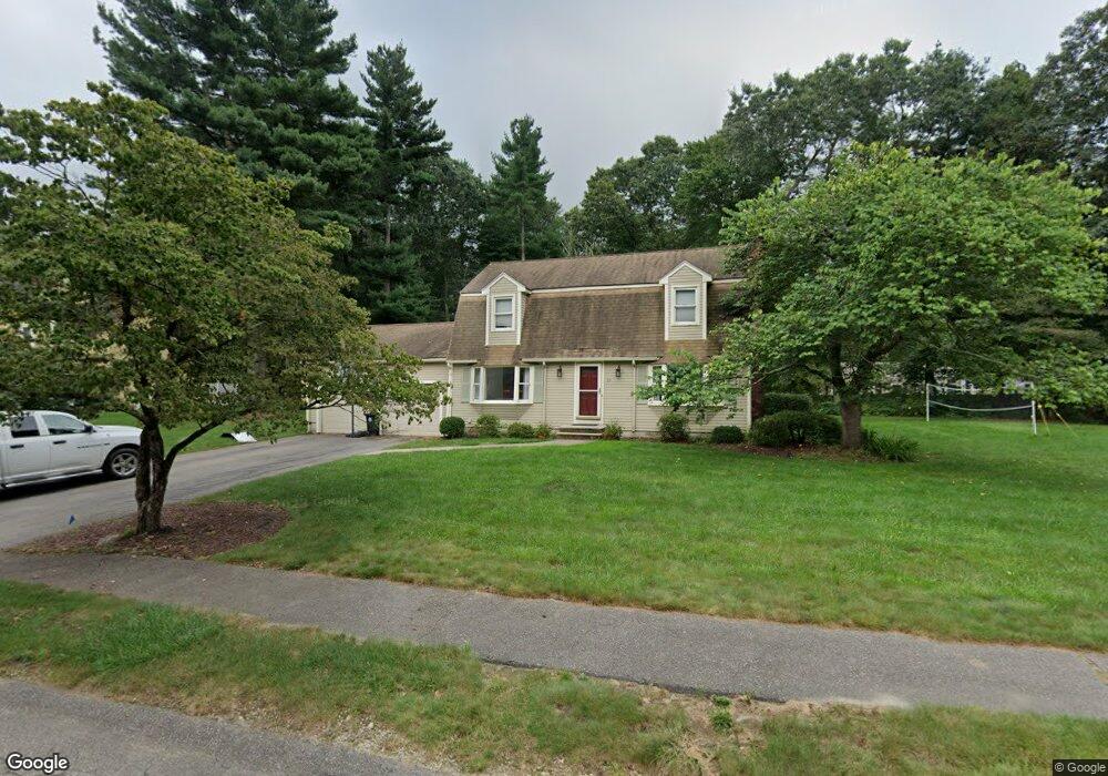
10 Kevin Joes Way Wrentham, MA 02093
Estimated Value: $692,494 - $786,000
3
Beds
2
Baths
1,829
Sq Ft
$396/Sq Ft
Est. Value
About This Home
This home is located at 10 Kevin Joes Way, Wrentham, MA 02093 and is currently estimated at $724,874, approximately $396 per square foot. 10 Kevin Joes Way is a home located in Norfolk County with nearby schools including Delaney Elementary School and Charles E Roderick.
Ownership History
Date
Name
Owned For
Owner Type
Purchase Details
Closed on
Sep 30, 2008
Sold by
Signes Stephen E
Bought by
Fruci Connie and Signes Stephen E
Current Estimated Value
Purchase Details
Closed on
Nov 30, 2006
Sold by
Setty Raghavendra K
Bought by
Signes Stephen E
Home Financials for this Owner
Home Financials are based on the most recent Mortgage that was taken out on this home.
Original Mortgage
$324,000
Interest Rate
6.36%
Mortgage Type
Purchase Money Mortgage
Purchase Details
Closed on
Dec 17, 1999
Sold by
Bernardini Mary A
Bought by
Setty Raghavendra K
Home Financials for this Owner
Home Financials are based on the most recent Mortgage that was taken out on this home.
Original Mortgage
$208,000
Interest Rate
7.81%
Mortgage Type
Purchase Money Mortgage
Create a Home Valuation Report for This Property
The Home Valuation Report is an in-depth analysis detailing your home's value as well as a comparison with similar homes in the area
Home Values in the Area
Average Home Value in this Area
Purchase History
| Date | Buyer | Sale Price | Title Company |
|---|---|---|---|
| Fruci Connie | -- | -- | |
| Signes Stephen E | $405,000 | -- | |
| Setty Raghavendra K | $260,000 | -- |
Source: Public Records
Mortgage History
| Date | Status | Borrower | Loan Amount |
|---|---|---|---|
| Previous Owner | Signes Stephen E | $324,000 | |
| Previous Owner | Signes Stephen E | $60,750 | |
| Previous Owner | Setty Raghavendra K | $232,000 | |
| Previous Owner | Setty Raghavendra K | $208,000 | |
| Closed | Setty Raghavendra K | $26,000 |
Source: Public Records
Tax History Compared to Growth
Tax History
| Year | Tax Paid | Tax Assessment Tax Assessment Total Assessment is a certain percentage of the fair market value that is determined by local assessors to be the total taxable value of land and additions on the property. | Land | Improvement |
|---|---|---|---|---|
| 2025 | $6,944 | $599,100 | $290,000 | $309,100 |
| 2024 | $6,700 | $558,300 | $290,000 | $268,300 |
| 2023 | $6,594 | $522,500 | $263,700 | $258,800 |
| 2022 | $6,385 | $467,100 | $246,100 | $221,000 |
| 2021 | $6,078 | $432,000 | $214,800 | $217,200 |
| 2020 | $6,185 | $434,000 | $191,000 | $243,000 |
| 2019 | $6,128 | $434,000 | $191,000 | $243,000 |
| 2018 | $5,482 | $385,000 | $191,200 | $193,800 |
| 2017 | $5,394 | $378,500 | $187,500 | $191,000 |
| 2016 | $5,167 | $361,800 | $182,100 | $179,700 |
| 2015 | $5,080 | $339,100 | $175,000 | $164,100 |
| 2014 | $4,997 | $326,400 | $168,300 | $158,100 |
Source: Public Records
Map
Nearby Homes
- 10 Nature View Dr
- 15 Nature View Dr
- 270 Dedham St
- 1 Lorraine Metcalf Dr
- 362 East St
- 131 Creek St Unit 7
- 570 Franklin St
- 319 Taunton St
- 246 Forest Grove Ave
- Lot 3 - 14 Earle Stewart Ln
- Lot 1 - Blueberry 2 Car Plan at King Philip Estates
- Lot 8 - Blueberry 2 Car Plan at King Philip Estates
- Lot 6 - Blueberry 3 Car Plan at King Philip Estates
- Lot 2 - Camden 2 Car Plan at King Philip Estates
- Lot 7 - Cedar Plan at King Philip Estates
- Lot 4 - Hemingway 2 Car Plan at King Philip Estates
- Lot 3 - Blueberry 2 Car Plan at King Philip Estates
- 3 Oak Rd
- 0 W Birch Rd
- 10 W Birch Rd
- 35 Kevin Joes Way
- 72 Circle Dr
- 20 Kevin Joes Way
- 25 Kevin Joes Way
- 15 Kevin Joes Way
- 30 Kevin Joes Way
- 87 Circle Dr
- 92 Circle Dr
- 158 Franklin St
- 95 Circle Dr
- LOT 25 Manchester Dr
- LOT 13 Hales Pond Ln
- LOT 23 Manchester Dr
- B Old Quarry Rd
- 40 Kevin Joes Way
- 45 Kevin Joes Way
- 53 Circle Dr
- 100 Circle Dr
- 58 Circle Dr
- 45 Circle Dr