Estimated Value: $179,228 - $457,000
1
Bed
1
Bath
480
Sq Ft
$606/Sq Ft
Est. Value
About This Home
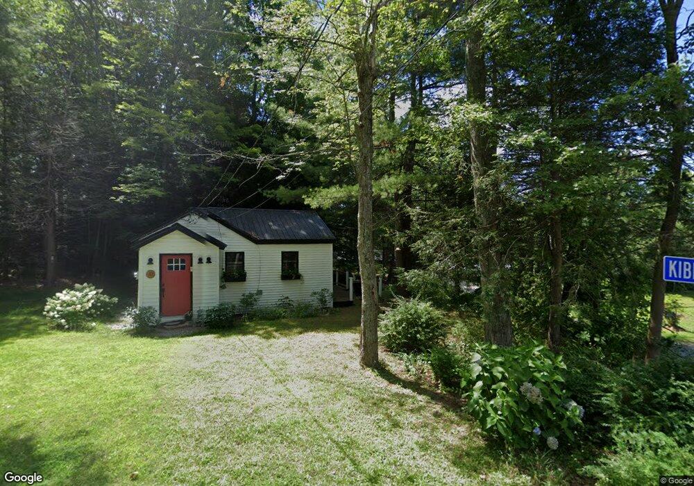
This home is located at 10 Kibbe Point Rd, Otis, MA 01253 and is currently estimated at $290,807, approximately $605 per square foot. 10 Kibbe Point Rd is a home with nearby schools including Farmington River Elementary School.
Ownership History
Date
Name
Owned For
Owner Type
Purchase Details
Closed on
Nov 5, 2002
Sold by
Hamuka James M and Hamuka Barbara G
Bought by
Terrill Wallace R and Terrill Donna I
Current Estimated Value
Home Financials for this Owner
Home Financials are based on the most recent Mortgage that was taken out on this home.
Original Mortgage
$68,000
Outstanding Balance
$28,629
Interest Rate
6.09%
Mortgage Type
Purchase Money Mortgage
Estimated Equity
$262,178
Create a Home Valuation Report for This Property
The Home Valuation Report is an in-depth analysis detailing your home's value as well as a comparison with similar homes in the area
Home Values in the Area
Average Home Value in this Area
Purchase History
| Date | Buyer | Sale Price | Title Company |
|---|---|---|---|
| Terrill Wallace R | $85,000 | -- | |
| Terrill Wallace R | $85,000 | -- |
Source: Public Records
Mortgage History
| Date | Status | Borrower | Loan Amount |
|---|---|---|---|
| Open | Terrill Wallace R | $68,000 | |
| Closed | Terrill Wallace R | $68,000 |
Source: Public Records
Tax History
| Year | Tax Paid | Tax Assessment Tax Assessment Total Assessment is a certain percentage of the fair market value that is determined by local assessors to be the total taxable value of land and additions on the property. | Land | Improvement |
|---|---|---|---|---|
| 2025 | $790 | $122,300 | $61,200 | $61,100 |
| 2024 | $742 | $114,500 | $60,400 | $54,100 |
| 2023 | $557 | $84,100 | $30,000 | $54,100 |
| 2022 | $619 | $79,900 | $29,000 | $50,900 |
| 2021 | $618 | $73,000 | $29,000 | $44,000 |
| 2020 | $600 | $72,000 | $29,000 | $43,000 |
| 2019 | $596 | $72,000 | $29,000 | $43,000 |
| 2018 | $596 | $72,000 | $29,000 | $43,000 |
| 2017 | $582 | $72,000 | $29,000 | $43,000 |
| 2016 | $573 | $73,000 | $29,000 | $44,000 |
| 2015 | $578 | $76,700 | $26,600 | $50,100 |
Source: Public Records
Map
Nearby Homes
- 134 Kibbe Rd
- 454 Pine Rd
- 23 S Pine St
- 0 Island Acres Rd Unit 73459836
- 0 E Otis Rd Unit 73483991
- 129 W Shore Rd
- 0 Curtis Hall Rd Unit 73425043
- 0 Curtis Hall Rd Unit 73376838
- 1828 E Otis Rd
- 103 Algerie Rd
- 15B-7 E Otis Rd
- 0 Leisure Ln
- 0 Perry Rd
- 0 N Beech Plain Rd Unit 247823
- 0 Lion Hill Rd
- 314 & 316 Lakeshore Dr
- 314 Lakeshore Dr
- 316 Lakeshore Dr
- 343 Lakeshore Dr
- 93 S Main Rd
Your Personal Tour Guide
Ask me questions while you tour the home.