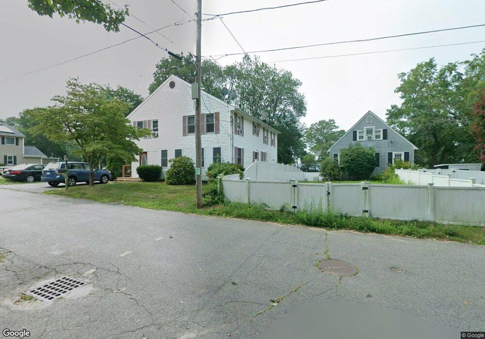
10 Lagoon Ln Norton, MA 02766
Estimated Value: $572,213 - $620,000
4
Beds
2
Baths
2,400
Sq Ft
$253/Sq Ft
Est. Value
About This Home
This home is located at 10 Lagoon Ln, Norton, MA 02766 and is currently estimated at $606,553, approximately $252 per square foot. 10 Lagoon Ln is a home located in Bristol County with nearby schools including J.C. Solmonese Elementary School, Henri A. Yelle Elementary School, and Norton Middle School.
Ownership History
Date
Name
Owned For
Owner Type
Purchase Details
Closed on
Jun 11, 2008
Sold by
Grady Jennifer M and Lydon Michael P
Bought by
Hayes Catherine Megha and Hayes James F
Current Estimated Value
Purchase Details
Closed on
Apr 29, 2005
Sold by
Bleau Rhonda M
Bought by
Grady Jennifer M and Lydon Michael P
Home Financials for this Owner
Home Financials are based on the most recent Mortgage that was taken out on this home.
Original Mortgage
$279,420
Interest Rate
5.95%
Mortgage Type
Purchase Money Mortgage
Purchase Details
Closed on
Feb 27, 2003
Sold by
Maiato Kristopher J and Maiato Stephanie L
Bought by
Lydon Michael P and Grady Jennifer M
Home Financials for this Owner
Home Financials are based on the most recent Mortgage that was taken out on this home.
Original Mortgage
$175,000
Interest Rate
5.98%
Mortgage Type
Purchase Money Mortgage
Create a Home Valuation Report for This Property
The Home Valuation Report is an in-depth analysis detailing your home's value as well as a comparison with similar homes in the area
Home Values in the Area
Average Home Value in this Area
Purchase History
| Date | Buyer | Sale Price | Title Company |
|---|---|---|---|
| Hayes Catherine Megha | $300,000 | -- | |
| Grady Jennifer M | $349,400 | -- | |
| Lydon Michael P | $225,000 | -- |
Source: Public Records
Mortgage History
| Date | Status | Borrower | Loan Amount |
|---|---|---|---|
| Previous Owner | Grady Jennifer M | $279,420 | |
| Previous Owner | Lydon Michael P | $175,000 |
Source: Public Records
Tax History
| Year | Tax Paid | Tax Assessment Tax Assessment Total Assessment is a certain percentage of the fair market value that is determined by local assessors to be the total taxable value of land and additions on the property. | Land | Improvement |
|---|---|---|---|---|
| 2025 | $6,110 | $471,100 | $160,100 | $311,000 |
| 2024 | $5,921 | $457,200 | $152,500 | $304,700 |
| 2023 | $5,605 | $431,500 | $143,800 | $287,700 |
| 2022 | $5,410 | $379,400 | $130,700 | $248,700 |
| 2021 | $5,122 | $343,100 | $124,500 | $218,600 |
| 2020 | $4,933 | $333,300 | $120,900 | $212,400 |
| 2019 | $4,778 | $320,700 | $116,300 | $204,400 |
| 2018 | $4,606 | $303,800 | $109,800 | $194,000 |
| 2017 | $4,462 | $290,300 | $109,800 | $180,500 |
| 2016 | $4,182 | $267,900 | $103,400 | $164,500 |
| 2015 | $4,032 | $262,000 | $101,300 | $160,700 |
| 2014 | $3,839 | $249,800 | $96,500 | $153,300 |
Source: Public Records
Map
Nearby Homes
- 21 Juniper Rd
- 16 Holly Rd
- 0 Brook Pkwy
- 0 Cobb St
- 19 Barberry Rd
- 157 Mansfield Ave Unit 27
- 157 Mansfield Ave Unit 14
- 250 Mansfield Ave Unit 11
- 93 Mansfield Ave
- 343 Godfrey Dr
- 101 Godfrey Dr Unit 101
- 14 Windchime Dr
- 0 Kensington Rd
- 1 Wilbur Terrace Unit 6
- 1 Wilbur Terrace Unit 2
- 0 Knollwood & 0 Rear Kensington
- 1 Deer Path Ln
- 5 Robin Cir Unit 5
- 46 Newland St
- 7 Fieldstone Dr
Your Personal Tour Guide
Ask me questions while you tour the home.