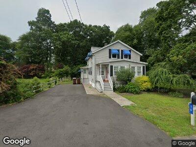
10 Lambert St Acushnet, MA 02743
Sherwood Forest NeighborhoodEstimated Value: $357,000 - $378,812
2
Beds
1
Bath
800
Sq Ft
$461/Sq Ft
Est. Value
About This Home
This home is located at 10 Lambert St, Acushnet, MA 02743 and is currently estimated at $368,703, approximately $460 per square foot. 10 Lambert St is a home located in Bristol County with nearby schools including Acushnet Elementary School, Albert F Ford Middle School, and Alma del Mar Charter School.
Ownership History
Date
Name
Owned For
Owner Type
Purchase Details
Closed on
May 10, 2022
Sold by
10 Lambert Rt and Gomes
Bought by
Gomes Noah D
Current Estimated Value
Home Financials for this Owner
Home Financials are based on the most recent Mortgage that was taken out on this home.
Original Mortgage
$248,000
Outstanding Balance
$237,233
Interest Rate
4.67%
Mortgage Type
Stand Alone Refi Refinance Of Original Loan
Estimated Equity
$134,638
Create a Home Valuation Report for This Property
The Home Valuation Report is an in-depth analysis detailing your home's value as well as a comparison with similar homes in the area
Home Values in the Area
Average Home Value in this Area
Purchase History
| Date | Buyer | Sale Price | Title Company |
|---|---|---|---|
| Gomes Noah D | -- | None Available | |
| Gomes Noah D | -- | None Available |
Source: Public Records
Mortgage History
| Date | Status | Borrower | Loan Amount |
|---|---|---|---|
| Open | Gomes Noah D | $248,000 | |
| Closed | Gomes Noah D | $248,000 |
Source: Public Records
Tax History Compared to Growth
Tax History
| Year | Tax Paid | Tax Assessment Tax Assessment Total Assessment is a certain percentage of the fair market value that is determined by local assessors to be the total taxable value of land and additions on the property. | Land | Improvement |
|---|---|---|---|---|
| 2025 | $39 | $364,000 | $97,800 | $266,200 |
| 2024 | $3,596 | $315,200 | $93,500 | $221,700 |
| 2023 | $3,388 | $282,300 | $85,000 | $197,300 |
| 2022 | $3,612 | $272,200 | $80,800 | $191,400 |
| 2021 | $3,343 | $241,700 | $80,800 | $160,900 |
| 2020 | $2,589 | $185,700 | $80,800 | $104,900 |
| 2019 | $2,462 | $173,600 | $80,800 | $92,800 |
| 2018 | $5,405 | $173,600 | $80,800 | $92,800 |
| 2017 | $2,355 | $163,100 | $80,800 | $82,300 |
| 2016 | $2,379 | $163,700 | $80,800 | $82,900 |
| 2015 | $2,262 | $158,400 | $80,800 | $77,600 |
Source: Public Records
Map
Nearby Homes
- 3299 Acushnet Ave Unit 23
- 8 Rounseville St
- 3388A Acushnet Ave
- 365 Middle Rd
- 8 Whelden Ln
- 939 Lucy St
- 67 Morses Ln
- 16 Holly Tree Ln
- 1023 Bowles St
- 850 Terry Ln
- 1310 Phillips Rd
- 1251 Church St Unit 7
- 1251 Church St Unit 10
- 1216 Church St Unit 15
- 1261 Church St Unit 70
- 1261 Church St Unit 46
- 1261 Church St Unit 53
- 28 Hamlin St
- 145 Heritage Dr
- 60 Avery St