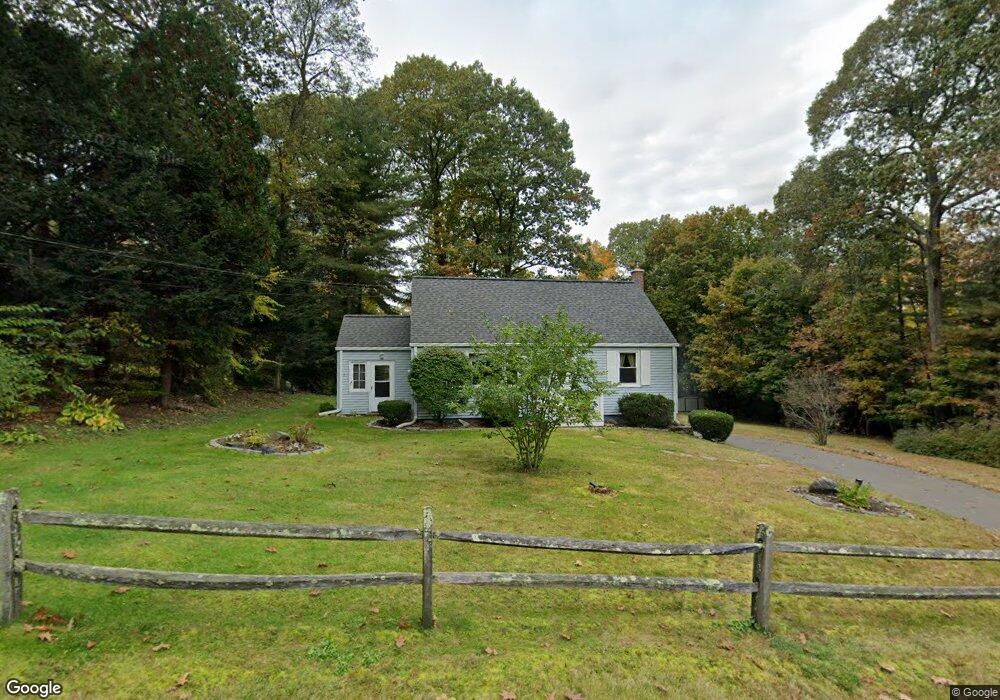
10 Laurel Rd Ellington, CT 06029
Estimated Value: $230,000 - $373,000
3
Beds
1
Bath
1,075
Sq Ft
$285/Sq Ft
Est. Value
About This Home
This home is located at 10 Laurel Rd, Ellington, CT 06029 and is currently estimated at $306,645, approximately $285 per square foot. 10 Laurel Rd is a home located in Tolland County with nearby schools including Ellington High School.
Ownership History
Date
Name
Owned For
Owner Type
Purchase Details
Closed on
May 17, 2010
Sold by
Hart Donna
Bought by
Bastek Rheresa
Current Estimated Value
Home Financials for this Owner
Home Financials are based on the most recent Mortgage that was taken out on this home.
Original Mortgage
$168,000
Outstanding Balance
$112,934
Interest Rate
5.11%
Estimated Equity
$193,711
Purchase Details
Closed on
Aug 29, 2002
Sold by
Schmidt William
Bought by
Hart Donna
Purchase Details
Closed on
May 22, 1998
Sold by
Page Frank
Bought by
Schmidt William and Schmidt Michelle
Purchase Details
Closed on
Oct 24, 1997
Sold by
Johnson Julia
Bought by
Page Frank
Create a Home Valuation Report for This Property
The Home Valuation Report is an in-depth analysis detailing your home's value as well as a comparison with similar homes in the area
Home Values in the Area
Average Home Value in this Area
Purchase History
| Date | Buyer | Sale Price | Title Company |
|---|---|---|---|
| Bastek Rheresa | $210,000 | -- | |
| Hart Donna | $158,900 | -- | |
| Schmidt William | $104,000 | -- | |
| Page Frank | $42,000 | -- |
Source: Public Records
Mortgage History
| Date | Status | Borrower | Loan Amount |
|---|---|---|---|
| Open | Page Frank | $29,000 | |
| Open | Page Frank | $168,000 | |
| Previous Owner | Page Frank | $165,590 |
Source: Public Records
Tax History Compared to Growth
Tax History
| Year | Tax Paid | Tax Assessment Tax Assessment Total Assessment is a certain percentage of the fair market value that is determined by local assessors to be the total taxable value of land and additions on the property. | Land | Improvement |
|---|---|---|---|---|
| 2025 | $4,256 | $114,720 | $53,950 | $60,770 |
| 2024 | $4,130 | $114,720 | $53,950 | $60,770 |
| 2023 | $3,935 | $114,720 | $53,950 | $60,770 |
| 2022 | $3,728 | $114,720 | $53,950 | $60,770 |
| 2021 | $3,625 | $114,720 | $53,950 | $60,770 |
| 2020 | $3,997 | $122,610 | $56,940 | $65,670 |
| 2019 | $3,997 | $122,610 | $56,940 | $65,670 |
| 2016 | $3,740 | $122,610 | $56,940 | $65,670 |
| 2015 | $3,860 | $126,560 | $56,940 | $69,620 |
| 2014 | $3,632 | $126,560 | $56,940 | $69,620 |
Source: Public Records
Map
Nearby Homes
- 31 Gail Dr
- 178 Crystal Lake Rd
- 1 Maple St Unit 21
- 2 Pease Farm Rd
- 2 Setting Sun Trail
- 58 Maple St
- 222 Mountain Rd
- 7 Sunset Rd
- 0 Porter Rd
- 24 Bonair Hill Rd
- 89 Maple St
- 41 Hoffman Rd
- 89 Crystal Lake Rd Unit T7
- 8 Sadds Mill Rd
- 14 Cherrywood Dr
- 43 Highland Ave
- 0000 Webster Rd
- 48 Cervens Rd
- 64 N Park St
- 634 Crystal Lake Rd
- 8 Laurel Rd
- 12 Laurel Rd
- 9 Laurel Rd
- 6 Laurel Rd
- 7 Laurel Rd
- 11 Laurel Rd
- 242 Crystal Lake Rd
- 5 Laurel Rd
- 45 Cider Mill Rd
- 6 Deer Run Dr
- 244 Crystal Lake Rd
- 2 Laurel Rd
- 3 Deer Run Dr
- 3 Laurel Rd
- 47 Cider Mill Rd
- 44 Cider Mill Rd
- 41 Cider Mill Rd
- 240 Crystal Lake Rd
- 250 Crystal Lake Rd
- 49 Cider Mill Rd