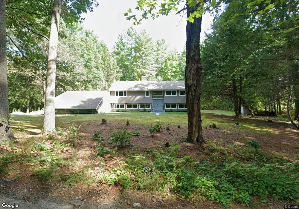
10 Lawrence Ln Hollis, NH 03049
Hollis NeighborhoodEstimated Value: $681,000 - $813,000
3
Beds
2
Baths
1,695
Sq Ft
$444/Sq Ft
Est. Value
About This Home
This home is located at 10 Lawrence Ln, Hollis, NH 03049 and is currently estimated at $752,192, approximately $443 per square foot. 10 Lawrence Ln is a home located in Hillsborough County with nearby schools including Hollis Primary School, Hollis Upper Elementary School, and Hollis-Brookline Middle School.
Ownership History
Date
Name
Owned For
Owner Type
Purchase Details
Closed on
Jul 28, 2009
Sold by
National Transfer Svc
Bought by
Lolley Dianna C
Current Estimated Value
Home Financials for this Owner
Home Financials are based on the most recent Mortgage that was taken out on this home.
Original Mortgage
$294,566
Interest Rate
5.58%
Purchase Details
Closed on
Oct 2, 2007
Sold by
Davis Karen P
Bought by
Gates Mitchell S and Gates Lori Ap
Home Financials for this Owner
Home Financials are based on the most recent Mortgage that was taken out on this home.
Original Mortgage
$300,000
Interest Rate
6.65%
Mortgage Type
Purchase Money Mortgage
Purchase Details
Closed on
May 20, 1997
Sold by
Lunardo Laura S
Bought by
Davis Karen P
Create a Home Valuation Report for This Property
The Home Valuation Report is an in-depth analysis detailing your home's value as well as a comparison with similar homes in the area
Home Values in the Area
Average Home Value in this Area
Purchase History
| Date | Buyer | Sale Price | Title Company |
|---|---|---|---|
| Lolley Dianna C | $300,000 | -- | |
| National Transfer Svc | $300,000 | -- | |
| Gates Mitchell S | $300,000 | -- | |
| Davis Karen P | $170,000 | -- |
Source: Public Records
Mortgage History
| Date | Status | Borrower | Loan Amount |
|---|---|---|---|
| Open | Davis Karen P | $287,383 | |
| Closed | Davis Karen P | $294,566 | |
| Previous Owner | Davis Karen P | $300,000 |
Source: Public Records
Tax History Compared to Growth
Tax History
| Year | Tax Paid | Tax Assessment Tax Assessment Total Assessment is a certain percentage of the fair market value that is determined by local assessors to be the total taxable value of land and additions on the property. | Land | Improvement |
|---|---|---|---|---|
| 2024 | $10,353 | $583,900 | $252,300 | $331,600 |
| 2023 | $9,921 | $595,500 | $252,300 | $343,200 |
| 2022 | $13,440 | $595,500 | $252,300 | $343,200 |
| 2021 | $8,281 | $364,800 | $165,100 | $199,700 |
| 2020 | $3,112 | $364,800 | $165,100 | $199,700 |
| 2019 | $8,427 | $364,800 | $165,100 | $199,700 |
| 2018 | $7,905 | $364,800 | $165,100 | $199,700 |
| 2017 | $7,788 | $336,400 | $145,100 | $191,300 |
| 2016 | $7,882 | $336,400 | $145,100 | $191,300 |
| 2015 | $7,744 | $336,400 | $145,100 | $191,300 |
| 2014 | $7,781 | $336,400 | $145,100 | $191,300 |
| 2013 | $7,574 | $331,900 | $145,100 | $186,800 |
Source: Public Records
Map
Nearby Homes
- 84 Irene Dr
- 143 Worcester Rd
- 6 Flint Meadow Dr
- 47 Pepperell Rd
- 55 Oak Hill Rd
- 46 Oak Hill Rd
- 179 Brookline St
- 6 High Oaks Path
- 22 Austin Ln
- 23 Austin Ln
- 21 Cranberry St
- 22 Hobart Hill Rd
- 2 Old Farm Ln
- 13 Oak Hill St
- 28A Rocky Pond Rd
- 6 Laurelcrest Dr
- 91 Deacon Ln
- 4-58 Dow Rd
- 194 Dow Rd
- 29 Southgate Rd
- 4 Lawrence Ln
- 50 W Hollis Rd
- 16 Lawrence Ln
- 36 W Hollis Rd
- 20 Lawrence Ln
- 56 W Hollis Rd Unit 56 and 56A
- 56A W Hollis Rd
- 56 W Hollis Rd
- 56-A B W Hollis Rd
- 49 W Hollis Rd
- 8 Lawrence Ln
- 39 W Hollis Rd
- Lot 61023 W Hollis Rd
- 58 W Hollis Rd
- 37 W Hollis Rd
- 51 W Hollis Rd
- 32 W Hollis Rd
- 2 Iron Works Ln
- 25 Lawrence Ln
- 67 W Hollis Rd