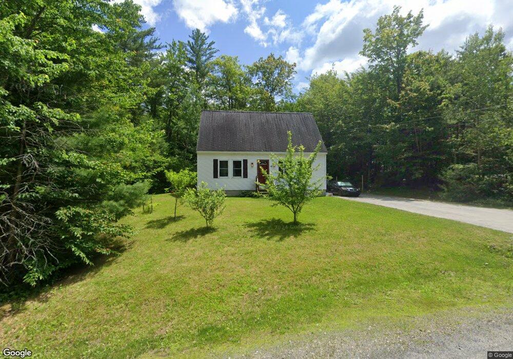
10 Lincoln Cir Hillsborough, NH 03244
Hillsboro NeighborhoodEstimated Value: $398,000 - $425,000
3
Beds
2
Baths
1,726
Sq Ft
$240/Sq Ft
Est. Value
About This Home
This home is located at 10 Lincoln Cir, Hillsborough, NH 03244 and is currently estimated at $413,991, approximately $239 per square foot. 10 Lincoln Cir is a home located in Hillsborough County with nearby schools including Hillsboro-Deering Elementary School and Hillsboro-Deering High School.
Ownership History
Date
Name
Owned For
Owner Type
Purchase Details
Closed on
Aug 23, 2016
Sold by
Swirko Francis M
Bought by
Sirmones Sara G
Current Estimated Value
Purchase Details
Closed on
May 18, 2007
Sold by
Jones Steven D
Bought by
Swirko Francis M
Home Financials for this Owner
Home Financials are based on the most recent Mortgage that was taken out on this home.
Original Mortgage
$204,500
Interest Rate
6.18%
Mortgage Type
Purchase Money Mortgage
Purchase Details
Closed on
Jul 17, 2003
Sold by
Mcallister Const Svcs
Bought by
Jones Steven D
Home Financials for this Owner
Home Financials are based on the most recent Mortgage that was taken out on this home.
Original Mortgage
$171,000
Interest Rate
5.34%
Mortgage Type
Purchase Money Mortgage
Create a Home Valuation Report for This Property
The Home Valuation Report is an in-depth analysis detailing your home's value as well as a comparison with similar homes in the area
Home Values in the Area
Average Home Value in this Area
Purchase History
| Date | Buyer | Sale Price | Title Company |
|---|---|---|---|
| Sirmones Sara G | -- | -- | |
| Swirko Francis M | $205,000 | -- | |
| Jones Steven D | $180,000 | -- |
Source: Public Records
Mortgage History
| Date | Status | Borrower | Loan Amount |
|---|---|---|---|
| Previous Owner | Jones Steven D | $204,500 | |
| Previous Owner | Jones Steven D | $171,000 |
Source: Public Records
Tax History Compared to Growth
Tax History
| Year | Tax Paid | Tax Assessment Tax Assessment Total Assessment is a certain percentage of the fair market value that is determined by local assessors to be the total taxable value of land and additions on the property. | Land | Improvement |
|---|---|---|---|---|
| 2024 | $7,103 | $212,400 | $82,900 | $129,500 |
| 2023 | $6,631 | $212,400 | $82,900 | $129,500 |
| 2022 | $5,669 | $212,400 | $82,900 | $129,500 |
| 2021 | $6,143 | $212,400 | $82,900 | $129,500 |
| 2020 | $6,102 | $212,400 | $82,900 | $129,500 |
| 2018 | $5,183 | $175,700 | $57,600 | $118,100 |
| 2017 | $5,354 | $175,700 | $57,600 | $118,100 |
| 2016 | $5,024 | $170,200 | $50,800 | $119,400 |
| 2015 | $4,944 | $170,200 | $50,800 | $119,400 |
| 2014 | $4,691 | $170,200 | $50,800 | $119,400 |
| 2013 | $4,776 | $170,200 | $50,800 | $119,400 |
Source: Public Records
Map
Nearby Homes
- 23 Pleasant St
- 31 Central St Unit G
- 0 Center Rd
- 1 W Main St
- 0 Red Fox Crossing Unit 34 4858470
- 28 Merrill Rd
- 20-22 Church St
- 0 Raccoon Alley Unit 86 4855473
- 73 W Main St
- 17 Gould Pond Rd
- 32-33 Red Fox Crossing
- 447 Center Rd
- 0 Midnight Walk Unit 264 4914126
- 0 Huntington Dr Unit 373 4855140
- 0 Huntington Dr Unit 307 4855146
- 0 W Main St Unit 1
- 32 Union St
- 32 Deerpoint Dr
- 9 Ellen Brook Rd
- Lot 265 Midnight Walk
- 68 Jefferson Dr
- 7 Lincoln Cir
- 16 Lincoln Cir
- 11 Lincoln Cir
- 58 Jefferson Dr
- 19 Lincoln Cir
- 74 Jefferson Dr
- 50 Jefferson Dr
- 65 Jefferson Dr
- 44 Jefferson Dr
- 71 Jefferson Dr
- 82 Jefferson Dr
- 2 Madison Cir
- 77 Jefferson Dr
- 18 Jefferson Dr
- 38 Jefferson Dr
- 22 Jefferson Dr
- 30 Jefferson Dr
- 14 Jefferson Dr
- 83 Jefferson Dr