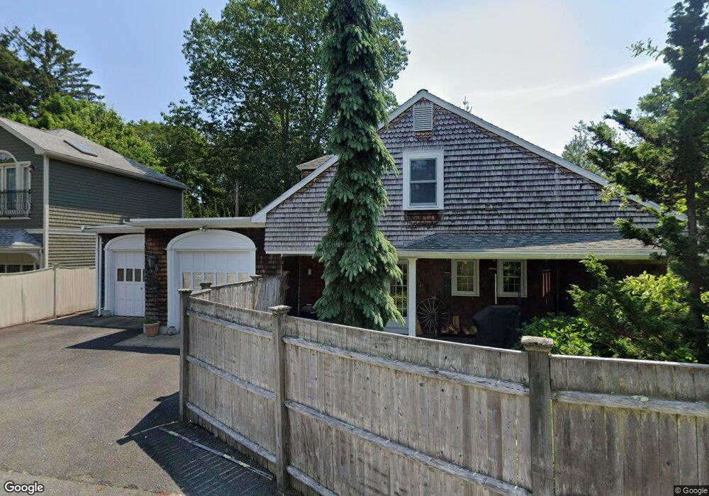
10 Littles Point Rd Swampscott, MA 01907
Estimated Value: $988,026 - $1,167,000
3
Beds
2
Baths
1,673
Sq Ft
$651/Sq Ft
Est. Value
About This Home
This home is located at 10 Littles Point Rd, Swampscott, MA 01907 and is currently estimated at $1,089,257, approximately $651 per square foot. 10 Littles Point Rd is a home located in Essex County with nearby schools including Swampscott Middle School, Swampscott High School, and Epstein Hillel School.
Ownership History
Date
Name
Owned For
Owner Type
Purchase Details
Closed on
Jul 21, 1994
Sold by
Stevens Paul P and Stevens Maryanne B
Bought by
Castleman Beverly and Castleman Jerrold
Current Estimated Value
Purchase Details
Closed on
Sep 15, 1992
Sold by
Blodgett Nancy
Bought by
Stevens Paul P and Stevens Maryanne
Create a Home Valuation Report for This Property
The Home Valuation Report is an in-depth analysis detailing your home's value as well as a comparison with similar homes in the area
Home Values in the Area
Average Home Value in this Area
Purchase History
| Date | Buyer | Sale Price | Title Company |
|---|---|---|---|
| Castleman Beverly | $326,000 | -- | |
| Castleman Beverly | $326,000 | -- | |
| Stevens Paul P | $255,000 | -- | |
| Stevens Paul P | $255,000 | -- |
Source: Public Records
Mortgage History
| Date | Status | Borrower | Loan Amount |
|---|---|---|---|
| Open | Stevens Paul P | $200,000 | |
| Closed | Stevens Paul P | $240,000 | |
| Closed | Stevens Paul P | $100,000 |
Source: Public Records
Tax History Compared to Growth
Tax History
| Year | Tax Paid | Tax Assessment Tax Assessment Total Assessment is a certain percentage of the fair market value that is determined by local assessors to be the total taxable value of land and additions on the property. | Land | Improvement |
|---|---|---|---|---|
| 2025 | $11,773 | $1,026,400 | $454,700 | $571,700 |
| 2024 | $11,535 | $1,003,900 | $435,800 | $568,100 |
| 2023 | $10,882 | $926,900 | $397,900 | $529,000 |
| 2022 | $10,331 | $805,200 | $341,000 | $464,200 |
| 2021 | $10,194 | $738,700 | $284,200 | $454,500 |
| 2020 | $10,355 | $724,100 | $284,200 | $439,900 |
| 2019 | $10,575 | $695,700 | $255,800 | $439,900 |
| 2018 | $10,613 | $663,300 | $255,800 | $407,500 |
| 2017 | $10,761 | $616,700 | $241,600 | $375,100 |
| 2016 | $10,687 | $616,700 | $241,600 | $375,100 |
| 2015 | $10,576 | $616,700 | $241,600 | $375,100 |
| 2014 | $10,300 | $550,800 | $220,200 | $330,600 |
Source: Public Records
Map
Nearby Homes
- 35 Alden Rd
- 35 Littles Point Rd Unit S201
- 110 Galloupes Point Rd
- 24 Orchard Cir
- 8 Ocean View Rd
- 21 Bay View Dr
- 71 Walnut Rd
- 75 Bay View Dr
- 13 Cedar Hill Terrace Unit 2
- 25 Manton Rd
- 37 Stanley Rd
- 179 Beach Bluff Ave
- 71 Greenwood Ave Unit 207
- 48 Bellevue Rd
- 309 Paradise Rd
- 306 Paradise Rd
- 140 Elmwood Rd
- 212 Humphrey St Unit 205
- 1004 Paradise Rd Unit PHJ
- 1006 Paradise Rd Unit 3R
- 12 Littles Point Rd
- 14 Littles Point Rd
- 6 Littles Point Rd
- 8 Littles Point Rd
- 11 Littles Point Rd
- 16 Littles Point Rd
- 17 Phillips Beach Ave
- 15 Phillips Beach Ave
- 21 Phillips Beach Ave
- 18 Littles Point Rd
- 437 Puritan Rd
- 15 Littles Point Rd
- 471 Puritan Rd
- 17 Littles Point Rd
- 23 Phillips Beach Ave
- 24 Littles Point Rd
- 3 Tip Top Rd
- 16 Phillips Beach Ave
- 425 Puritan Rd
- 448 Puritan Rd