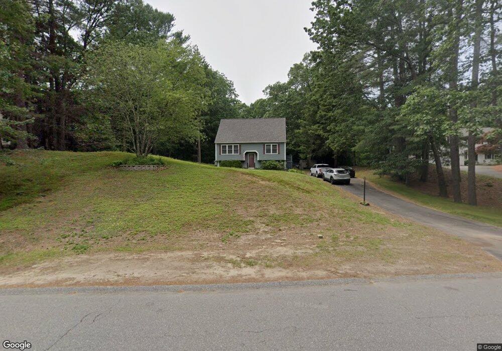
10 McElwain Dr Litchfield, NH 03052
Estimated Value: $528,000 - $591,000
3
Beds
2
Baths
1,687
Sq Ft
$324/Sq Ft
Est. Value
About This Home
This home is located at 10 McElwain Dr, Litchfield, NH 03052 and is currently estimated at $545,935, approximately $323 per square foot. 10 McElwain Dr is a home with nearby schools including Griffin Memorial School and St. Francis of Assisi School.
Ownership History
Date
Name
Owned For
Owner Type
Purchase Details
Closed on
Aug 22, 2005
Sold by
Cerato Gregg W
Bought by
Latsha John R and Latsha Judy A
Current Estimated Value
Home Financials for this Owner
Home Financials are based on the most recent Mortgage that was taken out on this home.
Original Mortgage
$124,000
Interest Rate
5.66%
Mortgage Type
Purchase Money Mortgage
Purchase Details
Closed on
Nov 30, 2000
Sold by
Talbot Deborah A and Talbot Robert M
Bought by
Cerato Gregg W
Home Financials for this Owner
Home Financials are based on the most recent Mortgage that was taken out on this home.
Original Mortgage
$130,000
Interest Rate
7.76%
Create a Home Valuation Report for This Property
The Home Valuation Report is an in-depth analysis detailing your home's value as well as a comparison with similar homes in the area
Home Values in the Area
Average Home Value in this Area
Purchase History
| Date | Buyer | Sale Price | Title Company |
|---|---|---|---|
| Latsha John R | $300,000 | -- | |
| Cerato Gregg W | $166,000 | -- |
Source: Public Records
Mortgage History
| Date | Status | Borrower | Loan Amount |
|---|---|---|---|
| Open | Cerato Gregg W | $162,000 | |
| Closed | Cerato Gregg W | $133,700 | |
| Closed | Cerato Gregg W | $124,000 | |
| Previous Owner | Cerato Gregg W | $130,000 |
Source: Public Records
Tax History Compared to Growth
Tax History
| Year | Tax Paid | Tax Assessment Tax Assessment Total Assessment is a certain percentage of the fair market value that is determined by local assessors to be the total taxable value of land and additions on the property. | Land | Improvement |
|---|---|---|---|---|
| 2024 | $6,130 | $295,000 | $140,600 | $154,400 |
| 2023 | $6,177 | $295,000 | $140,600 | $154,400 |
| 2022 | $5,614 | $295,000 | $140,600 | $154,400 |
| 2021 | $5,316 | $288,300 | $140,600 | $147,700 |
| 2020 | $5,357 | $288,300 | $140,600 | $147,700 |
| 2019 | $3,996 | $233,100 | $123,300 | $109,800 |
| 2017 | $5,242 | $233,100 | $123,300 | $109,800 |
| 2016 | $12,528 | $233,100 | $123,300 | $109,800 |
| 2015 | $4,751 | $233,100 | $123,300 | $109,800 |
| 2014 | $4,757 | $229,800 | $121,000 | $108,800 |
| 2013 | $4,727 | $229,800 | $121,000 | $108,800 |
Source: Public Records
Map
Nearby Homes
- 7 Chamberlin Dr
- 5 Jennifer Dr Unit B
- 5 Jennifer Dr
- 5 Jennifer Dr Unit A
- 35 Windsor Dr Unit 5
- 30 Windsor Dr Unit 9
- 9 Tallarico St Unit Lot 4
- 14 Turnbuckle Ln Unit 38
- 23 Pondview Dr
- 1 Longwood Ln
- 18 Tallarico St Unit Lot 23
- 77 E Ridge Rd
- 23 Colonial Dr
- 343 Charles Bancroft Hwy
- 5 Talent Rd Unit 29-2
- 7 Talent Rd Unit 7/29-2
- 19 Dixon Dr
- 13 Moose Hollow Rd
- 20 Locke Mill Dr
- 5 Lynn Dr
- 8 McElwain Dr
- 12 McElwain Dr
- 14 McElwain Dr
- 10 Underwood Dr
- 2 McElwain Dr
- 12 Underwood Dr
- 8 Underwood Dr
- 1 McElwain Dr
- 6 Underwood Dr
- 8 Pinecrest Rd
- 13 Underwood Dr
- 4 Underwood Dr
- 16 Pinecrest Rd
- 9 Underwood Dr
- 11 Underwood Dr
- 2 Underwood Dr
- 5 Underwood Dr
- 3 Underwood Dr
- 9 Pinecrest Rd
- 13 Pinecrest Rd