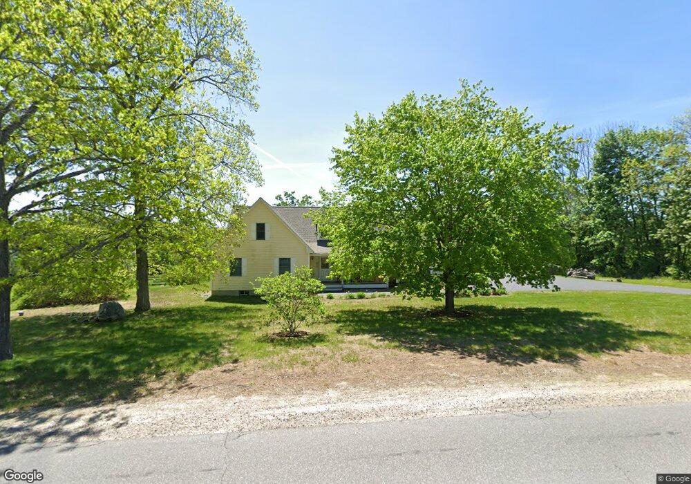
10 Meaderboro Rd Rochester, NH 03867
Estimated Value: $610,000 - $633,000
2
Beds
3
Baths
2,297
Sq Ft
$271/Sq Ft
Est. Value
About This Home
This home is located at 10 Meaderboro Rd, Rochester, NH 03867 and is currently estimated at $622,215, approximately $270 per square foot. 10 Meaderboro Rd is a home located in Strafford County with nearby schools including Mcclelland School, Rochester Middle School, and Spaulding High School.
Ownership History
Date
Name
Owned For
Owner Type
Purchase Details
Closed on
Aug 15, 2025
Sold by
Budel Construction Corp
Bought by
Mmcdl Ft and Kalin
Current Estimated Value
Home Financials for this Owner
Home Financials are based on the most recent Mortgage that was taken out on this home.
Original Mortgage
$225,000
Outstanding Balance
$224,406
Interest Rate
6.67%
Mortgage Type
Purchase Money Mortgage
Estimated Equity
$397,809
Purchase Details
Closed on
Dec 10, 2015
Sold by
Scruton Cathleen B
Bought by
Pauline F P Scruton T F and Pauline Scruton
Purchase Details
Closed on
Sep 14, 2015
Sold by
John F Scruton Ret and Scruton
Bought by
Scruton John F
Purchase Details
Closed on
May 17, 2013
Sold by
Wilson Lois A
Bought by
Lois A Wilson Ret and Wilson
Create a Home Valuation Report for This Property
The Home Valuation Report is an in-depth analysis detailing your home's value as well as a comparison with similar homes in the area
Home Values in the Area
Average Home Value in this Area
Purchase History
| Date | Buyer | Sale Price | Title Company |
|---|---|---|---|
| Mmcdl Ft | $625,000 | -- | |
| Mmcdl Ft | $625,000 | -- | |
| Pauline F P Scruton T F | $52,533 | -- | |
| Pauline F P Scruton T F | $52,533 | -- | |
| Scruton John F | -- | -- | |
| Scruton John F | -- | -- | |
| John F Scruton Ret | -- | -- | |
| John F Scruton Ret | -- | -- | |
| Lois A Wilson Ret | -- | -- | |
| Lois A Wilson Ret | -- | -- | |
| Lois A Wilson Ret | -- | -- |
Source: Public Records
Mortgage History
| Date | Status | Borrower | Loan Amount |
|---|---|---|---|
| Open | Mmcdl Ft | $225,000 | |
| Closed | Mmcdl Ft | $225,000 |
Source: Public Records
Tax History Compared to Growth
Tax History
| Year | Tax Paid | Tax Assessment Tax Assessment Total Assessment is a certain percentage of the fair market value that is determined by local assessors to be the total taxable value of land and additions on the property. | Land | Improvement |
|---|---|---|---|---|
| 2024 | $8,888 | $598,500 | $132,800 | $465,700 |
| 2023 | $9,459 | $367,500 | $64,400 | $303,100 |
| 2022 | $9,290 | $367,500 | $64,400 | $303,100 |
| 2021 | $9,059 | $367,500 | $64,400 | $303,100 |
| 2020 | $9,044 | $367,500 | $64,400 | $303,100 |
| 2019 | $9,151 | $367,500 | $64,400 | $303,100 |
| 2018 | $8,705 | $316,300 | $59,400 | $256,900 |
| 2017 | $8,328 | $316,300 | $59,400 | $256,900 |
| 2016 | $8,481 | $300,100 | $59,400 | $240,700 |
| 2015 | $8,448 | $300,100 | $59,400 | $240,700 |
| 2014 | $8,244 | $300,100 | $59,400 | $240,700 |
| 2013 | $6,891 | $261,400 | $80,600 | $180,800 |
| 2012 | $6,713 | $261,400 | $80,600 | $180,800 |
Source: Public Records
Map
Nearby Homes
- 272 Walnut St
- 38 Strafford Rd
- Map 220 Lot 16 Four Rod Rd
- 948 Strafford Rd
- 00 Squire Rd
- 345 Dry Hill Rd
- 71 Ten Rod Rd
- 67 Ten Rod Rd
- 40 Dry Hill Rd Unit Lot 0250/0006/0000
- 13 Miami Way Unit B
- 14 1/2 Yvonne St
- 2 Cape Coral Way Unit A
- 2 Cape Coral Way Unit B
- 2 Hale St
- 81 Washington St
- 31 Brock St
- 30 Avalon Rd
- 10 Blue Hills Dr
- 74 Seneca St
- 16 Nashoba Dr
- 11 Meaderboro Rd
- 9 Meaderboro Rd
- 3 Meaderboro Rd
- 2 Meaderboro Rd
- 10 Crown Point Rd
- 10 Crown Point Rd Unit 10-1
- 10 Crown Point Rd Unit 10-2
- 18 Meaderboro Rd
- 18 Meaderboro Rd
- 18 Meaderboro Rd
- 18 Stephens Dr
- 1 Meaderboro Rd
- 12 Stephens Dr
- 00 Stephens Dr
- 299 Walnut St
- 19 Stephens Dr
- 18 Julia Ave
- 202 Estes Rd
- 201 Estes Rd
- 26 Crown Point Rd