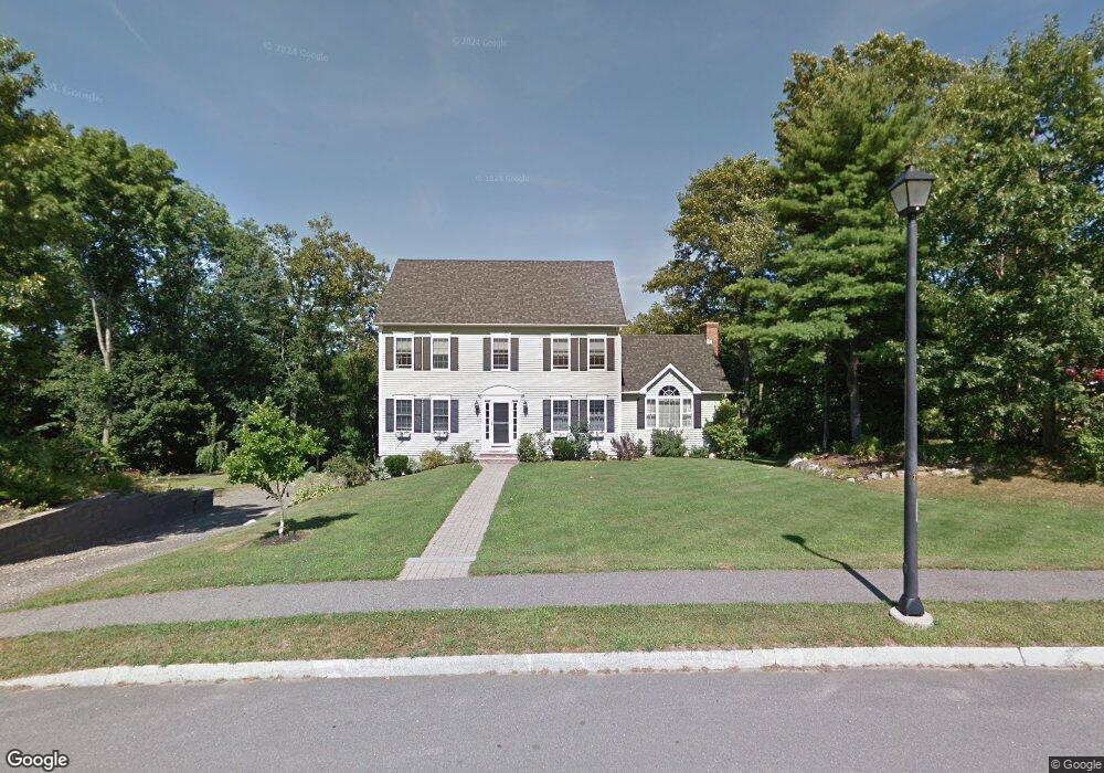
10 Mears Farm Rd Haverhill, MA 01830
Riverside NeighborhoodEstimated Value: $714,000 - $780,000
3
Beds
3
Baths
2,412
Sq Ft
$313/Sq Ft
Est. Value
About This Home
This home is located at 10 Mears Farm Rd, Haverhill, MA 01830 and is currently estimated at $754,621, approximately $312 per square foot. 10 Mears Farm Rd is a home located in Essex County with nearby schools including Dr. Paul Nettle Middle School.
Create a Home Valuation Report for This Property
The Home Valuation Report is an in-depth analysis detailing your home's value as well as a comparison with similar homes in the area
Home Values in the Area
Average Home Value in this Area
Tax History Compared to Growth
Tax History
| Year | Tax Paid | Tax Assessment Tax Assessment Total Assessment is a certain percentage of the fair market value that is determined by local assessors to be the total taxable value of land and additions on the property. | Land | Improvement |
|---|---|---|---|---|
| 2025 | $7,302 | $681,800 | $222,700 | $459,100 |
| 2024 | $6,938 | $652,100 | $211,500 | $440,600 |
| 2023 | $6,636 | $595,200 | $193,000 | $402,200 |
| 2022 | $6,298 | $495,100 | $170,800 | $324,300 |
| 2021 | $6,199 | $461,200 | $163,400 | $297,800 |
| 2020 | $6,139 | $451,400 | $161,600 | $289,800 |
| 2019 | $6,012 | $431,000 | $141,200 | $289,800 |
| 2018 | $5,881 | $412,400 | $141,200 | $271,200 |
| 2017 | $5,707 | $380,700 | $126,400 | $254,300 |
| 2016 | $5,765 | $375,300 | $126,400 | $248,900 |
| 2015 | $5,448 | $354,900 | $126,400 | $228,500 |
Source: Public Records
Map
Nearby Homes
- 89 Goodale St
- 28 Fernald Ave
- 27 Webster St
- 16 S Charles St
- 5 Pond St
- 70 Race St
- 83 S Central St Unit 83
- 8 Bartlett Ave Unit 5
- 5 Central Ave
- 7 Clinton St Unit 4
- 5 S Webster St
- 81-83 Kenoza Ave
- 300 Kenoza St
- 20 Ashland St
- 23 Arlington St
- 17 Arlington St
- 13-15 Arlington St
- 14 Greystone Ave
- 8 Fay Place
- 12 Greystone Ave Unit 12