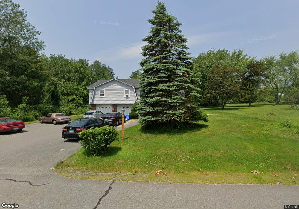
10 Mercury Dr Londonderry, NH 03053
Estimated Value: $535,817 - $601,000
4
Beds
3
Baths
1,572
Sq Ft
$365/Sq Ft
Est. Value
About This Home
This home is located at 10 Mercury Dr, Londonderry, NH 03053 and is currently estimated at $573,454, approximately $364 per square foot. 10 Mercury Dr is a home with nearby schools including Londonderry Middle School, Londonderry Senior High School, and Southern New Hampshire Montessori Academy.
Ownership History
Date
Name
Owned For
Owner Type
Purchase Details
Closed on
Aug 29, 1996
Sold by
Oliver Donald F and Oliver Ann L
Bought by
Carroll John H and Carroll Deborah A
Current Estimated Value
Home Financials for this Owner
Home Financials are based on the most recent Mortgage that was taken out on this home.
Original Mortgage
$109,918
Interest Rate
8.18%
Create a Home Valuation Report for This Property
The Home Valuation Report is an in-depth analysis detailing your home's value as well as a comparison with similar homes in the area
Home Values in the Area
Average Home Value in this Area
Purchase History
| Date | Buyer | Sale Price | Title Company |
|---|---|---|---|
| Carroll John H | $110,000 | -- |
Source: Public Records
Mortgage History
| Date | Status | Borrower | Loan Amount |
|---|---|---|---|
| Open | Carroll John H | $150,000 | |
| Closed | Carroll 3Rd John H | $204,000 | |
| Closed | Carroll John H | $69,576 | |
| Closed | Carroll John H | $109,918 |
Source: Public Records
Tax History Compared to Growth
Tax History
| Year | Tax Paid | Tax Assessment Tax Assessment Total Assessment is a certain percentage of the fair market value that is determined by local assessors to be the total taxable value of land and additions on the property. | Land | Improvement |
|---|---|---|---|---|
| 2024 | $7,215 | $447,000 | $179,900 | $267,100 |
| 2023 | $6,996 | $447,000 | $179,900 | $267,100 |
| 2022 | $7,087 | $383,500 | $134,900 | $248,600 |
| 2021 | $6,830 | $371,600 | $134,900 | $236,700 |
| 2020 | $6,369 | $316,700 | $112,400 | $204,300 |
| 2019 | $6,141 | $316,700 | $112,400 | $204,300 |
| 2018 | $5,709 | $261,900 | $93,700 | $168,200 |
| 2017 | $5,660 | $261,900 | $93,700 | $168,200 |
| 2016 | $5,631 | $261,900 | $93,700 | $168,200 |
| 2015 | $5,505 | $261,900 | $93,700 | $168,200 |
| 2014 | $5,523 | $261,900 | $93,700 | $168,200 |
| 2011 | -- | $267,400 | $93,700 | $173,700 |
Source: Public Records
Map
Nearby Homes
- 12 Morrison Dr
- 3 Elise Ave Unit 95
- 14 Elise Ave Unit 7
- 12 Elise Ave Unit 6
- 7 Elise Ave Unit Lot 93
- 8 Elise Ave Unit Lot 4
- 36 Elise Ave Unit Lot 18
- 1 Elise Ave Unit Lot 96
- 40 Elise Ave Unit Lot 20
- 47 Winding Pond Rd
- 111 Winterwood Dr
- 14 Reed St
- 5 Elise Ave Unit Lot 94
- 27 Midridge Cir
- 31 Midridge Cir
- 14 Mohawk Dr
- 214 Winding Pond Rd
- 267 Winding Pond Rd
- 74 Boulder Dr Unit 74
- 24 Sheffield Way
- 8 Mercury Dr
- 30 Mercury Dr Unit 30
- 28 Mercury Dr Unit 28
- 13 Mercury Dr
- 20 Mercury Dr Unit 20
- 20 Mercury Dr Unit B
- 11 Mercury Dr
- 12 Mercury Dr Unit R 491
- 15 Mercury Dr
- 22 Mercury Dr Unit 22
- 21 Mercury Dr
- 11 Mcallister Dr
- 13 Mc Allister Dr
- 18 Mercury Dr Unit 18B
- 9 Mercury Dr Unit 128
- 9 Mercury Dr Unit Lot91
- 9 Mercury Dr Unit 9
- 4 Mercury Dr
- 9 Mcallister Dr
- 17 Mercury Dr