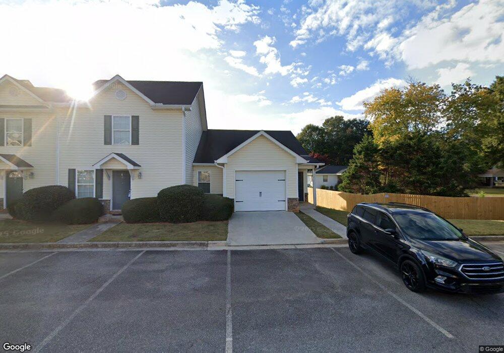
10 Middlebrook Dr Unit /12 Cartersville, GA 30120
Estimated Value: $173,744 - $195,000
2
Beds
2
Baths
971
Sq Ft
$190/Sq Ft
Est. Value
About This Home
This home is located at 10 Middlebrook Dr Unit /12, Cartersville, GA 30120 and is currently estimated at $184,186, approximately $189 per square foot. 10 Middlebrook Dr Unit /12 is a home located in Bartow County with nearby schools including Kingston Elementary School, Cass Middle School, and Cass High School.
Ownership History
Date
Name
Owned For
Owner Type
Purchase Details
Closed on
Feb 25, 2015
Sold by
Keelaghan Desmond
Bought by
Cartersville Rental Homes Llc
Current Estimated Value
Purchase Details
Closed on
Oct 23, 2014
Sold by
Bennett Daniel Clay
Bought by
Cat Daddy Real Estate Llc
Purchase Details
Closed on
Nov 6, 2012
Sold by
Allman Sam
Bought by
Bennett Daniel Clay
Purchase Details
Closed on
Oct 26, 2012
Sold by
Allman Sam
Bought by
Bennett Daniel Clay
Purchase Details
Closed on
Apr 21, 2010
Sold by
Suntrust Bank
Bought by
Allman Sam
Purchase Details
Closed on
Jan 30, 2006
Sold by
Providence Managment Inc
Bought by
Lovell Mark
Home Financials for this Owner
Home Financials are based on the most recent Mortgage that was taken out on this home.
Original Mortgage
$87,200
Interest Rate
7.5%
Mortgage Type
New Conventional
Create a Home Valuation Report for This Property
The Home Valuation Report is an in-depth analysis detailing your home's value as well as a comparison with similar homes in the area
Home Values in the Area
Average Home Value in this Area
Purchase History
| Date | Buyer | Sale Price | Title Company |
|---|---|---|---|
| Cartersville Rental Homes Llc | -- | -- | |
| Keelaghan Desmond | $96,000 | -- | |
| Cat Daddy Real Estate Llc | -- | -- | |
| Bennett Daniel Clay | $69,840 | -- | |
| Bennett Daniel Clay | $69,840 | -- | |
| Allman Sam | -- | -- | |
| Lovell Mark | $109,000 | -- |
Source: Public Records
Mortgage History
| Date | Status | Borrower | Loan Amount |
|---|---|---|---|
| Previous Owner | Lovell Mark | $87,200 |
Source: Public Records
Tax History
| Year | Tax Paid | Tax Assessment Tax Assessment Total Assessment is a certain percentage of the fair market value that is determined by local assessors to be the total taxable value of land and additions on the property. | Land | Improvement |
|---|---|---|---|---|
| 2025 | $1,700 | $70,678 | $12,000 | $58,678 |
| 2024 | $1,700 | $75,818 | $12,000 | $63,818 |
| 2023 | $1,842 | $64,286 | $10,000 | $54,286 |
| 2022 | $1,224 | $48,212 | $8,000 | $40,212 |
| 2021 | $1,013 | $37,957 | $8,000 | $29,957 |
| 2020 | $1,043 | $37,957 | $8,000 | $29,957 |
| 2019 | $1,017 | $36,640 | $8,000 | $28,640 |
| 2018 | $762 | $27,360 | $4,000 | $23,360 |
| 2017 | $766 | $27,360 | $4,000 | $23,360 |
| 2016 | $772 | $27,360 | $4,000 | $23,360 |
| 2015 | $773 | $27,360 | $4,000 | $23,360 |
| 2014 | $581 | $19,920 | $2,000 | $17,920 |
| 2013 | -- | $13,920 | $2,000 | $11,920 |
Source: Public Records
Map
Nearby Homes
- 37 Middlebrook Dr
- 38 Middleton Ct
- 506 Cassville Rd
- 73 Cotton Bend
- 4 Miles Dr
- 20 Wesley Trace SE
- 27 Cotton Bend
- 135 Mercer Ln
- 1100 Sugar Valley Rd
- 101 Marion Dr
- 42 Benham Cir
- 22 Oakbrook Dr SW
- 110 Marion Dr
- 30 Grove Cir
- 19 Allweather St
- 26 Blackberry Ridge SW
- 21 Ember Way
- 13 Shadow Ln
- 101 Garland Gable Dr
- 101 Garland Gable Dr Unit 1A
- 10 Middlebrook Dr
- 10 Middlebrook Dr Unit 10
- 12 Middlebrook Dr
- 12 Middlebrook Dr Unit 12
- 14 Middlebrook Dr
- 16 Middlebrook Dr
- 18 Middlebrook Dr
- 504 Cassville Rd
- 13 Middlebrook Dr
- 38 Middlebrook Dr Unit 38
- 11 Middlebrook Dr
- 11 Middlebrook Dr
- 15 Middlebrook Dr
- 40 Middlebrook Dr
- 40 Middlebrook Dr
- 40 Middlebrook Dr Unit 40
- 17 Middlebrook Dr
- 42 Middlebrook Dr Unit 42
- 42 Middlebrook Dr
- 19 Middlebrook Dr
Your Personal Tour Guide
Ask me questions while you tour the home.