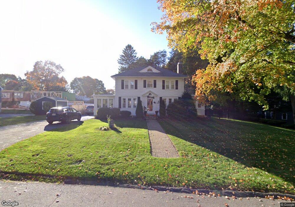
10 Morrison Rd Wakefield, MA 01880
West Side NeighborhoodEstimated Value: $982,000 - $1,161,000
5
Beds
3
Baths
2,099
Sq Ft
$505/Sq Ft
Est. Value
About This Home
This home is located at 10 Morrison Rd, Wakefield, MA 01880 and is currently estimated at $1,060,151, approximately $505 per square foot. 10 Morrison Rd is a home located in Middlesex County with nearby schools including Wakefield Memorial High School, St Joseph School, and St. Patrick Elementary School.
Ownership History
Date
Name
Owned For
Owner Type
Purchase Details
Closed on
Nov 17, 2015
Sold by
Umano Melissa and Umano Merlene
Bought by
Umano Melissa
Current Estimated Value
Purchase Details
Closed on
Oct 27, 2005
Sold by
Bringola Thomas J
Bought by
Umano Robert F
Home Financials for this Owner
Home Financials are based on the most recent Mortgage that was taken out on this home.
Original Mortgage
$325,000
Interest Rate
5.79%
Mortgage Type
Purchase Money Mortgage
Purchase Details
Closed on
Jun 3, 2004
Sold by
Loomis Nancy E
Bought by
Bringola Thomas J
Home Financials for this Owner
Home Financials are based on the most recent Mortgage that was taken out on this home.
Original Mortgage
$369,000
Interest Rate
5.94%
Mortgage Type
Purchase Money Mortgage
Create a Home Valuation Report for This Property
The Home Valuation Report is an in-depth analysis detailing your home's value as well as a comparison with similar homes in the area
Home Values in the Area
Average Home Value in this Area
Purchase History
| Date | Buyer | Sale Price | Title Company |
|---|---|---|---|
| Umano Melissa | -- | -- | |
| Umano Melissa | -- | -- | |
| Umano Robert F | $640,000 | -- | |
| Bringola Thomas J | $410,000 | -- |
Source: Public Records
Mortgage History
| Date | Status | Borrower | Loan Amount |
|---|---|---|---|
| Previous Owner | Umano Robert F | $325,000 | |
| Previous Owner | Bringola Thomas J | $369,000 |
Source: Public Records
Tax History
| Year | Tax Paid | Tax Assessment Tax Assessment Total Assessment is a certain percentage of the fair market value that is determined by local assessors to be the total taxable value of land and additions on the property. | Land | Improvement |
|---|---|---|---|---|
| 2025 | $11,411 | $1,005,400 | $429,100 | $576,300 |
| 2024 | $10,637 | $945,500 | $403,500 | $542,000 |
| 2023 | $10,464 | $892,100 | $380,700 | $511,400 |
| 2022 | $9,992 | $811,000 | $346,100 | $464,900 |
| 2021 | $9,406 | $738,900 | $325,300 | $413,600 |
| 2020 | $8,885 | $695,800 | $306,300 | $389,500 |
| 2019 | $8,493 | $662,000 | $291,400 | $370,600 |
| 2018 | $8,164 | $630,400 | $277,800 | $352,600 |
| 2017 | $8,015 | $615,100 | $271,100 | $344,000 |
| 2016 | $8,082 | $599,100 | $269,000 | $330,100 |
| 2015 | $7,771 | $576,500 | $258,800 | $317,700 |
| 2014 | $7,225 | $565,300 | $253,800 | $311,500 |
Source: Public Records
Map
Nearby Homes
- 4 Adams St
- 95 Prospect St
- 1 Summit Dr Unit 57
- 62 High St Unit Lot 8
- 62 High St Unit 4
- 62 High St Unit Lot 5
- 62 High St Unit Lot 12
- 64 Main St Unit 24B
- 311 Gazebo Cir Unit 311
- 2 Summit Dr Unit 43
- 12 Isola Ln
- 66 Main St Unit 15A
- 403 Gazebo Cir
- 55 Bartley St
- 1014 Gazebo Cir Unit 1014
- 248 Albion St Unit 231
- 248 Albion St Unit 321
- 252 Albion St Unit 3
- 98 Main St Unit 2
- 8 Steele St
- 14 Morrison Rd
- 3 Morrison Rd
- 15 Morrison Rd
- 20 Morrison Rd
- 136 Prospect St
- 140 Prospect St
- 7 Shumway Cir
- 12 Shumway Cir
- 132 Prospect St
- 14 Shumway Cir
- 23 Morrison Rd
- 1 Morrison Rd
- 135 Prospect St
- 9 Shumway Cir
- 22 Morrison Rd
- 25 Morrison Ave
- 148 Prospect St
- 21 Morrison Ave
- 131 Prospect St
- 128 Prospect St
Your Personal Tour Guide
Ask me questions while you tour the home.