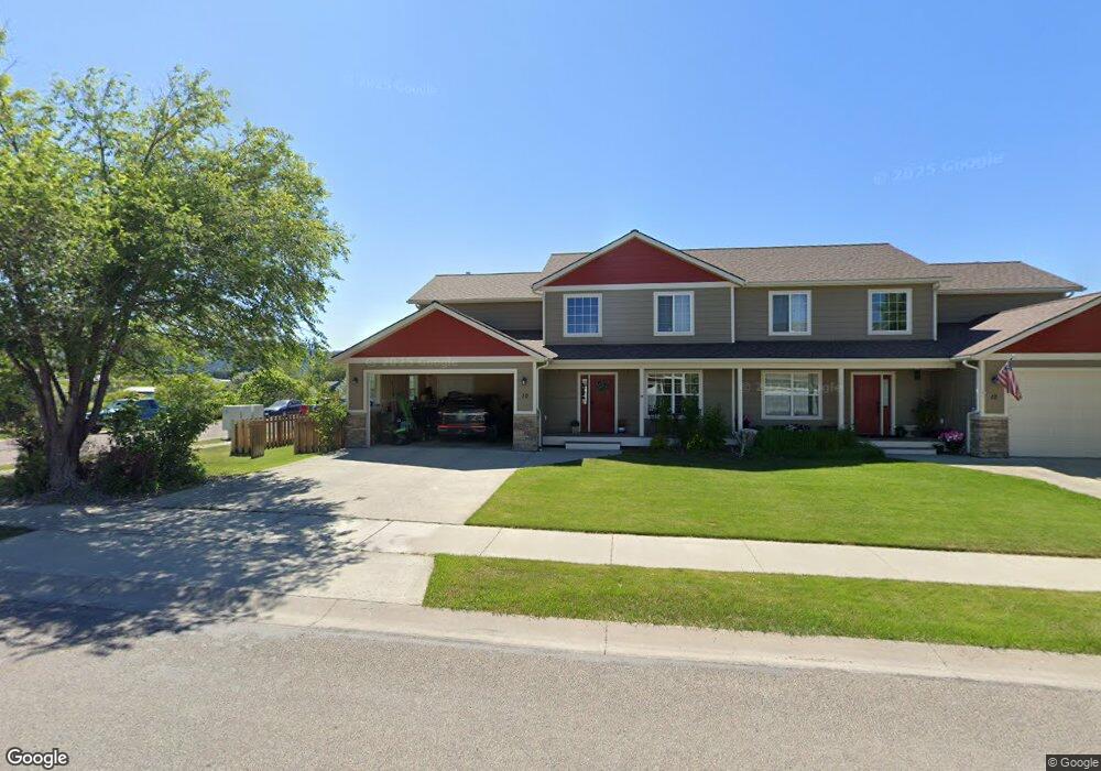
10 Muskrat Dr Kalispell, MT 59901
Estimated Value: $443,000 - $820,463
3
Beds
2
Baths
1,685
Sq Ft
$361/Sq Ft
Est. Value
About This Home
This home is located at 10 Muskrat Dr, Kalispell, MT 59901 and is currently estimated at $608,866, approximately $361 per square foot. 10 Muskrat Dr is a home located in Flathead County with nearby schools including Elrod School, Flathead High School, and Stillwater Christian School.
Ownership History
Date
Name
Owned For
Owner Type
Purchase Details
Closed on
May 25, 2021
Sold by
Jlp Investments Llc
Bought by
Payne Mark and Payne Ann
Current Estimated Value
Purchase Details
Closed on
Mar 18, 2011
Sold by
Federal Home Loan Mortgage Corporation
Bought by
Jlp Investments Llc
Purchase Details
Closed on
Jun 8, 2010
Sold by
Estremo Rosemarie
Bought by
Federal Home Loan Mortgage Corp
Purchase Details
Closed on
Jul 20, 2007
Sold by
Hardy James D and Hardy Terry D
Bought by
Estremo Rosemarie
Home Financials for this Owner
Home Financials are based on the most recent Mortgage that was taken out on this home.
Original Mortgage
$209,000
Interest Rate
6.66%
Mortgage Type
New Conventional
Purchase Details
Closed on
Apr 15, 2005
Sold by
Birk Timothy R
Bought by
Muskrat Slough Llc
Create a Home Valuation Report for This Property
The Home Valuation Report is an in-depth analysis detailing your home's value as well as a comparison with similar homes in the area
Home Values in the Area
Average Home Value in this Area
Purchase History
| Date | Buyer | Sale Price | Title Company |
|---|---|---|---|
| Payne Mark | -- | Insured Titles | |
| Jlp Investments Llc | $115,000 | Servicelink | |
| Federal Home Loan Mortgage Corp | $155,000 | First American Title Ins Co | |
| Estremo Rosemarie | -- | Alliance Title | |
| Muskrat Slough Llc | -- | None Available |
Source: Public Records
Mortgage History
| Date | Status | Borrower | Loan Amount |
|---|---|---|---|
| Previous Owner | Estremo Rosemarie | $209,000 |
Source: Public Records
Tax History Compared to Growth
Tax History
| Year | Tax Paid | Tax Assessment Tax Assessment Total Assessment is a certain percentage of the fair market value that is determined by local assessors to be the total taxable value of land and additions on the property. | Land | Improvement |
|---|---|---|---|---|
| 2025 | $2,552 | $492,000 | $0 | $0 |
| 2024 | $3,018 | $387,500 | $0 | $0 |
| 2023 | $3,198 | $387,500 | $0 | $0 |
| 2022 | $2,885 | $261,100 | $0 | $0 |
| 2021 | $2,896 | $261,100 | $0 | $0 |
| 2020 | $2,521 | $213,000 | $0 | $0 |
| 2019 | $2,527 | $213,000 | $0 | $0 |
| 2018 | $2,437 | $196,100 | $0 | $0 |
| 2017 | $2,447 | $196,100 | $0 | $0 |
| 2016 | $1,892 | $162,200 | $0 | $0 |
| 2015 | $1,894 | $162,200 | $0 | $0 |
| 2014 | $2,092 | $108,544 | $0 | $0 |
Source: Public Records
Map
Nearby Homes
- 11 Muskrat Dr
- 19 Muskrat Dr
- 2147 S Woodland Dr
- 50 Twin Acres Dr Unit 7
- 50 Twin Acres Dr Unit 11
- 1509 Eagle Dr
- 2455 Us Highway 93 S
- 1340 Willow Glen Dr Unit 19
- 1340 Willow Glen Dr Unit 23
- 1340 Willow Glen Dr Unit 26
- NHN U S 93 S
- 59 Honeysuckle Ln
- 1717 S Woodland Dr Unit SPC -21
- 1692 Bull Run
- 1687 Bull Run
- 2883 & 2879 Lower Valley Rd
- 3943 Lower Valley Rd
- 2252 Canvasback Ct
- 1221 7th Ave E
- 826 11th St E