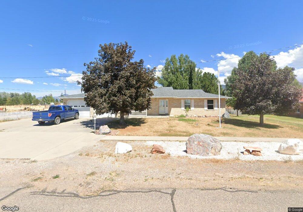
10 N 400 E Meadow, UT 84644
Estimated Value: $288,000
Studio
--
Bath
--
Sq Ft
79,279
Sq Ft Lot
About This Home
This home is located at 10 N 400 E, Meadow, UT 84644 and is currently estimated at $288,000. 10 N 400 E is a home.
Ownership History
Date
Name
Owned For
Owner Type
Purchase Details
Closed on
Nov 10, 2021
Sold by
Kendel Twitchell Family Trust
Bought by
Hebbert Travis and Hebbert Misty
Current Estimated Value
Purchase Details
Closed on
Aug 26, 2021
Sold by
Steele Twitchell Kendel
Bought by
Kendel Twitchell Family Trust
Home Financials for this Owner
Home Financials are based on the most recent Mortgage that was taken out on this home.
Original Mortgage
$117,900
Interest Rate
2.86%
Purchase Details
Closed on
Aug 24, 2021
Sold by
Roberts Melba T
Bought by
Hebbert Travis and Hebbert Misty
Home Financials for this Owner
Home Financials are based on the most recent Mortgage that was taken out on this home.
Original Mortgage
$117,900
Interest Rate
2.86%
Purchase Details
Closed on
Feb 20, 2009
Sold by
Twitchell Kendal S and Twitchell Zola B
Bought by
Twtchell Kendal S and Twitchell Zola B
Home Financials for this Owner
Home Financials are based on the most recent Mortgage that was taken out on this home.
Original Mortgage
$397,500
Interest Rate
5.08%
Mortgage Type
Reverse Mortgage Home Equity Conversion Mortgage
Create a Home Valuation Report for This Property
The Home Valuation Report is an in-depth analysis detailing your home's value as well as a comparison with similar homes in the area
Purchase History
| Date | Buyer | Sale Price | Title Company |
|---|---|---|---|
| Hebbert Travis | -- | Inwest Title | |
| Kendel Twitchell Family Trust | -- | -- | |
| Hebbert Travis | -- | None Available | |
| Twtchell Kendal S | -- | -- |
Source: Public Records
Mortgage History
| Date | Status | Borrower | Loan Amount |
|---|---|---|---|
| Previous Owner | Hebbert Travis | $117,900 | |
| Previous Owner | Twtchell Kendal S | $397,500 |
Source: Public Records
Tax History
| Year | Tax Paid | Tax Assessment Tax Assessment Total Assessment is a certain percentage of the fair market value that is determined by local assessors to be the total taxable value of land and additions on the property. | Land | Improvement |
|---|---|---|---|---|
| 2025 | $2,221 | $285,553 | $51,100 | $234,453 |
| 2024 | $2,221 | $279,174 | $38,706 | $240,468 |
| 2023 | $2,767 | $279,174 | $38,706 | $240,468 |
| 2022 | $2,167 | $199,790 | $31,726 | $168,064 |
| 2021 | $1,723 | $151,771 | $27,588 | $124,183 |
| 2020 | $1,529 | $135,656 | $22,990 | $112,666 |
| 2019 | $1,362 | $121,047 | $20,900 | $100,147 |
| 2018 | $109 | $121,047 | $20,900 | $100,147 |
| 2017 | $113 | $121,047 | $20,900 | $100,147 |
| 2016 | $110 | $101,881 | $20,900 | $80,981 |
| 2015 | $110 | $101,881 | $20,900 | $80,981 |
| 2014 | -- | $101,881 | $20,900 | $80,981 |
| 2013 | -- | $108,381 | $27,400 | $80,981 |
Source: Public Records
Map
Nearby Homes
- 479 E 100 N
- 50 N 100 Rd E
- 0 County Road 4616
- 1565 W Sunflower Ln Unit 3
- 1615 W Sunflower Ln
- 1615 W Sunflower Ln Unit 4
- 1565 W Sunflower Ln
- 2000 N West Frontage I-15
- 1100 S 725 Rd W
- 135 E 200 N
- 310 S 500 West Rd
- 465 S 100 W
- 115 W 200 S
- 260 W 200 S
- 58 E 300 South St
- 155 E 500 St S
- 157 E 500 South St
- 760 E 700 St S
- 351 W 100 South St
- 405 E 500 St S
Your Personal Tour Guide
Ask me questions while you tour the home.