
10 Nuttall Ln Unit 3 Worcester, MA 01604
Union HIll Neighborhood
2
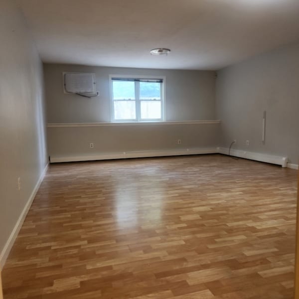
Beds
1
Bath
950
Sq Ft
1990
Built
About This Home
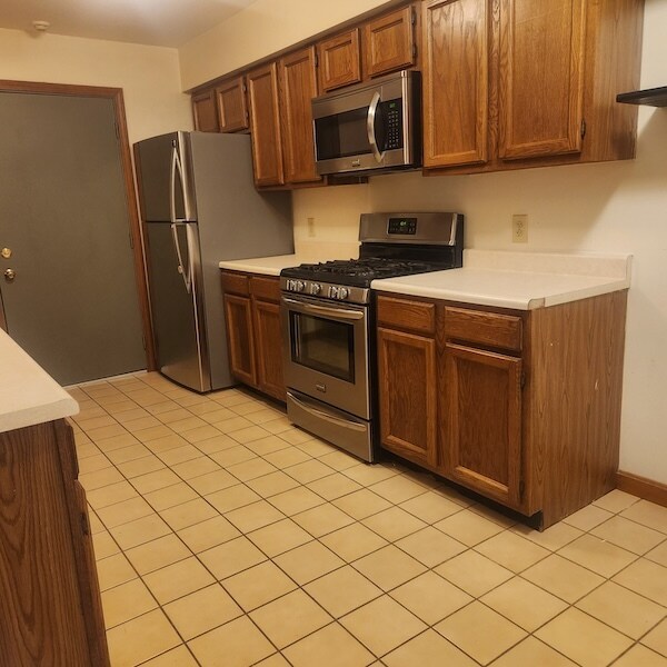
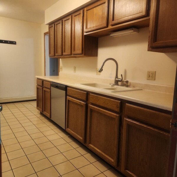
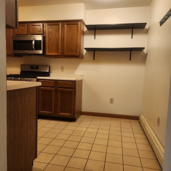
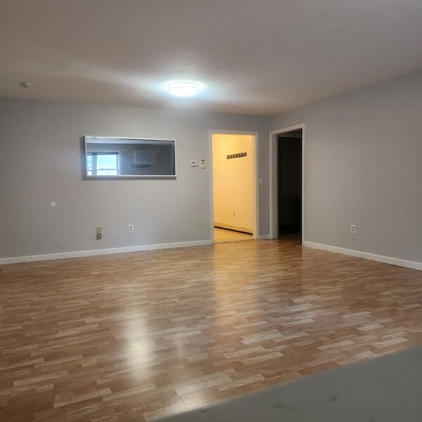
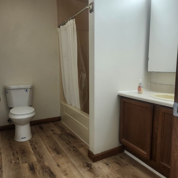
Spacious two bedroom condo with HEAT and HOT WATER included. This unit features a fully applianced eat-in kitchen with dishwater, microwave, and garbage disposal. Standard bathroom with tub/shower. Linen closet and coat closet in hallway. One medium sized bedroom and one large bedroom.
Coin-op laundry is available, along with deeded off-street parking. No smoking of any kind. No pets. 1st, last, and security deposit to move-in. 1 year lease. All candidates are subject to full background check. Minimum household monthly income of $6000 and credit score of 650+, please
Listing Provided By

Condo Details
Property Information
- Built in 1990
- 2 units
Lease Options
- 12 Months
Utilities Included
- Water
- Heat
- Trash Removal
- Sewer
Condo Features
- Air Conditioning
- Cable Ready
- Tub/Shower
- Smoke Free
Property Services
- Laundry Facilities
Kitchen Features & Appliances
- Dishwasher
- Disposal
- Microwave
- Eat-in Kitchen
- Kitchen
- Refrigerator
- Oven
- Range
- Instant Hot Water
Model Details
- Linen Closet
Map
Property History
| Date | Event | Price | List to Sale | Price per Sq Ft | Prior Sale |
|---|---|---|---|---|---|
| 03/06/2026 03/06/26 | For Rent | $1,995 | 0.0% | -- | |
| 01/11/2026 01/11/26 | Off Market | $1,995 | -- | -- | |
| 12/10/2025 12/10/25 | Price Changed | $1,995 | 0.0% | $2 / Sq Ft | |
| 12/10/2025 12/10/25 | For Rent | $1,995 | -5.0% | -- | |
| 11/16/2025 11/16/25 | Off Market | $2,100 | -- | -- | |
| 10/06/2025 10/06/25 | For Rent | $2,100 | 0.0% | -- | |
| 09/22/2025 09/22/25 | Sold | $219,000 | -4.8% | $235 / Sq Ft | View Prior Sale |
| 08/26/2025 08/26/25 | Pending | -- | -- | -- | |
| 08/04/2025 08/04/25 | Price Changed | $230,000 | -4.2% | $247 / Sq Ft | |
| 07/07/2025 07/07/25 | For Sale | $240,000 | 0.0% | $258 / Sq Ft | |
| 06/08/2025 06/08/25 | Pending | -- | -- | -- | |
| 05/29/2025 05/29/25 | For Sale | $240,000 | -- | $258 / Sq Ft |
Nearby Homes
- 1 Rosamond St
- 10 Acton St Unit 1
- 53 Barclay St Unit 1
- 17 N Woodford St Unit 1
- 5 Massasoit Rd Unit 2
- 43 Arthur St
- 43 Arthur St
- 3 N Woodford St Unit 2
- 58 Cutler St Unit Apartment #3
- 425B Grafton St Unit 425B
- 153 Providence St Unit . 3
- 70 Arlington St Unit 3
- 7 Village St Unit 4
- 15 Mendon St Unit 3
- 247 Pilgrim Ave Unit 1
- 247 Pilgrim Ave Unit 2
- 247 Pilgrim Ave Unit 3
- 30 Pattison St Unit 2
- 5 Cohasset St
- 5 Cohasset St
Your Personal Tour Guide
Ask me questions while you tour the home.