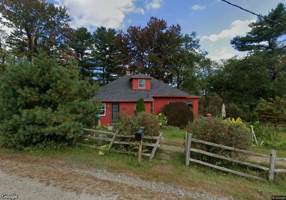
10 Old Gray Rd Cumberland Center, ME 04021
West Cumberland NeighborhoodEstimated Value: $407,000 - $447,000
3
Beds
1
Bath
1,520
Sq Ft
$282/Sq Ft
Est. Value
About This Home
This home is located at 10 Old Gray Rd, Cumberland Center, ME 04021 and is currently estimated at $427,970, approximately $281 per square foot. 10 Old Gray Rd is a home located in Cumberland County with nearby schools including Mabel I. Wilson School, Greely Middle School 4-5, and Greely Middle School.
Ownership History
Date
Name
Owned For
Owner Type
Purchase Details
Closed on
Mar 22, 2016
Sold by
Banfield James
Bought by
Banfield James and Ford Lesley
Current Estimated Value
Home Financials for this Owner
Home Financials are based on the most recent Mortgage that was taken out on this home.
Original Mortgage
$167,500
Interest Rate
4%
Mortgage Type
New Conventional
Purchase Details
Closed on
Jul 26, 2007
Sold by
Lindholm Robert R and Lindholm Valerie J
Bought by
Banfield James M
Home Financials for this Owner
Home Financials are based on the most recent Mortgage that was taken out on this home.
Original Mortgage
$184,004
Interest Rate
6.78%
Mortgage Type
Purchase Money Mortgage
Create a Home Valuation Report for This Property
The Home Valuation Report is an in-depth analysis detailing your home's value as well as a comparison with similar homes in the area
Home Values in the Area
Average Home Value in this Area
Purchase History
| Date | Buyer | Sale Price | Title Company |
|---|---|---|---|
| Banfield James | -- | -- | |
| Banfield James M | -- | -- |
Source: Public Records
Mortgage History
| Date | Status | Borrower | Loan Amount |
|---|---|---|---|
| Previous Owner | Banfield James | $167,500 | |
| Previous Owner | Banfield James M | $181,500 | |
| Previous Owner | Banfield James M | $185,600 | |
| Previous Owner | Banfield James M | $184,004 |
Source: Public Records
Tax History Compared to Growth
Tax History
| Year | Tax Paid | Tax Assessment Tax Assessment Total Assessment is a certain percentage of the fair market value that is determined by local assessors to be the total taxable value of land and additions on the property. | Land | Improvement |
|---|---|---|---|---|
| 2025 | $4,935 | $196,000 | $98,300 | $97,700 |
| 2024 | $4,557 | $196,000 | $98,300 | $97,700 |
| 2023 | $4,341 | $196,000 | $98,300 | $97,700 |
| 2022 | $4,155 | $196,000 | $98,300 | $97,700 |
| 2021 | $4,028 | $196,000 | $98,300 | $97,700 |
| 2020 | $3,484 | $196,000 | $98,300 | $97,700 |
| 2019 | $3,891 | $196,000 | $98,300 | $97,700 |
| 2018 | $3,808 | $193,300 | $98,300 | $95,000 |
| 2017 | $3,634 | $193,300 | $98,300 | $95,000 |
| 2016 | $3,528 | $193,300 | $98,300 | $95,000 |
| 2015 | $3,499 | $193,300 | $98,300 | $95,000 |
| 2014 | $3,363 | $193,300 | $98,300 | $95,000 |
| 2013 | $3,286 | $193,300 | $98,300 | $95,000 |
Source: Public Records
Map
Nearby Homes
- 5 Skillin Rd
- 43 Skillin Rd
- 63 Peaceful Way
- 8 Feldspar Ln Unit 29
- 5 Feldspar Ln Unit 3
- 1 Feldspar Ln Unit 1
- 25 Feldspar Ln Unit 13
- 13 Feldspar Ln Unit 7
- 30 Feldspar Ln Unit 21
- 24 Feldspar Ln Unit 23
- 21 Feldspar Ln Unit 11
- 23 Feldspar Ln Unit 12
- 26 Feldspar Ln Unit 22
- 31 Feldspar Ln Unit 16
- 8 Castle Rock
- 7 Castle Rock Dr
- 1,8 Sugar Maple Rd
- 0 Tinker Ln Unit 57D
- 57&57D Tinker Ln and Pointer Way
- 0 Thomes Way