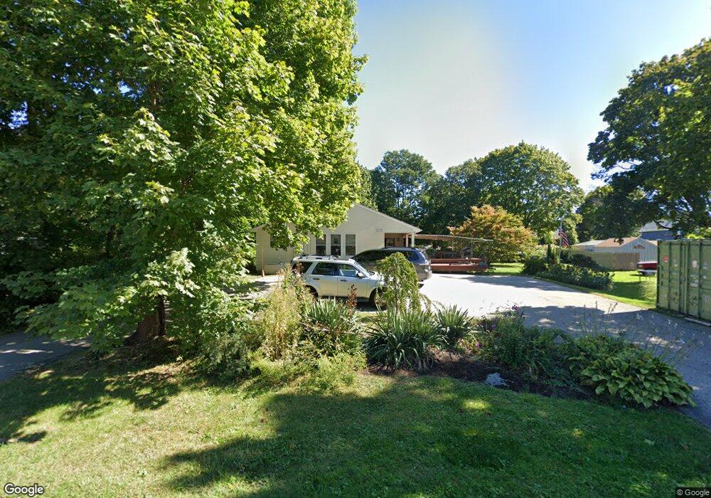
10 Pemberton Ave Jamestown, RI 02835
Jamestown Village NeighborhoodEstimated Value: $967,000 - $1,103,000
3
Beds
2
Baths
1,584
Sq Ft
$668/Sq Ft
Est. Value
About This Home
This home is located at 10 Pemberton Ave, Jamestown, RI 02835 and is currently estimated at $1,058,078, approximately $667 per square foot. 10 Pemberton Ave is a home located in Newport County with nearby schools including Melrose Avenue School and Lawn Avenue School.
Ownership History
Date
Name
Owned For
Owner Type
Purchase Details
Closed on
Oct 13, 1995
Sold by
Church Comm Hsng Corp
Bought by
Hamel Betsy A and Hamel William
Current Estimated Value
Home Financials for this Owner
Home Financials are based on the most recent Mortgage that was taken out on this home.
Original Mortgage
$90,100
Outstanding Balance
$639
Interest Rate
7.71%
Mortgage Type
Purchase Money Mortgage
Estimated Equity
$1,057,439
Create a Home Valuation Report for This Property
The Home Valuation Report is an in-depth analysis detailing your home's value as well as a comparison with similar homes in the area
Home Values in the Area
Average Home Value in this Area
Purchase History
| Date | Buyer | Sale Price | Title Company |
|---|---|---|---|
| Hamel Betsy A | $90,500 | -- |
Source: Public Records
Mortgage History
| Date | Status | Borrower | Loan Amount |
|---|---|---|---|
| Open | Hamel Betsy A | $25,000 | |
| Open | Hamel Betsy A | $90,100 |
Source: Public Records
Tax History Compared to Growth
Tax History
| Year | Tax Paid | Tax Assessment Tax Assessment Total Assessment is a certain percentage of the fair market value that is determined by local assessors to be the total taxable value of land and additions on the property. | Land | Improvement |
|---|---|---|---|---|
| 2025 | $4,136 | $733,300 | $414,000 | $319,300 |
| 2024 | $4,022 | $560,900 | $314,000 | $246,900 |
| 2023 | $3,972 | $569,100 | $314,000 | $255,100 |
| 2022 | $4,149 | $611,100 | $330,600 | $280,500 |
| 2021 | $3,026 | $365,500 | $214,300 | $151,200 |
| 2020 | $2,950 | $365,500 | $214,300 | $151,200 |
| 2019 | $2,942 | $365,500 | $214,300 | $151,200 |
| 2018 | $2,902 | $327,900 | $187,800 | $140,100 |
| 2017 | $2,840 | $327,900 | $187,800 | $140,100 |
| 2016 | $2,813 | $327,900 | $187,800 | $140,100 |
| 2015 | $2,940 | $334,900 | $224,700 | $110,200 |
| 2014 | $2,930 | $334,900 | $224,700 | $110,200 |
Source: Public Records
Map
Nearby Homes
- 46 North Rd
- 22 Cole St
- 48 Ocean Ave
- 20 Lincoln St
- 63 Longfellow Rd
- 73 Conanicus Ave Unit 4
- 104 Howland Ave
- 39 Walcott Ave
- 76 Battery Ln
- 10 Coulter St
- 21 Helm St
- 27 Marcello Dr
- 30 Bonnet View Dr
- 21 Bonnet View Dr
- 625 N Main Rd
- 121 Seaside Dr
- 94 Spindrift St
- 174 Seaside Dr
- 65 Ridge Rd Unit P37
- 58 Dolphin St
- 14 Pemberton Ave
- 7 Pemberton Ave
- 124 Narragansett Ave
- 126 Narragansett Ave
- 0 Pemberton Ave
- 20 Pemberton Ave
- 138 Narragansett Ave
- 138 Narragansett Ave Unit 2
- 138 Narragansett Ave Unit 11
- 138 Narragansett Ave Unit 1
- 138 Narragansett Ave Unit 15
- 138 Narragansett Ave Unit 3
- 138 Narragansett Ave Unit 12
- 138 Narragansett Ave Unit 10
- 138 Narragansett Ave Unit 8
- 138 Narragansett Ave Unit 14
- 138 Narragansett Ave Unit 9
- 138 Narragansett Ave Unit 4
- 132 Narragansett Ave
- 120 Narragansett Ave