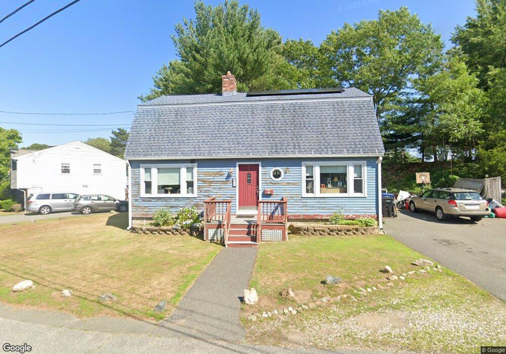
10 Peter Rd Salem, MA 01970
Vinnin Square NeighborhoodEstimated Value: $671,000 - $768,000
2
Beds
2
Baths
1,687
Sq Ft
$430/Sq Ft
Est. Value
About This Home
This home is located at 10 Peter Rd, Salem, MA 01970 and is currently estimated at $725,032, approximately $429 per square foot. 10 Peter Rd is a home located in Essex County with nearby schools including Saltonstall School, Horace Mann Laboratory, and Witchcraft Heights Elementary School.
Ownership History
Date
Name
Owned For
Owner Type
Purchase Details
Closed on
Nov 21, 2012
Sold by
Benoit Paul L and Benoit Kathy E
Bought by
Donadio Dominic C and Donadio Lauren
Current Estimated Value
Home Financials for this Owner
Home Financials are based on the most recent Mortgage that was taken out on this home.
Original Mortgage
$279,800
Outstanding Balance
$192,061
Interest Rate
3.25%
Mortgage Type
FHA
Estimated Equity
$532,971
Create a Home Valuation Report for This Property
The Home Valuation Report is an in-depth analysis detailing your home's value as well as a comparison with similar homes in the area
Home Values in the Area
Average Home Value in this Area
Purchase History
| Date | Buyer | Sale Price | Title Company |
|---|---|---|---|
| Donadio Dominic C | $290,000 | -- |
Source: Public Records
Mortgage History
| Date | Status | Borrower | Loan Amount |
|---|---|---|---|
| Open | Donadio Dominic C | $279,800 | |
| Previous Owner | Donadio Dominic C | $219,500 |
Source: Public Records
Tax History
| Year | Tax Paid | Tax Assessment Tax Assessment Total Assessment is a certain percentage of the fair market value that is determined by local assessors to be the total taxable value of land and additions on the property. | Land | Improvement |
|---|---|---|---|---|
| 2025 | $7,499 | $661,300 | $266,400 | $394,900 |
| 2024 | $7,292 | $627,500 | $251,400 | $376,100 |
| 2023 | $6,959 | $556,300 | $228,900 | $327,400 |
| 2022 | $6,571 | $495,900 | $210,100 | $285,800 |
| 2021 | $6,569 | $476,000 | $195,100 | $280,900 |
| 2020 | $6,576 | $455,100 | $191,400 | $263,700 |
| 2019 | $6,425 | $425,500 | $180,000 | $245,500 |
| 2018 | $6,183 | $402,000 | $168,100 | $233,900 |
| 2017 | $6,079 | $383,300 | $157,600 | $225,700 |
| 2016 | $5,836 | $372,400 | $157,600 | $214,800 |
| 2015 | $5,689 | $346,700 | $138,900 | $207,800 |
Source: Public Records
Map
Nearby Homes
- 469 Loring Ave
- 1008 Paradise Rd Unit 1M
- 1002 Paradise Rd Unit PHE
- 1004 Paradise Rd Unit 1K
- 1004 Paradise Rd Unit 1L
- 11 Angenica Terrace
- 212 Humphrey St Unit 205
- 11 Elbridge Ln Unit 11
- 49 Weatherly Dr
- 30 Weatherly Dr
- 11 Weatherly Dr
- 28 Surrey Rd
- 2 Ocean Ave
- 3 Stillwell Dr Unit 10B
- 445 Essex St Unit 304
- 441 Essex St Unit 302
- 12 Pickwick Rd
- 16 Pickwick Rd
- 8 Russell Dr Unit 7D
- 3 Didio Dr
Your Personal Tour Guide
Ask me questions while you tour the home.