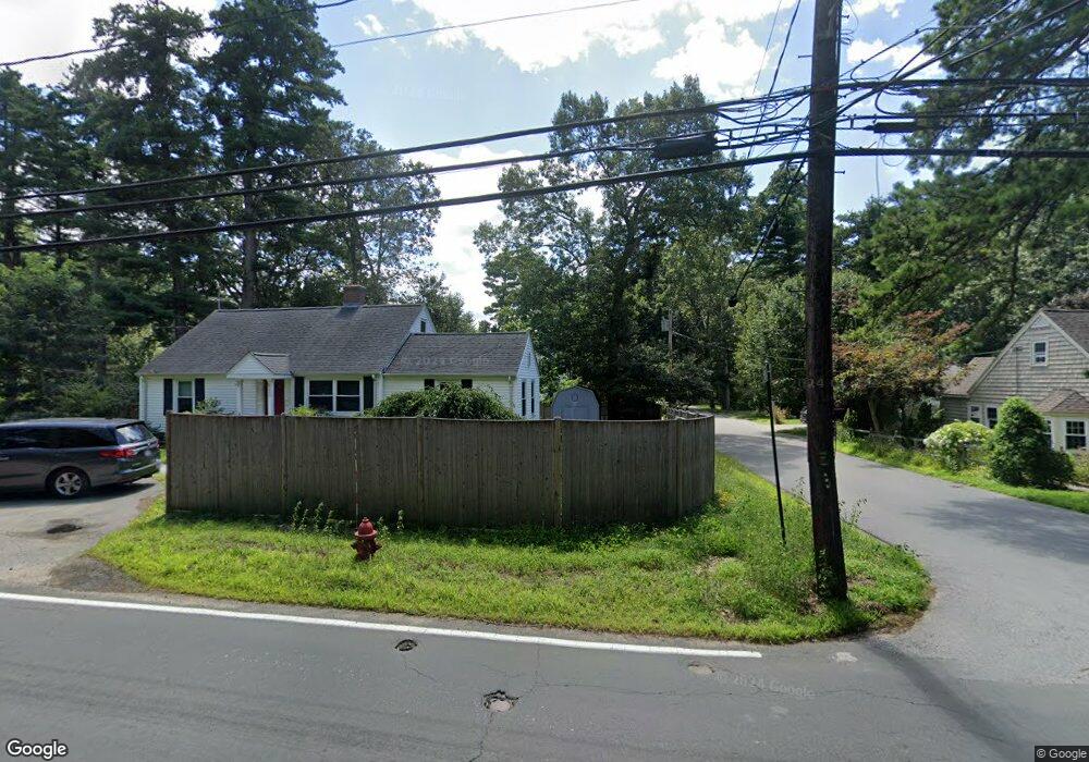
10 Richard Ave Unit SF Sudbury, MA 01776
Estimated Value: $1,103,000 - $1,323,000
4
Beds
3
Baths
2,408
Sq Ft
$503/Sq Ft
Est. Value
About This Home
This home is located at 10 Richard Ave Unit SF, Sudbury, MA 01776 and is currently estimated at $1,210,590, approximately $502 per square foot. 10 Richard Ave Unit SF is a home located in Middlesex County with nearby schools including General John Nixon Elementary School, Ephraim Curtis Middle School, and Lincoln-Sudbury Regional High School.
Ownership History
Date
Name
Owned For
Owner Type
Purchase Details
Closed on
Mar 19, 2020
Sold by
Mclaughlin Ian P and Mclaughlin Kathleen
Bought by
Beaulieu Brian C and Beaulieu Kathryn M
Current Estimated Value
Home Financials for this Owner
Home Financials are based on the most recent Mortgage that was taken out on this home.
Original Mortgage
$660,000
Outstanding Balance
$583,410
Interest Rate
3.4%
Mortgage Type
New Conventional
Estimated Equity
$627,180
Purchase Details
Closed on
Apr 29, 2016
Sold by
Edsall Craig
Bought by
Mclaughlin Ian P and Mclaughlin Kathleen
Home Financials for this Owner
Home Financials are based on the most recent Mortgage that was taken out on this home.
Original Mortgage
$452,000
Interest Rate
3.73%
Mortgage Type
New Conventional
Purchase Details
Closed on
Nov 20, 2015
Sold by
Kurian Abraham P
Bought by
Edsall Craig
Home Financials for this Owner
Home Financials are based on the most recent Mortgage that was taken out on this home.
Original Mortgage
$378,750
Interest Rate
3.79%
Mortgage Type
New Conventional
Purchase Details
Closed on
Jul 21, 1997
Sold by
Bush Timothy M
Bought by
Kurian Abraham P and Kurian Thresiamma
Purchase Details
Closed on
Oct 30, 1996
Sold by
Portside Rt
Bought by
Bush Timothy M
Purchase Details
Closed on
Jan 22, 1996
Sold by
Habel Ann J and Ireland Doris
Bought by
Protside Rt
Create a Home Valuation Report for This Property
The Home Valuation Report is an in-depth analysis detailing your home's value as well as a comparison with similar homes in the area
Home Values in the Area
Average Home Value in this Area
Purchase History
| Date | Buyer | Sale Price | Title Company |
|---|---|---|---|
| Beaulieu Brian C | $880,000 | None Available | |
| Mclaughlin Ian P | $565,000 | -- | |
| Edsall Craig | $447,000 | -- | |
| Kurian Abraham P | $287,000 | -- | |
| Bush Timothy M | $269,900 | -- | |
| Protside Rt | $55,000 | -- |
Source: Public Records
Mortgage History
| Date | Status | Borrower | Loan Amount |
|---|---|---|---|
| Open | Beaulieu Brian C | $660,000 | |
| Previous Owner | Mclaughlin Ian P | $452,000 | |
| Previous Owner | Edsall Craig | $378,750 | |
| Previous Owner | Protside Rt | $440,000 | |
| Previous Owner | Protside Rt | $58,600 |
Source: Public Records
Tax History Compared to Growth
Tax History
| Year | Tax Paid | Tax Assessment Tax Assessment Total Assessment is a certain percentage of the fair market value that is determined by local assessors to be the total taxable value of land and additions on the property. | Land | Improvement |
|---|---|---|---|---|
| 2025 | $15,155 | $1,035,200 | $361,100 | $674,100 |
| 2024 | $14,582 | $998,100 | $350,600 | $647,500 |
| 2023 | $13,696 | $868,500 | $318,600 | $549,900 |
| 2022 | $13,223 | $732,600 | $292,400 | $440,200 |
| 2021 | $11,038 | $586,200 | $292,400 | $293,800 |
| 2020 | $10,815 | $586,200 | $292,400 | $293,800 |
| 2019 | $10,499 | $586,200 | $292,400 | $293,800 |
| 2018 | $9,530 | $531,500 | $295,800 | $235,700 |
| 2017 | $9,209 | $519,100 | $285,600 | $233,500 |
| 2016 | $8,930 | $501,700 | $274,800 | $226,900 |
| 2015 | $8,525 | $484,400 | $261,800 | $222,600 |
| 2014 | $8,489 | $470,800 | $252,600 | $218,200 |
Source: Public Records
Map
Nearby Homes
- 36 Old Forge Ln
- 47 Fairbank Rd
- 4 Elderberry Cir
- 24 Goodnow Rd
- 12 Camperdown Ln
- 54 Phillips Rd
- 14 Tanbark Rd
- 21 Summer St
- 55 Widow Rites Ln
- 45 Widow Rites Ln
- 7 Saddle Ridge Rd
- 11 Great Lake Dr
- 270 Old Lancaster Rd
- 63 Canterbury Dr
- 89 Bridle Path
- 25 Bridle Path
- 30 Rolling Ln
- 427 Concord Rd
- 5 Taintor Dr
- 166 Parker St Unit 4