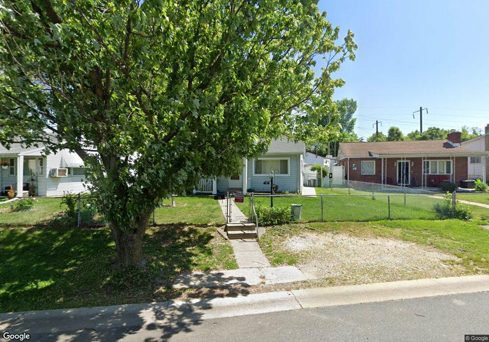
10 Right Wing Dr Middle River, MD 21220
Estimated Value: $233,000 - $254,000
Studio
1
Bath
864
Sq Ft
$283/Sq Ft
Est. Value
About This Home
This home is located at 10 Right Wing Dr, Middle River, MD 21220 and is currently estimated at $244,723, approximately $283 per square foot. 10 Right Wing Dr is a home located in Baltimore County with nearby schools including Orems Elementary, Stemmers Run Middle School, and Kenwood High.
Ownership History
Date
Name
Owned For
Owner Type
Purchase Details
Closed on
Jan 25, 2025
Sold by
Smialkowski Patricia J
Bought by
Smialkowski Patricia J and Smialkowski Edward George
Current Estimated Value
Purchase Details
Closed on
Jun 4, 2002
Sold by
Right Wing Associates Llc
Bought by
Smialkowski Edward G and Smialkowski Patricia J
Purchase Details
Closed on
Jan 3, 2002
Sold by
Reese Francis Stewart
Bought by
Right Wing Associates Llc
Purchase Details
Closed on
Aug 27, 1986
Sold by
Hagenbucher Frank B
Bought by
Reese Francis Stewart
Create a Home Valuation Report for This Property
The Home Valuation Report is an in-depth analysis detailing your home's value as well as a comparison with similar homes in the area
Home Values in the Area
Average Home Value in this Area
Purchase History
| Date | Buyer | Sale Price | Title Company |
|---|---|---|---|
| Smialkowski Patricia J | -- | Endeavor Title | |
| Smialkowski Patricia J | -- | Endeavor Title | |
| Smialkowski Edward G | $98,000 | -- | |
| Right Wing Associates Llc | $50,000 | -- | |
| Reese Francis Stewart | $46,900 | -- |
Source: Public Records
Tax History
| Year | Tax Paid | Tax Assessment Tax Assessment Total Assessment is a certain percentage of the fair market value that is determined by local assessors to be the total taxable value of land and additions on the property. | Land | Improvement |
|---|---|---|---|---|
| 2025 | $2,821 | $179,267 | -- | -- |
| 2024 | $2,821 | $168,233 | -- | -- |
| 2023 | $1,328 | $157,200 | $52,700 | $104,500 |
| 2022 | $2,604 | $148,200 | $0 | $0 |
| 2021 | $2,405 | $139,200 | $0 | $0 |
| 2020 | $2,405 | $130,200 | $52,700 | $77,500 |
| 2019 | $2,469 | $129,367 | $0 | $0 |
| 2018 | $2,285 | $128,533 | $0 | $0 |
| 2017 | $2,309 | $127,700 | $0 | $0 |
| 2016 | $1,785 | $124,133 | $0 | $0 |
| 2015 | $1,785 | $120,567 | $0 | $0 |
| 2014 | $1,785 | $117,000 | $0 | $0 |
Source: Public Records
Map
Nearby Homes
- 18 Blister St
- 33 Left Wing Dr
- 1201 Fuselage Ave
- 215 Seamaster Rd
- 17 Propeller Dr
- 1018 Cord St
- 1008 Fuselage Ave
- 109 Judywood Ln
- 1812 Kitty Hawk Rd
- 64 Rockywood Ln
- 37 Walkern Rd
- 902 Cord St
- 49 Rockywood Ln
- 1713 Glen Curtis Rd
- 214 Ballard Ave
- 24 Harrison Ave N
- 577 Welbrook Rd
- 13 Harrison Ave N
- 60 S Hawthorne Rd
- 1535 Chilworth Ave
- 12 Right Wing Dr
- 8 Right Wing Dr
- 14 Right Wing Dr
- 6 Right Wing Dr
- 7 Right Wing Dr
- 16 Right Wing Dr
- 11 Right Wing Dr
- 4 Right Wing Dr
- 5 Right Wing Dr
- 24 Cockpit St
- 3 Right Wing Dr
- 2 Right Wing Dr
- 22 Cockpit St
- 20 Right Wing Dr
- 21 Right Wing Dr
- 20 Cockpit St
- 1 Left Wing Dr
- 22 Right Wing Dr
- 18 Cockpit St
- 29 Cockpit St
Your Personal Tour Guide
Ask me questions while you tour the home.