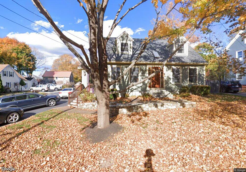
10 Russell St Amesbury, MA 01913
Estimated Value: $601,000 - $719,000
3
Beds
2
Baths
1,870
Sq Ft
$366/Sq Ft
Est. Value
About This Home
This home is located at 10 Russell St, Amesbury, MA 01913 and is currently estimated at $684,655, approximately $366 per square foot. 10 Russell St is a home located in Essex County with nearby schools including Amesbury High School and Amesbury Seventh-Day Adventist School.
Ownership History
Date
Name
Owned For
Owner Type
Purchase Details
Closed on
Jul 27, 2000
Sold by
Shaw David R and Shaw Tracy L
Bought by
Walsh Matthew S and Walsh Theresa A
Current Estimated Value
Purchase Details
Closed on
May 21, 1993
Sold by
Bradku Inc
Bought by
Shaw David R and Shaw Tracy L
Purchase Details
Closed on
Dec 31, 1992
Sold by
Obrien Blanche A
Bought by
Bradku Inc
Create a Home Valuation Report for This Property
The Home Valuation Report is an in-depth analysis detailing your home's value as well as a comparison with similar homes in the area
Home Values in the Area
Average Home Value in this Area
Purchase History
| Date | Buyer | Sale Price | Title Company |
|---|---|---|---|
| Walsh Matthew S | $215,000 | -- | |
| Shaw David R | $129,900 | -- | |
| Bradku Inc | $31,500 | -- |
Source: Public Records
Mortgage History
| Date | Status | Borrower | Loan Amount |
|---|---|---|---|
| Open | Bradku Inc | $251,000 | |
| Closed | Bradku Inc | $251,000 |
Source: Public Records
Tax History Compared to Growth
Tax History
| Year | Tax Paid | Tax Assessment Tax Assessment Total Assessment is a certain percentage of the fair market value that is determined by local assessors to be the total taxable value of land and additions on the property. | Land | Improvement |
|---|---|---|---|---|
| 2025 | $8,671 | $566,700 | $202,300 | $364,400 |
| 2024 | $8,685 | $555,300 | $190,900 | $364,400 |
| 2023 | $7,855 | $480,700 | $165,900 | $314,800 |
| 2022 | $7,182 | $406,000 | $144,300 | $261,700 |
| 2021 | $6,800 | $372,600 | $111,400 | $261,200 |
| 2020 | $6,161 | $358,600 | $107,200 | $251,400 |
| 2019 | $6,137 | $334,100 | $107,200 | $226,900 |
| 2018 | $6,269 | $330,100 | $102,100 | $228,000 |
| 2017 | $6,003 | $300,900 | $102,100 | $198,800 |
| 2016 | $5,808 | $286,400 | $102,100 | $184,300 |
| 2015 | $5,770 | $280,900 | $102,100 | $178,800 |
| 2014 | $5,280 | $251,800 | $102,100 | $149,700 |
Source: Public Records
Map
Nearby Homes
- 105 Market St Unit B
- 103 Market St Unit A
- 103 Market St Unit B
- 101 Market St Unit B
- 101 Market St Unit A
- 57 Clinton St
- 3 Glenwood St
- 25 Cedar St Unit 7
- 7 Melrose St
- 97 Elm St
- 53 Market St
- 17 Linwood Place
- 3 Brown Ave Unit 75
- 1 Brown Ave Unit 3-80
- 48 Orchard St
- 100 Congress St
- 2 Locke Hill Ln
- 22 Huntington Ave
- 81 High St Unit 27
- 25 Whittier Meadows Dr