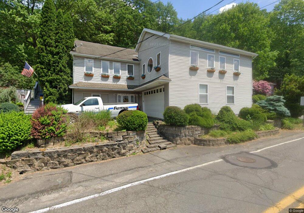
10 S Lehigh St Shavertown, PA 18708
Estimated Value: $323,000 - $393,000
3
Beds
2
Baths
2,232
Sq Ft
$154/Sq Ft
Est. Value
About This Home
This home is located at 10 S Lehigh St, Shavertown, PA 18708 and is currently estimated at $342,900, approximately $153 per square foot. 10 S Lehigh St is a home located in Luzerne County with nearby schools including Dallas Senior High School and Cornerstone Christian Academy.
Ownership History
Date
Name
Owned For
Owner Type
Purchase Details
Closed on
Jan 9, 2019
Sold by
Brougham Reo Owner Lp
Bought by
Strenkoski Manning Jean and Manning Douglas John
Current Estimated Value
Purchase Details
Closed on
Mar 26, 2018
Sold by
Wilmington Savings Fund Society Fsb
Bought by
Brougham Reo Owner Lp
Purchase Details
Closed on
Feb 28, 2018
Sold by
Oboyle Michael L and Oboyle Suzanne P
Bought by
Willmington Savings Fund Society Fsb and The Primestar H Fund I Trust
Purchase Details
Closed on
Feb 15, 2007
Sold by
Oboyle Suzanne P and Oboyle Michael L
Bought by
Oboyle Michael L and Oboyle Suzanne P
Home Financials for this Owner
Home Financials are based on the most recent Mortgage that was taken out on this home.
Original Mortgage
$126,750
Interest Rate
12.12%
Mortgage Type
New Conventional
Create a Home Valuation Report for This Property
The Home Valuation Report is an in-depth analysis detailing your home's value as well as a comparison with similar homes in the area
Home Values in the Area
Average Home Value in this Area
Purchase History
| Date | Buyer | Sale Price | Title Company |
|---|---|---|---|
| Strenkoski Manning Jean | $68,000 | National Abstract Company In | |
| Brougham Reo Owner Lp | $15,114 | None Available | |
| Willmington Savings Fund Society Fsb | $1,500 | None Available | |
| Oboyle Michael L | -- | First American Title Ins Co |
Source: Public Records
Mortgage History
| Date | Status | Borrower | Loan Amount |
|---|---|---|---|
| Previous Owner | Oboyle Michael L | $126,750 |
Source: Public Records
Tax History Compared to Growth
Tax History
| Year | Tax Paid | Tax Assessment Tax Assessment Total Assessment is a certain percentage of the fair market value that is determined by local assessors to be the total taxable value of land and additions on the property. | Land | Improvement |
|---|---|---|---|---|
| 2025 | $3,402 | $157,100 | $29,300 | $127,800 |
| 2024 | $3,297 | $157,100 | $29,300 | $127,800 |
| 2023 | $3,297 | $157,100 | $29,300 | $127,800 |
| 2022 | $3,268 | $157,100 | $29,300 | $127,800 |
| 2021 | $3,268 | $157,100 | $29,300 | $127,800 |
| 2020 | $3,268 | $157,100 | $29,300 | $127,800 |
| 2019 | $3,238 | $157,100 | $29,300 | $127,800 |
| 2018 | $3,206 | $157,100 | $29,300 | $127,800 |
| 2017 | $3,160 | $157,100 | $29,300 | $127,800 |
| 2016 | -- | $157,100 | $29,300 | $127,800 |
| 2015 | $2,700 | $157,100 | $29,300 | $127,800 |
| 2014 | $2,700 | $157,100 | $29,300 | $127,800 |
Source: Public Records
Map
Nearby Homes
- 3 N Pioneer Ave
- 70 Shaver Ave
- Lot # 4 Pioneer Ave
- 59 Zinn St
- 98 Davis St
- 7 Orchard St
- 945 Lantern Hill Rd
- 175 N Pioneer Ave
- 318 Echo Valley Dr
- 7 Echo Valley Dr
- 205 Beech St
- 242 Maple St
- 249 Cliffside Ave
- 65 E Overbrook Rd
- 65 E Overbrook Ave
- 162 E Overbrook Rd
- 235 E Center St
- 1021 Lower Demunds Rd
- 1312 Sutton Rd
- 0 Main St