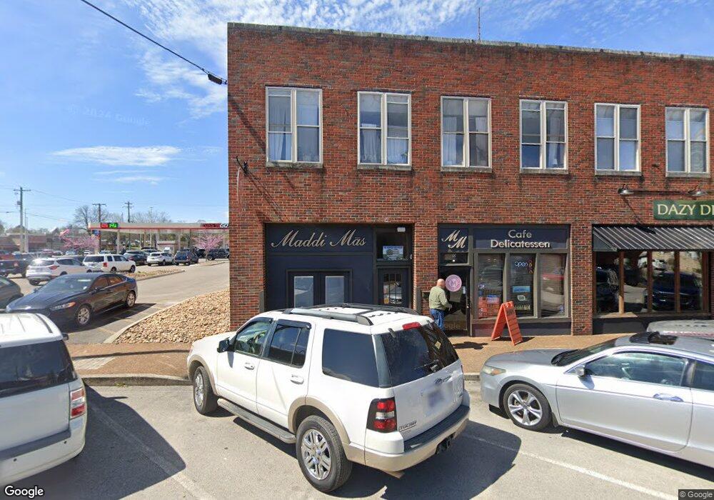
10 S White St Athens, TN 37303
Estimated Value: $285,546
--
Bed
3
Baths
1,925
Sq Ft
$148/Sq Ft
Est. Value
About This Home
This home is located at 10 S White St, Athens, TN 37303 and is currently estimated at $285,546, approximately $148 per square foot. 10 S White St is a home located in McMinn County with nearby schools including Ingleside Elementary School, City Park Elementary School, and Westside Elementary School.
Ownership History
Date
Name
Owned For
Owner Type
Purchase Details
Closed on
Apr 11, 2018
Sold by
Willis Susan H
Bought by
Willis Murray H and Willis Amber L
Current Estimated Value
Home Financials for this Owner
Home Financials are based on the most recent Mortgage that was taken out on this home.
Original Mortgage
$150,000
Outstanding Balance
$87,351
Interest Rate
4.44%
Mortgage Type
New Conventional
Estimated Equity
$198,195
Purchase Details
Closed on
Jan 2, 1991
Bought by
Willis Susan H
Create a Home Valuation Report for This Property
The Home Valuation Report is an in-depth analysis detailing your home's value as well as a comparison with similar homes in the area
Home Values in the Area
Average Home Value in this Area
Purchase History
| Date | Buyer | Sale Price | Title Company |
|---|---|---|---|
| Willis Murray H | $150,000 | -- | |
| Willis Susan H | $35,000 | -- |
Source: Public Records
Mortgage History
| Date | Status | Borrower | Loan Amount |
|---|---|---|---|
| Open | Willis Murray H | $150,000 |
Source: Public Records
Tax History Compared to Growth
Tax History
| Year | Tax Paid | Tax Assessment Tax Assessment Total Assessment is a certain percentage of the fair market value that is determined by local assessors to be the total taxable value of land and additions on the property. | Land | Improvement |
|---|---|---|---|---|
| 2025 | $1,260 | $60,280 | $0 | $0 |
| 2024 | $1,260 | $60,280 | $3,360 | $56,920 |
| 2023 | $1,260 | $60,280 | $3,360 | $56,920 |
| 2022 | $1,255 | $43,360 | $3,360 | $40,000 |
| 2021 | $1,255 | $43,360 | $3,360 | $40,000 |
| 2020 | $1,221 | $43,360 | $3,360 | $40,000 |
| 2019 | $1,221 | $43,360 | $3,360 | $40,000 |
| 2018 | $1,221 | $43,360 | $3,360 | $40,000 |
| 2017 | $1,193 | $40,040 | $4,760 | $35,280 |
| 2016 | $1,193 | $40,040 | $4,760 | $35,280 |
| 2015 | -- | $40,040 | $4,760 | $35,280 |
| 2014 | $1,101 | $40,047 | $0 | $0 |
Source: Public Records
Map
Nearby Homes
- 112 S Hill St
- 0 Kilgore St
- 110 S Kilgore St
- 215 Sunset Dr
- 106 S Kilgore St
- 112 Ray St
- 13 Douglas St
- 307 W College St
- 409 High St
- 0 W College St Unit 20252139
- 0 W College St Unit 1300814
- 129 Elizabeth St Unit 131
- 00 Tell St
- 922 Highway 39 E
- 215 Forrest Ave
- 501 Central Ave
- 707 Elizabeth St
- 530 Sunset Dr
- 620 Tell St
- 421 Hicks St
- 12 S White St
- 10 W Bank St
- 0 N White St Unit RTC2735990
- 0 N White St
- 000 W Bank St
- 5 W Madison Ave
- Lot 2 Highway 39e
- LOT 2 Highway 39
- LOT 2 Hwy 39
- 7 W Madison Ave Unit 9 Madison Ave
- 7 W Madison Ave
- Lot 4 Highway 39
- 17 S White St
- 1 N White St
- 0 Hwy 11 Unit 20113397
- 0 Hwy 11 Unit 553523
- 0 Hwy 11 Unit 518533
- 0 Hwy 11 Unit 474177
- 0 Hwy 11 Unit 474176
- 0 Hwy 11 Unit 448285
