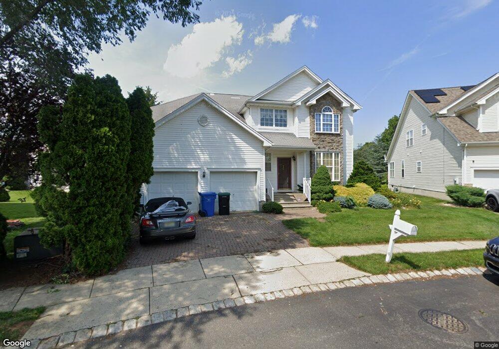
10 Saint Andrews Ct Monroe Township, NJ 08831
Estimated Value: $863,000 - $885,212
3
Beds
4
Baths
2,700
Sq Ft
$325/Sq Ft
Est. Value
About This Home
This home is located at 10 Saint Andrews Ct, Monroe Township, NJ 08831 and is currently estimated at $878,553, approximately $325 per square foot. 10 Saint Andrews Ct is a home located in Middlesex County with nearby schools including Barclay Brook Elementary School, Brookside Elementary School, and Monroe Township Middle School.
Ownership History
Date
Name
Owned For
Owner Type
Purchase Details
Closed on
Apr 14, 2008
Sold by
Tuffy Robert T and Tuffy Gloria
Bought by
Shapiro Richard
Current Estimated Value
Home Financials for this Owner
Home Financials are based on the most recent Mortgage that was taken out on this home.
Original Mortgage
$396,000
Interest Rate
6.29%
Mortgage Type
Purchase Money Mortgage
Purchase Details
Closed on
Jan 26, 2001
Sold by
Fairways At Forsgate
Bought by
Tuffy Robert and Tuffy Gloria
Home Financials for this Owner
Home Financials are based on the most recent Mortgage that was taken out on this home.
Original Mortgage
$263,900
Interest Rate
6.89%
Create a Home Valuation Report for This Property
The Home Valuation Report is an in-depth analysis detailing your home's value as well as a comparison with similar homes in the area
Home Values in the Area
Average Home Value in this Area
Purchase History
| Date | Buyer | Sale Price | Title Company |
|---|---|---|---|
| Shapiro Richard | $495,000 | None Available | |
| Tuffy Robert | $335,425 | -- |
Source: Public Records
Mortgage History
| Date | Status | Borrower | Loan Amount |
|---|---|---|---|
| Previous Owner | Shapiro Richard | $396,000 | |
| Previous Owner | Tuffy Robert | $263,900 |
Source: Public Records
Tax History Compared to Growth
Tax History
| Year | Tax Paid | Tax Assessment Tax Assessment Total Assessment is a certain percentage of the fair market value that is determined by local assessors to be the total taxable value of land and additions on the property. | Land | Improvement |
|---|---|---|---|---|
| 2025 | $12,410 | $429,100 | $120,000 | $309,100 |
| 2024 | $11,980 | $429,100 | $120,000 | $309,100 |
| 2023 | $11,980 | $429,100 | $120,000 | $309,100 |
| 2022 | $11,762 | $429,100 | $120,000 | $309,100 |
| 2021 | $11,684 | $429,100 | $120,000 | $309,100 |
| 2020 | $11,714 | $429,100 | $120,000 | $309,100 |
| 2019 | $11,440 | $429,100 | $120,000 | $309,100 |
| 2018 | $11,320 | $429,100 | $120,000 | $309,100 |
| 2017 | $11,148 | $429,100 | $120,000 | $309,100 |
| 2016 | $10,972 | $429,100 | $120,000 | $309,100 |
| 2015 | $10,697 | $429,100 | $120,000 | $309,100 |
| 2014 | $10,320 | $429,100 | $120,000 | $309,100 |
Source: Public Records
Map
Nearby Homes
- 16 Bermuda Dunes Dr
- 16 Moorland Blvd
- 5 Fairmount Ct
- 18 Rossmoor Dr Unit C
- 11 Pebble Beach Ct
- 40 Concord Ln Unit B
- 8 Sussex Way
- 87 Fairway Blvd
- 10 Sussex Way
- 5 Fairway Blvd
- 723 Mount Vernon Rd Unit A
- 105 Old Nassau Rd Unit N
- 9 Inverness Ct
- 72 Amherst Ln
- 72 Amherst Ln Unit A
- 22 Fairway Blvd
- 95 Gloucester Way Unit O
- 103 Gloucester Way
- 10 Sawgrass Ct
- 23 Rossmoor Dr Unit C
- 12 Saint Andrews Ct
- 8 Saint Andrews Ct
- 10 Wing Foot Ct
- 14 Saint Andrews Ct
- 6 Saint Andrews Ct
- 8 Wing Foot Ct
- 12 Wing Foot Ct
- 12 Wingfoot Ct
- 4 Saint Andrews Ct
- 6 Wing Foot Ct
- 16 Saint Andrews Ct
- 4 Wing Foot Ct
- 14 Wing Foot Ct
- 2 Wing Foot Ct
- 18 Muirfield Blvd
- 15 Wing Foot Ct
- 5 Wing Foot Ct
- 3 Wing Foot Ct
- 16 Muirfield Blvd
- 7 Wing Foot Ct