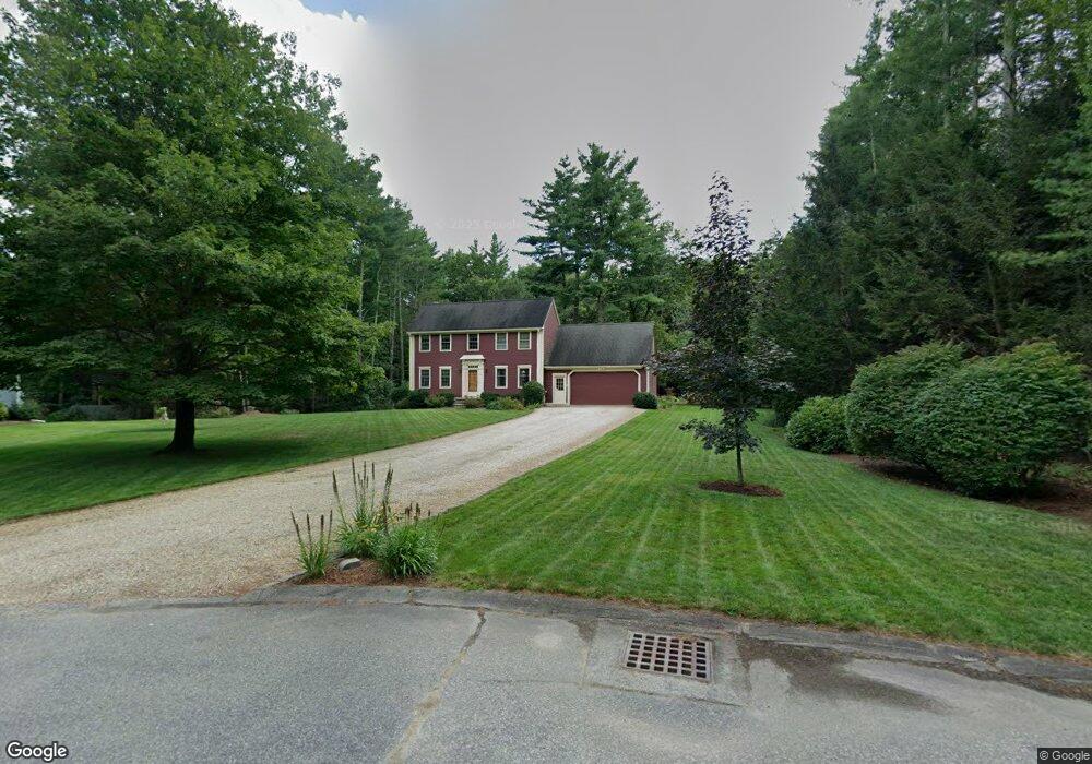
10 Saint James Place West Townsend, MA 01474
Estimated Value: $554,121 - $671,000
3
Beds
3
Baths
1,872
Sq Ft
$320/Sq Ft
Est. Value
About This Home
This home is located at 10 Saint James Place, West Townsend, MA 01474 and is currently estimated at $599,030, approximately $319 per square foot. 10 Saint James Place is a home located in Middlesex County with nearby schools including North Middlesex Regional High School.
Ownership History
Date
Name
Owned For
Owner Type
Purchase Details
Closed on
Jul 30, 1996
Sold by
Cederholm Hammond and Cederholm Margaret
Bought by
Magliozzi Vincent and Magliozzi Kimberly
Current Estimated Value
Home Financials for this Owner
Home Financials are based on the most recent Mortgage that was taken out on this home.
Original Mortgage
$90,000
Outstanding Balance
$7,216
Interest Rate
8.37%
Mortgage Type
Purchase Money Mortgage
Estimated Equity
$591,814
Create a Home Valuation Report for This Property
The Home Valuation Report is an in-depth analysis detailing your home's value as well as a comparison with similar homes in the area
Home Values in the Area
Average Home Value in this Area
Purchase History
| Date | Buyer | Sale Price | Title Company |
|---|---|---|---|
| Magliozzi Vincent | $165,750 | -- |
Source: Public Records
Mortgage History
| Date | Status | Borrower | Loan Amount |
|---|---|---|---|
| Open | Magliozzi Vincent | $90,000 |
Source: Public Records
Tax History Compared to Growth
Tax History
| Year | Tax Paid | Tax Assessment Tax Assessment Total Assessment is a certain percentage of the fair market value that is determined by local assessors to be the total taxable value of land and additions on the property. | Land | Improvement |
|---|---|---|---|---|
| 2025 | $6,919 | $476,500 | $97,700 | $378,800 |
| 2024 | $6,732 | $467,200 | $97,700 | $369,500 |
| 2023 | $6,716 | $440,100 | $84,700 | $355,400 |
| 2022 | $6,401 | $363,500 | $76,900 | $286,600 |
| 2021 | $3,134 | $342,100 | $76,200 | $265,900 |
| 2020 | $6,094 | $312,200 | $68,600 | $243,600 |
| 2019 | $5,998 | $310,300 | $68,600 | $241,700 |
| 2018 | $2,707 | $274,600 | $62,000 | $212,600 |
| 2017 | $5,185 | $263,600 | $64,800 | $198,800 |
| 2016 | $5,035 | $254,300 | $64,800 | $189,500 |
| 2015 | $4,919 | $257,400 | $71,800 | $185,600 |
| 2014 | $4,842 | $247,400 | $67,600 | $179,800 |
Source: Public Records
Map
Nearby Homes
- 1275 Valley Rd
- 18 Bridle Path
- 53 W Meadow Rd
- 11 Fox Run
- 1235 Townsend Rd
- 0 Davis Rd
- 637 Mason Rd
- 74 Wright Rd
- 137 Cascade Rd
- 531 Mason Rd
- 86 W Elm Lunenburg Rd Blood Rd
- 114 Blood Rd
- 91 Lunenburg Rd
- 183 New Hillcrest Dr
- 87 Laurel Dr
- 75 Merriam Hill Rd
- 1-65-C Barrett Rd
- 0 Brookline St
- 155 County Rd
- 10 Stearns Ave
- 8 Saint James Place
- 6 Saint James Place
- 4 Saint James Place
- 4 Kristopher Ln
- 2 Saint James Place
- 6 Kristopher Ln
- 210 Mason Rd
- 9 Kristopher Ln
- 225 Mason Rd
- 211 Mason Rd
- 1 Michael Way
- 11 Kristopher Ln
- 8 Kristopher Ln
- 10 Kristopher Ln
- 227 Mason Rd
- 213 Mason Rd
- 15 Kristopher Ln
- 3 Michael Way
- 202 Mason Rd
- 2 Michael Way